Get Full Government Meeting Transcripts, Videos, & Alerts Forever!
Get email alerts on the Floodplain Management topic
No spam. Unsubscribe anytime.
Phoenix seeks public input on 2025 floodplain management plan; residents reminded of 25% NFIP discount
Summary
City of Phoenix floodplain staff presented a draft 2025 Floodplain Management Plan at a virtual public meeting, outlined hazards and recommended actions, and urged residents to review the plan and complete a survey ahead of anticipated City Council adoption in August or September 2025.
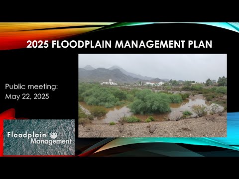
City of Phoenix floodplain staff on Wednesday presented a draft 2025 Floodplain Management Plan to the public, described hazards and proposed actions intended to preserve the city’s Community Rating System (CRS) benefits, and encouraged residents to review the draft ahead of expected City Council adoption in August or September 2025.
The plan update, the city said, supports Phoenix’s continued CRS Class 5 standing — a designation that grants a 25% reduction on National Flood Insurance Program (NFIP) premiums for policyholders in qualifying areas. Nazar Nabadi, the city’s floodplain administrator, told attendees, “When you are applying for that flood insurance, automatically should appear that 25% discount.”
Why this matters: floodplain maps and CRS classification affect whether homeowners must buy flood insurance and how much they pay. At the meeting, staff described how map revisions, development upstream and new hydraulic analyses can change flood-zone designations and base flood elevations (BFEs), which in turn influence insurance requirements and premiums.
Eric Froberg, City Engineer, opened the session by stressing the city’s role in protecting residents: “What most people don't realize is that homeowners insurance does not automatically protect your home, or property from flooding.” Froberg and the consulting team described the plan’s goals, the timeline for public review, and how residents can provide comments or ask about specific properties.
The presentation, led by floodplain staff and consultants from Black & Veatch, summarized the plan’s process and five broad goal areas: public education, interjurisdictional coordination, hazard reduction for people/property/infrastructure, enhanced maintenance and preventative measures, and pursuing additional public funding. Matt Hann, a water resources engineer with Black & Veatch, described the plan as a compilation of hazard identification, goal-setting and draft action items intended to guide projects and policy updates over coming years.
Staff walked through how flood hazards were categorized: special flood hazard areas (floodplains along washes and rivers), dam and levee related risk (with annual maintenance programs), and related hazards (wildfire, drought, funding constraints). They listed typical action categories in the draft plan: preventive measures, property-protection outreach, natural-resource protection and green infrastructure (bioswales, infiltration basins), emergency services coordination, structural projects (CIP and bond-funded work) and public information campaigns timed to monsoon season.
Nazar Nabadi summarized the City’s CRS history and timeline: Phoenix joined CRS in 1991, progressed through higher ratings over time and achieved Class 5 in 2018. The city’s timeline for the 2025 FMP update shown at the meeting lists planning and committee work in early 2025, a public review period in June–July, final delivery in July–August and anticipated City Council adoption in September 2025.
Several residents asked technical and procedural questions during the Q&A. On who maintains washes, Nabadi said the city maintains washes within its jurisdiction and that homeowners associations or private owners are responsible for private washes; he advised residents to contact neighborhood services when a private wash condition threatens property. He added that the city has enforcement mechanisms for private wash maintenance and that fines may apply.
On flood maps and who controls them, staff clarified that FEMA owns and maintains Flood Insurance Rate Maps (FIRMs). City staff review drainage and hydraulic studies (submitted by developers, the flood control district or the city) and forward those reviews to FEMA; FEMA then reviews and, if it concurs, updates the official maps. As Eric Froberg explained, the city’s role is to “assist [FEMA] with keeping [the maps] as current as possible.”
Staff described analytical methods used to revise maps, including hydrologic and hydraulic modeling and 2-D flow models. They noted that some FEMA map products are updated in phases and that data behind the maps may be more current than the printed or online map a homeowner sees. For parcels in Zone A (unnumbered flood hazard areas), Nabadi said ongoing regional studies — such as metro area drainage master studies that include hydrology and hydraulic (H&H) analyses — will provide more accurate BFEs that could affect future insurance requirements.
The team also described an ongoing five-year storm drain asset management program (part of the city’s capital program) to assess aging infrastructure and capacity constraints. Staff noted funding sources that support projects referenced in the FMP: the city’s Capital Improvement Program (CIP), a recently approved general obligation bond, and American Rescue Plan Act (ARPA) allocations for some work. No formal legislative action or vote took place during the meeting.
How residents can follow up: staff asked attendees to complete an online survey and provided a phone number and email for property-specific questions: (602) 262-4960 and floodplain@phoenix.gov. Nabadi said the draft plan will be posted for public review on the city’s floodplain website in the coming weeks and that the city will present the final plan to City Council for adoption in late summer or early fall 2025.
The meeting closed with a reminder that flood insurance remains a personal decision unless required by a mortgage lender; staff reiterated the city’s recommendation that all residents consider NFIP coverage because extreme events can occur outside historically flooded areas.