Get Full Government Meeting Transcripts, Videos, & Alerts Forever!
Get email alerts on the Regional Planning Act 181 topic
No spam. Unsubscribe anytime.
Rutland Regional Planning Commission previews 2026 regional plan, asks city to weigh Act 181 opt‑in by July 1
Summary
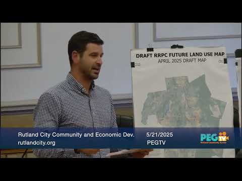
The Rutland Regional Planning Commission (RRPC) on Wednesday detailed the draft 2026 Regional Plan and a new statewide‑compatible regional future land use map and asked Rutland City officials to submit map revisions within about three weeks and to consider a municipal resolution by July 1 on whether to opt into a tier 1B Act 250 exemption.
The Rutland Regional Planning Commission (RRPC) on Wednesday detailed the draft 2026 Regional Plan and a new statewide‑compatible regional future land use map and asked Rutland City officials to submit map revisions within about three weeks and to consider a municipal resolution by July 1 on whether to opt into a tier 1B Act 250 exemption.
Devin, executive director and planner for the Rutland Regional Planning Commission, told the Board of Aldermen Community and Economic Development Committee that the plan will be released as a full draft on June 1 for public review and that the third and final phase of public engagement — called “alignment” — is intended to ensure towns see themselves in the plan. “Does the plan reflect the right community and economic development priorities for the Rutland region?” Devin asked, and he invited officials and residents to use an online survey and to submit written comments.
The nut of the presentation was how Act 181 (state statute) changes the land‑use framework used in Vermont and creates new, uniform land‑use categories and a multi‑tier system tied to Act 250 review. Devin said, “Tier 1A is complete exemption from Act 250,” and explained tier 1B would provide narrower exemptions for housing or mixed development of 50 units or fewer on parcels of 10 acres or less. He said a municipality must apply to the Land Use Review Board (the successor to the Natural Resources Board) for tier 1A status; tier 1B is a lower bar but offers narrower relief.
Why the city must decide soon: Devin and staff said the RRPC’s timeline is compressed because the regional mapping methodology was completed in February 2025 and mapping began in March; the regional plan must go through a six‑month statutory adoption process (review by the Land Use Review Board, public hearings, and final adoption). The RRPC asked Rutland City to (a) review and submit map revisions within roughly three weeks so the commission can analyze proposed changes under the state methodology and (b) provide a municipal resolution about opting into tier 1B by July 1 so the RRPC can include that municipal preference in the draft regional plan layout process.
City staff and elected officials raised practical implications. Ed Bogue, Rutland City planner, and others noted that Rutland City currently benefits from interim state exemptions tied to its downtown designation (Devin said the interim exemptions are set to expire in 2027). Several committee members asked whether opting into tier 1B would prevent the city from seeking tier 1A; Devin said it would not: tier 1A status would supersede 1B if the city later qualified. Committee members also noted that some projects in the city’s TIF (tax increment financing) district may soon seek permits; if the city adopts 1B before final tier 1A resolution or before some projects commence, those projects could become subject to Act 250 review under the new framework.
The RRPC walked attendees through the new land‑use categories that are now statutorily defined (downtown centers, village centers, planned growth areas, village areas, transition areas, enterprise areas, resource‑based recreation areas, and three rural categories). Devin said the map is intended to be statewide consistent so developers and agencies can know where Act 250 relief might apply across regions. He also described tier 3 (critical natural resources) as a separate overlay that the Land Use Review Board and Agency of Natural Resources will map; that rulemaking had hearings beginning the day after the Rutland meeting.
Officials asked about consequences for the Downtown Rutland Partnership (DRP) and business owners if the RRPC’s map expands the city’s downtown step‑1 designation beyond the current special benefits district. Devin said the draft map’s step‑1 expansion would not change the DRP’s special benefits district or the city’s existing step‑3 downtown designation; those local benefit programs remain controlled by the city’s designation process. He recommended the city coordinate communications with the DRP so property owners and businesses understand which benefits are local (special benefits district / step‑3 downtown) and which are tied to the RRPC/Act 181 mapping (step‑1 eligibility for grants and tax credits).
Committee members and planning commission members asked for technical detail: the RRPC gave sources and said the mapping methodology is published on the statewide site (VAPDA/VAPDA methodology referenced by presenter) and that the RRPC reviewed each town’s zoning maps while producing the draft map. Devin said the plan will include an implementation section and a regional plan “report card” to track progress on jobs, housing and other indicators.
Decisions and next steps from the meeting: the committee agreed to (1) designate Ed Bogue, Rutland City planner, as the city’s point person to collect input and relay it to the RRPC; and (2) ask the city planning commission to form a working recommendation on map edits so the committee (and the full Board of Aldermen if needed) can consider action at June meetings. The committee chair moved the designation of Ed as the contact and members approved the motion by voice vote; the motion carried. The RRPC reiterated that towns will be constrained by the statutory mapping methodology and that large, arbitrary changes to the map are unlikely to be approved by the Land Use Review Board.
The RRPC requested written map feedback (email or marked maps) and suggested that the city decide by July 1 whether it will opt into tier 1B. Devin said the city should also consider applying for tier 1A beginning January 1, and that the Land Use Review Board will be the final authority to approve any tiered status.
Less critical details: Devin highlighted outreach materials that are already available — a one‑page chapter summary for each plan chapter, a cartoon “plan visualize” product to explain policies, and the full plan layout to be published June 1. The presenter noted that the RRPC expects to present a pre‑approval draft to the regional board in September, hold hearings in January, and seek adoption in April of the following year.
The meeting closed with committee members agreeing to meet again in June if needed and with the RRPC offering to produce refreshed printed maps and to coordinate follow‑up communications with the DRP and other local stakeholders.