Get Full Government Meeting Transcripts, Videos, & Alerts Forever!
Get email alerts on the Transportation topic
No spam. Unsubscribe anytime.
Woodland planning commission reviews transportation chapter of comprehensive plan; staff to deliver full draft
Summary
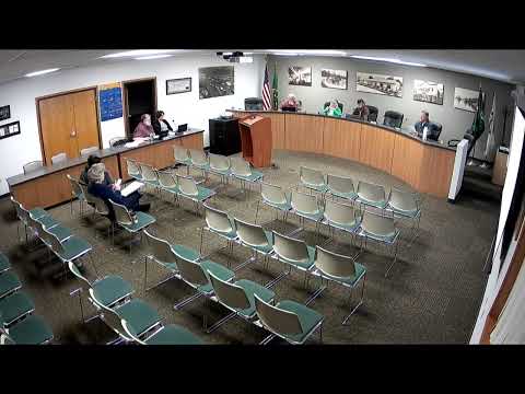
The Woodland Planning Commission met on May 15, 2025, to review the transportation chapter of the city’s comprehensive plan update and to discuss next steps for adoption.
The Woodland Planning Commission met on May 15, 2025, to review the transportation chapter of the city’s comprehensive plan update and to discuss next steps for adoption.
For the record, my name is Travis Goddard, community development director for the city of Woodland, said the chapter — prepared for the city by SCJ Alliance — “is a significant number of pages, and it is probably the 1 section of the comprehensive plan that was completely rewritten.” The chapter includes traffic forecasting, level‑of‑service (LOS) standards, an inventory of existing facilities, ADA compatibility, multimodal and active‑transportation mapping, and a realistic financing approach tied to annual project programming.
Why it matters: the chapter provides the city’s first comprehensive traffic forecasting and project prioritization analysis in years, with both near‑term and 2045 projections that the commission and staff said will drive which intersections and corridors the city seeks funding to fix. Commissioners and members of the public raised concerns about congestion at I‑5 interchanges, pedestrian and bicycle connectivity, transit service continuity and evacuation routes.
Most important details
- Consultant and scope: SCJ Alliance prepared a rewritten Chapter 6 (transportation) that staff described as unusually detailed for a comprehensive plan, including PM peak‑hour counts and 2045 projections based on recent local traffic studies (Exit 21 and Exit 22 modeling and subdivision traffic data).
- Level‑of‑service and classifications: the chapter documents desired LOS targets: LOS C or better on I‑5 mainline (noting the city has limited control there) and LOS D or better on arterial state highways, major arterials and minor arterials. The chapter also restates the city’s functional classifications (major/minor arterials, collectors, local streets) and design assumptions (for example, sidewalk width set at 6 feet to meet ADA when installed).
- Capacity and forecasts: staff showed the chapter’s volume‑to‑capacity calculations, which range in the consultant’s tables from roughly 0.23 to 1.2. Ratios below 1 indicate available capacity; values above 1 identify segments or intersections projected to be over capacity by 2045. Key locations flagged for attention include Exit 21 and its nearby intersections (Millard, Lakeshore/Goreg/Buckeye), Exit 22/dike‑access areas, and segments of Lewis River Road and Sherman Way.
- Exit 21 and roundabouts: staff emphasized that the planned Exit 21 fixes would relieve three of the four most significant problem locations identified through 2045. The chapter’s preliminary designs for Exit 21 include changes to sidewalk placement and turn‑lane geometry intended to increase roadway capacity without structural overpasses.
- Safety and multimodal planning: the chapter analyzes crash data and finds Woodland performs relatively well regionally, but identifies contributing factors to vehicle, pedestrian and bicycle crashes — higher travel speeds, impaired or distracted driving, turning movements, and limited sight distance. The chapter points to adopted complete‑streets language in local code and maps pedestrian and bicycle gaps the city should target.
- Transit and demand management: the chapter inventories local transit services, including a stop by Columbia Community Action Program (CAP) at the Chamber/Visitor Center and an 84‑space park‑and‑ride that functions as a de‑facto transit hub. Commissioners noted news reports that CAP’s contracted service could change in June; staff said the consultant used the most up‑to‑date information available but that language may need an amendment if service changes.
- Rail and marine recognition: the chapter acknowledges nearby port and marine facilities (Martins Bar, Austin Point) and discusses regional efforts to address rail‑crossing constraints. Staff noted the Port is pursuing funding for underpasses at Davidson, Whelan and Scott Avenues to eliminate at‑grade crossings — projects that would be costly and would require regional coordination.
Public safety and evacuation: members of the public and commissioners pressed for clearer attention to evacuation routes and emergency vehicle access. A resident said, “public safety becomes a real issue,” urging that capacity and safety be considered together when setting priorities.
Planning and funding linkages
Goddard told commissioners he intends to avoid listing a static capital projects table in the comp plan; instead, the plan will reference the city’s annually updated Transportation Improvement Program (TIP) so the adopted comprehensive plan points to a living, funded project list. He said staff will prepare a complete draft of the comprehensive plan as a grant deliverable for the commission and council to review; the draft is due under the grant schedule, and the timeline discussed would allow the city to refine and adopt the plan later in 2025.
What the commission debated
Commissioners and attendees discussed whether PM peak hour is the right planning metric and whether one hour of congestion should drive major infrastructure spending. Staff and commissioners agreed peak‑hour modeling is a standard, but traffic engineers increasingly use the worst hour or peak vehicle hour for impact fee and project appraisal. Commissioners also discussed behavioral, demand‑management and incremental approaches that could help avoid costly capital projects.
Next steps and follow‑ups
- Staff will place the consultant’s transportation goals and policies into the commission review matrix and provide a complete draft of the plan for the next commission agenda as the grant deliverable due in June. - The commission will use the TIP (adopted and updated annually) as the implementation list referenced by the comp plan rather than embedding a static, quickly outdated project list in the plan. - Staff said it may contact the region’s Council of Governments to clarify CAP transit status and potential replacement services if CAP routes change.
Ending
Commissioners asked staff to circulate the transportation chapter maps and tables for further review and to return with proposed edits to goals and policies. The commission will consider the full draft at a future meeting and forward recommended changes to the City Council for review and adoption.