Get Full Government Meeting Transcripts, Videos, & Alerts Forever!
Get email alerts on the Comprehensive Land Use Plan topic
No spam. Unsubscribe anytime.
Ann Arbor planners press ahead on draft land-use plan amid intense public comment on single-family zoning, trees and transit
Summary
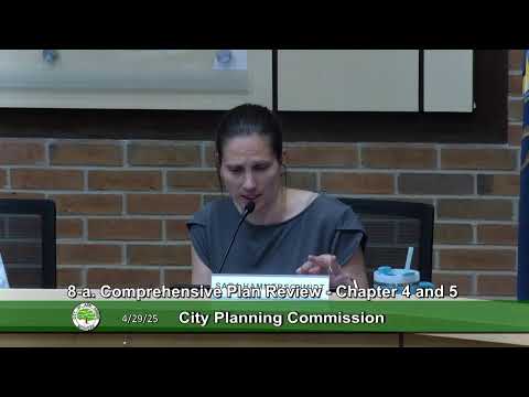
The Ann Arbor Planning Commission continued a detailed review of Chapters 4 and 5 of its Draft Comprehensive Land Use Plan on April 29, taking public comment for more than three hours and directing staff to clarify maps and rewrite language that public speakers said made the proposal sound like an open invitation to dense development in single-family neighborhoods.
ANN ARBOR, Mich. — The Ann Arbor Planning Commission continued a line-by-line review of Chapters 4 and 5 of the Draft Comprehensive Land Use Plan on April 29, hearing nearly six hours of testimony and holding detailed discussion on how the plan’s maps and district rules should balance increased housing supply, preservation of urban trees and coordination with transit and other city plans.
The session included more than 40 public commentators — many urging the commission to remove single-family-only rules so more housing can be built across neighborhoods, and many others urging preservation of neighborhood character, tree canopy and stronger public engagement. Commissioners and staff debated how explicitly the draft should show where denser development is envisioned, how to treat historic districts on the land-use map, and how to explain trade-offs between growth and natural-feature protections.
The meeting opened with routine business: staff called the roll and the commission approved the evening’s agenda and the minutes of the April 22 meeting. After public comment, Senior Planner Michelle Bennett led the staff presentation and a detailed, page-by-page review of the draft’s infrastructure, natural features and land-use sections.
Public comment: hundreds of concerns and support
During the public-comment period residents presented a wide range of positions. Some speakers framed the draft as a chance to increase affordability and keep young families in Ann Arbor. “We need as much housing as we can get, not just in downtown, but in all neighborhoods,” said a caller who identified himself as Gaurav, describing concerns about declining school enrollment and the loss of neighborhood peers.
Other speakers said the draft risks eroding single-family neighborhoods’ character and shade trees. “If you build apartment buildings in single-family neighborhoods, please don’t make them super tall,” said Holly Elliott of Miller Avenue, describing a neighborhood she said needs trees and yards preserved.
Speakers also questioned the plan’s outreach and the survey data staff used. “I looked at the survey of 3,100 and it was more of a demographic questionnaire than a substantive engagement about parking, traffic, noise and water runoff,” Brent Henderson told commissioners. Several callers said they had only recently learned of the draft and requested more accessible public meetings and mailings.
Environmental concerns and resilience
Multiple public speakers and commission members pressed the plan to treat natural features and tree canopy more clearly. Commissioner Sarah Wetherbee and others asked staff to better explain existing city programs — tree-planting efforts, the Natural Features Master Plan and the city’s stormwater and urban-forest work — so readers understand protections already in place.
Planner Bennett said the Office of Sustainability and Innovation’s work on resilience hubs is aligned with the plan; staff noted the city’s hazard-mitigation and natural-features documents already exist and should be cross-referenced. The Environmental Commission’s pending resolution to incorporate the Natural Features Master Plan into the comprehensive plan was mentioned repeatedly and commissioners asked staff to coordinate language with that work.
Maps, districts and historic areas
A major portion of the discussion focused on how the plan’s future land-use map was produced and how to present it. Commissioners and members of the public asked for clearer explanation of the “rules” the consultants used (for example: which existing residential zones were grouped into the proposed “low-rise” versus “transition” districts), and for transparency where the proposed map departs from current zoning. Several commissioners requested a set of supporting maps — simplified existing zoning or land-use layers, transit corridors and open-space overlays — so readers can see how staff moved from today’s zoning to the draft’s proposed districts.
Commissioners also debated whether historic districts were being treated consistently. The commission directed staff to show historic-district boundaries as an overlay on the future land-use map so readers can see where those protections already apply, and recommended using consistent logic when a historic designation overlays an area the plan proposes to reclassify.
Height, form and “number of homes” language
Commissioners discussed the draft’s illustrative district descriptions. A substantive vote (straw poll) supported a 3-story “typical” height for the proposed low-rise residential district; some commissioners asked staff to preserve tools — such as form-based standards, step-backs and targeted zoning mechanisms — that allow some flexibility where appropriate (for example, to enable affordable units or sustainability measures) without creating large-scale nonconforming development.
Commissioners and staff also asked consultants to rework wording that the public found alarming, for example an item in the draft that read “no limit on number of homes.” Commissioners directed staff to rewrite that line to explain that future regulations will control building scale and form (setbacks, lot coverage, height relative to neighbors and similar standards), instead of setting unit-count limits in the plan text itself.
Coordination with other city plans and agencies
Commissioners repeatedly asked that the draft explain how it interfaces with other ongoing work: the Office of Sustainability and Innovation’s resilience hub program; the Natural Features Master Plan; the Transportation/“Moving Together” plan; DDA (Downtown Development Authority) work; and University of Michigan land-use and transit proposals. Staff said some of those other studies (for example, utilities and infrastructure capacity analyses) are still in progress and will influence implementation and phasing.
Staff said upcoming public engagement sessions — April 30 at Malletts Creek Library (3–7 p.m.) and May 7 at Traverwood Library (3–7 p.m.) — will remain open and that consultants will return an updated draft in June after commissioners’ first series of edits.
What the commission decided and what’s next
- The commission approved the April 29 meeting agenda and the minutes of the April 22 meeting (motions carried by voice vote; no opposition recorded). - By straw poll the commission favored a 3‑story “typical” height reference for the low-rise residential district; commissioners directed staff and the consultants to refine the district text and illustrations to reduce confusion about unit counts and to show how form-based controls and other tools will regulate scale. - Commissioners asked staff to provide a clearer “show-your-work” explanation for the future land-use map: supply the simplified existing zoning/land-use layers and the rationale (transportation corridors, existing multifamily zoning, planned transit, open space) so the public can see how decisions were made.
The commission will continue the Chapter 4 and 5 review at its next meeting. Staff indicated it will compile the edits and return a revised draft in June; if the commission approves that revised draft it will be forwarded to city council for the required public review and council hearings.
Ending
Commissioners, staff and a steady stream of public speakers agreed on one practical point: the plan raises consequential trade-offs — housing supply, neighborhood character, tree canopy and infrastructure — that will require more outreach and clearer explanations in the draft. Planning staff said they will return with clearer maps, tightened language on form controls versus unit counts, and more links to the city’s existing natural-features and resilience plans.
Quotes used in this article were taken from the meeting transcript of the Ann Arbor Planning Commission, April 29, 2025. Specific attributions in the article follow the meeting transcript.