Get Full Government Meeting Transcripts, Videos, & Alerts Forever!
Get email alerts on the Flood Infrastructure Bridges topic
No spam. Unsubscribe anytime.
Army Corps details plan to replace Route 1 bridges over Byron River to reduce recurring flooding
Summary
Congressman Jim Himes and U.S. Army Corps of Engineers officials outlined a plan to remove and replace two low Route 1 bridges over the Byron River in Port Chester/Greenwich, aiming to reduce upstream riverine flooding by removing center piers and modestly raising the spans, while preserving traffic flow and addressing historic‑resource concerns.
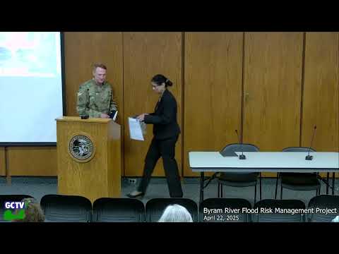
Congressman Jim Himes, U.S. Representative, and officials from the U.S. Army Corps of Engineers outlined plans and a tentative timeline to remove and replace two low Route 1 bridges over the Byron River that Corps engineers say constrict flow and contribute to upstream flooding.
The Army Corps is in the pre‑construction engineering and design phase for a replacement plan that removes the center piers, raises each span modestly and replaces the two parallel eastbound and westbound bridges one at a time so traffic can be maintained on a single bridge during work. "We are in the design phase and moving to construction as quickly as we can," Colonel Young of the U.S. Army Corps of Engineers told residents, adding the Corps is "committed to this project." Congressman Jim Himes said the work is urgent: "This is actually very this is not a nice to have. This has to happen. It has to happen fast."
The Corps described the project as the recommended plan following a feasibility study completed in 2020 and authorized under a provision the presenters referenced as "Section 340 Of Verdon" (as stated in the meeting materials). Project manager Rifat Saleem, U.S. Army Corps of Engineers, New York District, said design work began under an executed agreement with the Town of Greenwich in April 2023 and that the Corps completed the feasibility study with an integrated environmental review.
Why it matters: Corps technical staff said the Route 1 bridges currently act as a bottleneck during storm events, increasing upstream water surface elevations. The planned replacement will remove the center piers and raise the openings to reduce the floodplain extent and lower water surface elevations upstream; the Corps estimated reductions of up to roughly 2–3 feet in some areas during modeled events.
Costs and funding: The Corps gave several cost figures used in design planning: a pre‑construction engineering and design (PED) estimate of about $5,470,000; a design allocation listed as about $5,400,000 (federal funds via a disaster relief supplemental appropriation); and a construction cost estimate of $35,000,000. The Corps said construction would be cost‑shared 50/50 with a non‑federal sponsor (New York State, the Town of Greenwich or other local sponsors). Rifat Saleem said the Corps appreciates a federal appropriation that helps the project but noted that if costs rise the Corps and non‑federal partners would need to secure additional funds.
Schedule and approvals: The Corps presented a tentative schedule: 30% design by the summer of the current year, 100% plans and specifications targeted for April 2026, design approval in May 2026, execution of a Project Partnership Agreement in September 2026, and the start of construction activities (including real estate acquisition) in October 2026 — with an optimistic construction start in spring/summer 2027 if permits and easements proceed quickly. Saleem emphasized the team is seeking to complete construction in two construction seasons and is trying to avoid slipping an entire season.
Permits, property and rights‑of‑way: The Corps said the bridges sit in New York (Village of Port Chester) while many of the properties and flood‑impacted residents are in Connecticut, creating cross‑jurisdiction complexity. Environmental and historic reviews must be completed for both New York and Connecticut; the Corps is coordinating with the State Historic Preservation Officers in both states and with local historical societies. The Corps reported Connecticut permits and some rights‑of‑entry for geotechnical work are already obtained; New York State DOT permits and easement negotiations were described as still pending. Saleem said the Corps’ real estate specialist is coordinating with public and private property owners to obtain temporary and permanent easements needed for construction and staging.
Design, contractors and technical work: The Corps has contracted AECOM as the design consultant and is using technical support from its Omaha District for bridge design expertise. The scope of design work includes topographic and bathymetric surveys, geotechnical investigations, H&H (hydrology and hydraulics) modeling, hazardous material investigations (HTRW), a traffic study, and value‑engineering reviews. The Corps said it will produce a traffic management plan tied to construction sequencing and that one bridge will carry two‑way traffic while the other is rebuilt.
Public concerns raised and Corps responses: Residents and business owners asked about dredging, downstream impacts, the effect on nearby gas stations and the Carvel property, night‑time staging and traffic safety. The Corps said dredging upstream was studied and "was not economically justified," so it was eliminated from the recommended plan. The Corps also said its H&H modeling accounted for tidal influence up to the bridge locations where applicable and that removing the bridge restrictions will not increase downstream flow but is intended to reduce upstream flooding by eliminating the bottleneck. On access for adjacent businesses, Corps planners said they will regrade approaches and provide access; Karen Balmer, section chief in planning, said the team will reach out to impacted property owners and work to provide access during and after construction. On staging and contractor parking, Corps staff said they plan to use nearby public/divider areas as staging where feasible and will coordinate with local officials to avoid storing equipment in residential streets overnight.
Historic and aesthetic issues: The existing bridges are listed as historic in the Corps materials. The Corps is preparing a historic structure report and a historic treatment plan and coordinating with state preservation offices and local historical societies. Corps staff said there will be opportunities for review of aesthetic treatments; the Corps expects to show a draft look when the project reaches roughly 30% design and invited local officials to help gather community input while avoiding schedule delays.
Technical design standard and storm event level: The Corps said the project is designed to address fluvial (riverine) flooding and stated the replacement structure is being designed for a 50‑year storm (2% annual chance) as part of the feasibility/design criteria. The Corps warned that no project can eliminate all flood risk and recommended residents continue to follow local floodplain guidance, insurance and emergency plans.
Next steps and public outreach: The Corps plans to continue public briefings and said it will post the feasibility and supporting documents on the Corps and Town websites. Corps staff indicated they are coordinating with the Village of Port Chester on a follow‑up meeting in Port Chester, expected in three to four weeks, and will circulate renderings and a 30% design draft for community review.
The meeting combined technical presentation and public Q&A; Corps staff repeatedly stressed the need for intergovernmental agreements, easements and permits before construction can begin and encouraged affected residents to review posted materials and coordinate with the Corps’ real estate and outreach staff.