Get Full Government Meeting Transcripts, Videos, & Alerts Forever!
Get email alerts on the Superfund Site Investigation topic
No spam. Unsubscribe anytime.
Community advisory group presses EPA, PRPs for more sampling and flood-risk planning at Smurfit Stone site
Summary
At a Smurfit Stone Community Advisory Group meeting, residents, technical volunteers and agency staff reviewed the site's Superfund remedial-investigation progress, pressed for denser sampling of sludge, groundwater and downstream river sediments, and raised concerns that berms and ponds could erode in large floods and mobilize contamination.
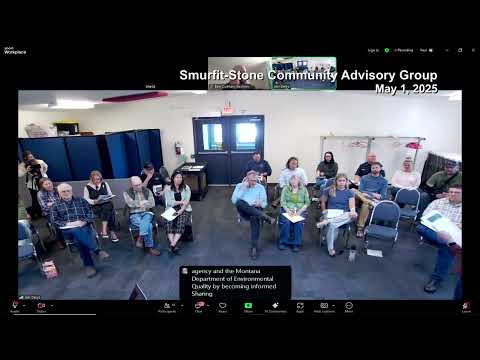
Members of the Smurfit Stone Community Advisory Group (CAG) and federal and state regulators on Monday reviewed recent remedial-investigation work at the former Smurfit Stone mill site and pressed for more sampling of sludge, shallow groundwater and downstream sediments to clarify contaminant pathways and flood-related erosion risks.
CAG administrative member Jen Harrington said the group has advocated for the community to be represented in every step of the Superfund process and urged more protective sampling. "That 1 in 10,000 is an acceptable rate for our community ... to me, that's just unacceptable," Harrington said, referring to comparisons raised in earlier risk discussions.
The meeting focused on three linked concerns: (1) whether current soil and groundwater sampling density is sufficient to map contaminant "hot spots" from historic wastewater operations and dumps; (2) whether the shallow groundwater and historical pond network can transport contaminants to the Clark Fork River; and (3) the stability of berms and ponds in a large flood that could create a new channel and mobilize buried wastes.
The CAG and several technical presenters described the site's long industrial history, noting operations beginning in 1955 and a 54-year industrial era that closed after the owner announced a permanent shutdown in late 2009. Presenters said the site footprint is large (the presentation cited roughly 3,200 acres total, with an industrial core of about 100 acres and roughly 900 acres of former wastewater areas) and that contamination of concern includes dioxins/furans, PCBs and metals.
Bruce (hydrogeology presenter) summarized how historic operations created ponds, berms and informal dumps and said those features were placed on former floodplain channels. He and other speakers warned that a sufficiently large flood could overtop or breach berms, fill successive ponds and conceivably carve a new channel through multiple ponds, mobilizing sediment and buried wastes.
David, who identified himself as a representative of the potentially responsible parties (PRPs), told the group the PRP team believes the project has collected enough data to support risk assessment but also acknowledged the PRPs collected additional data in 2024 that EPA is now reviewing. "We have collected enough data to support risk assessment," David said, also noting that EPA is reviewing newer data. He and other PRP-contracted scientists described the remedial-investigation and sampling schedule that has been posted in EPA work plans.
CAG members and university-affiliated volunteers recounted additional, community-sponsored field work and analyses (radon/isotope work, fiber-optic instruments, and a university hydrology project) intended to supplement the PRP and EPA datasets and better characterize groundwater-river connectivity and potential fish-tissue exposure. Logan, a university student who led a classroom study, described the group's efforts to re-analyze portions of the public dataset and identify gaps in geochemical data.
Participants repeatedly said that Superfund decision steps are risk-driven: the Remedial Investigation (RI) gathers data about contaminants, pathways and receptors; the Feasibility Study (FS) evaluates cleanup alternatives; and the Record of Decision (ROD) documents the selected remedy. Multiple speakers emphasized that once EPA advances from the RI into the FS, it becomes harder to add new sampling into the risk assessment that drives remedy selection.
CAG members said their principal outstanding requests to EPA and the PRPs include: (1) denser sludge/soil borings across the former wastewater treatment footprint (the CAG requested about one new soil boring per three acres and discrete samples within borings), (2) two slotted groundwater monitoring wells finished in discrete borings for quarterly sampling to capture seasonal variability, (3) additional downstream sediment and biota (fish tissue) sampling to resolve whether contamination in the river is attributable to the site, and (4) clearer plume maps showing fate-and-transport from known dumps and ponds toward the river.
EPA and DEQ staff at the meeting confirmed that EPA committed in prior exchanges to additional sampling and that the agency would delay finalizing the remedial-investigation report to allow some of that work. Mackenzie Meader, EPA community involvement coordinator, and Ally Archer, EPA project manager in Helena, were present for the discussion and described EPA's review process for new data. Katie Garson Forba, bureau chief for Superfund and abandoned mine lands at Montana DEQ, said institutional controls and deed restrictions exist for portions of the site and clarified that some restrictions are private covenants enforceable as civil matters rather than county-enforced land-use controls.
Several residents and technical volunteers urged the CAG and agencies to plan for flood scenarios that exceed historic records. Presenter Bruce summarized analyses of historic peak flows and noted that larger, less-typical storm events (rain-on-snow, atmospheric river-like events) could produce flows not well represented in historical estimates; he argued that planning should account for that possibility when evaluating whether "waste in place" remedies are protective.
No formal votes or regulatory decisions occurred at the meeting. The principal documented outcome was a restatement of community requests and a request that EPA and the PRPs provide the 2024 sampling datasets, clarify where borings and wells were finished in groundwater, and supply plume/fate-and-transport maps so the community can review whether the recent sampling matches the work plans.
The CAG invited continued participation from local residents, tribal representatives and technical partners and reiterated that the group will meet monthly as the EPA moves toward the feasibility study. Several speakers said continued community pressure and technical participation would be important to ensure the risk assessment captures groundwater-river connections, seasonal variability and the potential for mobilization during extreme flood events.
Ending: The group scheduled continuing technical work and community engagement; EPA and the PRPs will continue to revise and review data and the CAG said it will track whether the additional sampling is reflected in the final remedial-investigation report prior to the feasibility study.