Phoenix planning department previews Rio Phoenix land‑use plan after year of outreach
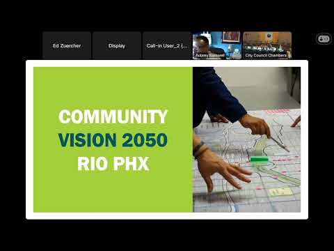
3175969 · April 25, 2025

Get AI-powered insights, summaries, and transcripts

Subscribe
AI-Generated Content: All content on this page was generated by AI to highlight key points from the meeting. For complete details and context, we recommend watching the full video. so we can fix them.

Summary

City planning staff summarized a draft Rio Phoenix land‑use plan for the Rio Salado corridor, describing a three‑step planning framework, four study subareas, community engagement results (900+ in‑person contacts, 500+ survey responses) and a path to public hearings and council review.

Planning and Development Department staff on Thursday presented a draft land‑use and implementation plan for the portion of the Rio Salado corridor inside Phoenix known as Rio Phoenix, saying the effort draws on a regional Rio Reimagined vision and more than a year of local outreach.

Enrique Bojorquez, a planner with the Planning and Development Department, told the Parks Board the city’s work focuses on six planning elements and aims to make the Rio Salado corridor a stronger local and regional destination while improving residents’ health outcomes. “We have been working on this initiative known as Rio Phoenix, which is essentially developing, or updating a land use plan,” Bojorquez said.

Bojorquez and staff described a three‑step planning framework used by the department: a current‑conditions assessment; a community‑crafted vision; and an implementation plan. The study area covers about seven square miles in Phoenix — roughly from I‑17 on the north to Broadway Road on the south, and from 30th Street/I‑10 on the east to 19th Avenue on the west — and is divided into four planning subareas that generally follow completed or planned habitat restoration projects in the Rio Salado Habitat Restoration Area.

Staff said the department and consultants Multi‑Studio and SCAPE have run three public workshops (first held in October 2024, a second in February 2025 and a larger workshop the week before the board meeting), staffed two recent project expos, and engaged more than 900 people in person and received more than 500 survey responses in English and Spanish. Those engagements informed draft maps, master plans, cross sections, and a revised land‑use map staff displayed for the board.

Bojorquez said the draft plan will proceed through village planning committees, the planning commission and then city council for consideration and adoption. “We will be taking this policy plan through a public hearing process, both with the village planning committees, with planning commission, and ultimately with city council for review and adoption,” he told the board.

Board members asked about outreach to tribal governments. Marty Whitfield, assistant director for Parks and Recreation, said the Gila River Indian Community provided a planning grant for the project and staff plan to continue engagement. “We have received that funding, and we do plan to keep engaging Gila River Indian Community as this project moves forward,” Whitfield said.

Staff said next steps include finalizing short‑ and long‑term implementation actions, identifying partners, and returning to the Parks Board and other city committees with the draft plan before council consideration. No formal action was requested or taken by the Parks Board at the presentation.