Get Full Government Meeting Transcripts, Videos, & Alerts Forever!
Get email alerts on the Rezoning topic
No spam. Unsubscribe anytime.
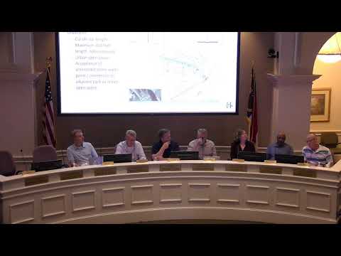
Huntersville planning board backs conditional rezoning for Blythe Landing residential subdivision
Summary
The Huntersville Planning Board recommended approval of petition R24-16 to rezone land along NC 73 for a 17‑lot single‑family subdivision, imposing conditions on stormwater design, a park trail connection and a cul‑de‑sac length exception.
The Huntersville Planning Board voted to recommend approval of petition R24‑16, Blythe Landing Residential, a conditional rezoning for 17 single‑family lots along N.C. Highway 73, after requiring conditions addressing stormwater treatment, a paved 10‑foot park connection and a waiver to extend a cul‑de‑sac to 600 feet.
The recommendation, approved by the board without recorded opposition, asks the town board to accept a rezoning plan that includes an amenitized stormwater facility counted as urban open space, clarified front build‑to lines for lots 1 and 7, updated tree‑save calculations and commitments about elevations and minor staff comments.
Why it matters: The project abuts Blythe Landing Park and a cove on Lake Norman and has drawn concerns from nearby homeowners about stormwater runoff, sediment and traffic on N.C. 73. The planning board’s conditions are intended to address neighborhood privacy, water quality and connectivity to the existing park while allowing the developer to increase density modestly from the site’s by‑right yield.
Planning staff described the rezoning request as a change from general residential to neighborhood residential conditional district for a development of 17 detached single‑family lots at roughly 2 units per acre, a density the Huntersville 2040 plan lists as “moderate.” Staff noted two ordinance modifications the applicant requested: extending the cul‑de‑sac maximum from 350 feet to 600 feet and allowing the stormwater sand filter/pond to qualify as urban open space even though it exceeds the ordinance’s typical 25% area limit for such features.
Residents who spoke at the meeting urged additional technical safeguards. "My name is Matt Wolfinger, and I am providing a response in regards to zoning request R2416," said Matt Wolfinger, a resident whose property borders the site. Wolfinger asked the developer and engineers to model post‑development flows, including a 100‑year storm, verify that the proposed spillway discharges away from his property, and provide a bathymetric survey of the cove to track any sedimentation.
Mike Kreitzberg, president of the Lookout Point homeowners association, told the board he was chiefly concerned about traffic and safety on N.C. 73 where the development would take direct access. "There's already been at least one pedestrian killed" at the corridor, Kreitzberg said, urging caution about adding additional curb cuts and conflicts with opposite‑side driveways.
Applicant representatives said they had worked with town staff on plan revisions. "This plan aligns with the moderate density recommendation in the plan," said Robert Irvin, an attorney with Irvin Law Group representing the applicant. Ryan Cox of Red Cedar, the builder, described homes as roughly two‑story, four‑bedroom plans of about 3,000 square feet, and said the team would continue working with neighbors on screening and stormwater details.
Staff and the applicant said the N.C. Department of Transportation (NCDOT) has indicated the entrance will be a right‑in/right‑out; staff noted NCDOT frequently requires a median or similar measures to prevent left turns at such locations. The applicant estimated breaking ground on horizontal work in late 2025 with vertical construction later in 2026, and planning staff noted NCDOT’s widening of N.C. 73 is not slated to begin construction until about 2029 — a scheduling gap board members flagged as a potential risk.
On stormwater, a town inspector explained that during construction the town performs regular inspections of stormwater control measures; after an initial period the facility is turned over to the county for long‑term maintenance. The planning board included as a condition that the submitted open‑space concept and commitments about the amenitized sand‑filter facility be shown on the rezoning plan and that final engineering and erosion control permits must meet town and Mecklenburg County requirements.
The board’s required conditions include: committing to the open‑space concept on the rezoning sheet; clarifying front build‑to lines for lots 1 and 7 to 15 feet; constructing a 10‑foot trail connection to Blythe Landing Park paved with a firm surface “to be as ADA‑accessible as reasonably possible”; updating the tree‑save plan to meet the ordinance’s canopy requirement; including intended commitments for building elevations on the final plan; and addressing all minor staff comments. The motion was amended on the floor to explicitly record acceptance of the two ordinance modifications (600‑foot cul‑de‑sac and acceptance of the amenitized stormwater pond as urban open space) and passed.
Next steps: The planning board’s favorable recommendation and the rezoning plan, with conditions, will be forwarded to the Huntersville Town Board for final action. The applicant still must complete detailed construction drawings, secure NCDOT and Mecklenburg County permits, and satisfy stormwater and erosion‑control requirements before work begins.
Quotes used in this article come from speakers at the planning board meeting and are attributed to the individuals who spoke during the record.