Get Full Government Meeting Transcripts, Videos, & Alerts Forever!
Get email alerts on the Rezoning 25 05 topic
No spam. Unsubscribe anytime.
Board approves rezoning of 45‑acre Foothills parcel with 10‑year development condition amid infrastructure concerns
Summary
The Yuma County Board of Supervisors approved rezoning 45 gross acres in the Foothills from RA‑10 to low‑density residential, with conditions requiring a tentative map, traffic impact analysis, and completion of required improvements within 10 years.
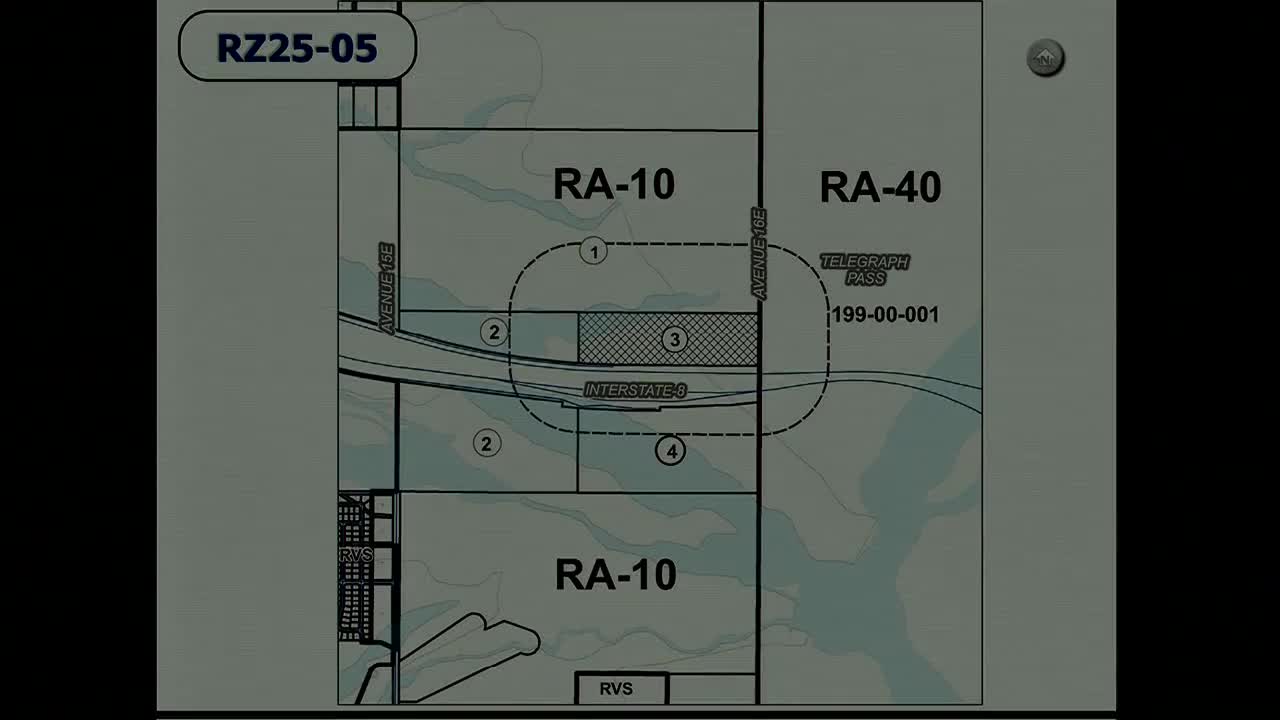
The Yuma County Board of Supervisors approved Rezoning Case 25‑05 to change a 45‑gross‑acre parcel in the Foothills Planning Area from rural agricultural zoning (RA‑10) to low‑density residential (6,000‑square‑foot minimum lots). The property lies on the north frontage road between Avenue 15½ E and Avenue 16 E; the applicant intends to develop the site as a residential subdivision.
Senior Planner Carillo presented the request and described performance conditions attached to approval: recordation of necessary notices and infrastructure agreements; filing and approval of a tentative map subdividing the parcel into six or more lots within 10 years of board approval; a traffic impact analysis to be completed in accordance with Yuma County Public Works standards (volume 4, section 4.5) during tentative map review; and completion of any improvements required by the traffic analysis within the timeframe the analysis specifies. Planning Commission recommended approval with those conditions.
Planning staff cautioned the board. Planning Director Maggie Katz told supervisors staff recommended denial because the request did not comply with certain comprehensive‑plan policies for the Foothills Planning Area (including policies to phase residential growth until infrastructure is available and to analyze water and sewer capacity). Katz also noted the site is in a flood zone and lacks adequate existing water and sewer infrastructure.
The applicant’s representative, Doug Nichols of Core Engineering Group, said the 10‑year timetable was an honest recognition of the property’s complexity — including utility extension, overland flow and a major wash on the parcel, trailhead access considerations, and recent FEMA rule changes — and that the developer needs time to complete necessary design and infrastructure work. He said the project will require engineering work to address flood flows and utilities before a constructible final plat can be submitted.
Supervisors expressed concerns about water, sewer capacity and flood mitigation but voted to approve the rezoning. Planning staff and the applicant agreed that subsequent steps include submission of a tentative map and, later, a final plat; the county indicated that Foothills Utilities or another provider may need to expand capacity before substantial build‑out can occur.
The motion passed by voice vote; several supervisors said they still had reservations but voted in favor. The decision allows the owner to proceed to tentative‑map work under the board’s performance conditions.