Get Full Government Meeting Transcripts, Videos, & Alerts Forever!
Get email alerts on the Calhoun Cemetery Geophysical Survey topic
No spam. Unsubscribe anytime.
Geophysical survey at Calhoun Cemetery finds 62 burial anomalies; 52 unmarked locations staked
Summary
A Vanderbilt research team using ground-penetrating radar mapped the Calhoun Cemetery near Nolensville Pike and identified 62 anomalies consistent with burials, marking 52 previously unrecorded locations for descendants and preservation partners to review.
Natalie Robbins, program manager at the Vanderbilt Institute for Spatial Research (VISER), told the Metro Historical Commission that a ground-penetrating radar (GPR) survey of Calhoun Cemetery identified 62 subsurface anomalies consistent with burials and documented 13 monuments with readable inscriptions.
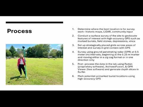
Robbins said the survey, conducted with support from the Preservation Society of Nashville and the Nashville Historical Foundation, combined surface mapping and GPR transects to locate both marked and likely unmarked interments. "This is a noninvasive technique. We're not disturbing anything at a site like this," Robbins said while describing how GPR reflections and depth slices help distinguish features such as tree roots, grave shafts and concrete-lined burial boxes.
The survey team recorded 13 legible monuments, 10 surface depressions, four broken or unreadable monuments, two concrete markers, two potential field stones and two features described in the report as "grave boxes." Robbins said the GPR interpretations produced 62 anomalies that the team judged to be burial-related; 10 of those anomalies corresponded with known marked burials. The team also identified what they described as at least two stacked burials in the central portion of the parcel.
As a temporary measure, the team placed wooden stakes at 52 potential unmarked burial locations and recommended installation of low-profile permanent markers tied to GPS coordinates to preserve and identify those locations. "We went back out to the site and mark[ed] all of these unmarked burial locations. There were 52 total locations that we marked with wooden stakes," Robbins reported.
Robbins and Metro Historical Commission staff cautioned that GPR is interpretive rather than conclusive: the only way to be certain a detected anomaly is a burial is by invasive investigation, which is not the aim of this work. "We have high confidence that these burials are potentially located in these locations, but the only way to a% know would be to excavate in those locations," Robbins said.
Commission staff and the presenter discussed limits of the field work. Robbins said the parcel’s heavily wooded rear area was unsuitable for GPR survey and therefore remains unexamined. She also noted that some markers may have been moved over time; one marker for an individual believed to have died in 1866 was not documented in earlier surveys or on Find a Grave and was uncovered because the team surveyed after seasonal vegetation dieback.
Caroline Eller of the Metro Historical Commission said descendants contacted the commission after damage by an adjacent grading contractor prompted the survey request. Eller said the recording of the presentation would be shared with the family and that the descendants have explored options for long-term care of the property, including possible transfer to a church. She also confirmed the project’s funders: the Preservation Society of Nashville paid for the GPR work and the Nashville Historical Foundation funded the public presentation.
Panelists and attendees asked logistical and historical questions about ownership and continuing burials. Robbins said she believed descendants retain ownership and that, under state cemetery laws, burials could still be performed if the descendants chose to do so. Commission staff reported the last interments occurred in the late 1960s or early 1970s, and that care has been handled by descendants in coordination with a local church on a paid basis.
The project team recommended the following next steps: (1) consider a tree-thinning and survey of the rear wooded parcel before any ground-disturbing work occurs there; (2) install low-profile permanent markers or rebar-mounted numbered markers linked to GPS coordinates to preserve identified locations; and (3) continue archival work to locate older plat maps referenced in earlier county surveys that might clarify historic burial extents. Robbins also urged care in interpreting anomalies and noted further archival correlation—death records, historical plats and Find a Grave memorials—would refine identifications.
The presentation closed with acknowledgments to funders and project partners: the Preservation Society of Nashville, the Nashville Historical Foundation, Vanderbilt Libraries staff member Stacy Curry Johnson, Adam Fracchia and Caroline Eller at the Metro Historical Commission, descendant Henry Maxwell (who was not present), and David Grider, who has discussed related projects publicly.