Get Full Government Meeting Transcripts, Videos, & Alerts Forever!
Get email alerts on the Land Use Planning topic
No spam. Unsubscribe anytime.
Norman planners present AIM Norman master plans, propose reserve-area survey change and simulation of rezoning scenarios
Summary
Norman planning staff and consultants presented the AIM Norman master plans to the City Council April 22 and proposed an ordinance amendment to require a 30-acre minimum certificate of survey in the 2045 reserve character area, while demonstrating how the new land-use framework will be applied to rezoning requests.
Norman planning staff and consultants presented the AIM Norman master plans to the City Council in a conference session April 22, outlining how the integrated land-use approach will shape future rezoning decisions and offering two rezoning scenarios as illustrations.
The presentation covered multiple plan elements — housing, stormwater, water and wastewater, parks and transportation — and emphasized how the new land-use framework, character-area maps and implementation tools will be used in staff reports and council decisions. Amy (project lead) said the scenarios are intended to “show how the plan will be used in staff reports and what you will be seeing come before you.”
The nut of the discussion was how the plan’s implementation rules would alter routine review. Staff recommended an ordinance amendment to the zoning and subdivision regulations to require a minimum 30-acre certificate of survey in the 2045 reserve character area (up from the current 10-acre minimum). Destiny Andrews and Laura Hoggett explained that the change applies to the 2045 reserve area only; parcels east of that area would keep the 10-acre minimum. Staff said the amendment is intended to preserve the reserve area as the long-term boundary for urban development and to give the city clearer tools when private owners seek parcel splits or rezonings.
The presentation also described how staff reports will change: zoning and land-use analyses will appear in the same packet, and comp-plan policies will be an explicit factor in recommendations. As Laura Hoggett explained, staff reports will include existing conditions, procedural history, a straight factual summary of the application, department review comments, and an integrated analysis of zoning and land-use/character-area policies.
Staff walked council through two illustrative cases to show how the plan would guide decisions. In the first, a property designated “urban medium” on the land-use map was proposed to rezone from R-1 to RM-6 for a multi-unit project; staff said the proposed building types, heights and parking configuration were consistent with the character-area and land-use policies and that the plan would “help direct support” for that application. In the second example, an applicant in the 2045 reserve sought a PUD to develop one-acre lots and extend urban-low land use into the urban reserve; staff said that proposal did not meet the reserve-area requirements (including contiguity to existing development and a requirement that at least 65% of the PUD acreage be held as outlots reserved for future urban densities) and that the plan would direct denial under current policy.
Presenters summarized elements of each master plan. Alec Dennis, describing stormwater, said Norman contains two major watersheds and that the Canadian River watershed includes much of the urbanized area with aging infrastructure and flood constraints. He recommended requiring runoff-quality treatment in new developments, preserving mapped Water Quality Protection Zones (WQPZ) at current widths, adding monitoring at Total Maximum Daily Load stations, creating incentives for projects that exceed stormwater requirements (potentially tied to a stormwater utility fee), and updating the engineering design criteria on a regular basis. “We recommend that [the WQPZ] be maintained and even preserved,” Dennis said.
On water and wastewater, Mary Elizabeth summarized that staff evaluated multiple supply options (expanding alluvium use, new wells in the Garber-Wellington aquifer, increasing finished-water purchases from Oklahoma City, and augmenting Lake Thunderbird via purified water) and assessed capital and operations costs to compare cost per 1,000 gallons among alternatives. For wastewater, staff said keeping and expanding treatment capacity at the existing Water Reclamation Facility with regional lift stations would be the most cost-advantageous approach for future growth; the audience asked conceptual questions about force-main routing and lift-station placement east of the city.
Parks priorities included building a comprehensive trail network, integrating stormwater management and protection of Lake Thunderbird with parks and open space, elevating arts and cultural assets, modernizing funding/maintenance policies, and maintaining diverse programming. On transportation, Brett (transportation presenter) described an updated active-transportation backbone connecting neighborhoods to parks and the lake, a re-evaluated roadway plan that treats “widening” as a safety concept (shoulders, sidepaths, turn-lane protection), and the use of a project-ranking tool that can identify potential roundabouts or signal improvements; staff noted a multimodal path concept (12-foot width) on Alameda in sections.
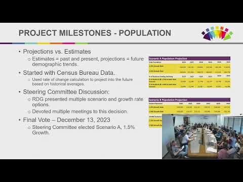
Population projection methodology drew extended council discussion. Staff said they presented two standard approaches — an annual growth-rate projection based on historic trends and a method that removes the student population for separate treatment — and provided the steering committee a range of scenarios. Councilors pressed staff on the data sources and differences among one-year and five-year Census estimates and asked how student counts were treated. Staff emphasized that the plan includes implementation tools and policies that will guide development decisions regardless of which numeric projection is used.
Council members asked about review cadence and adaptability; staff said the city intends annual plan reviews and that updates or targeted plan amendments could be scheduled as new census or ACS data become available. Several councilors debated whether the plan should be deliberately conservative or more permissive in anticipating growth; presenters and staff repeatedly said the plan’s policies — for example, minimum parcel sizes and the 65% holding requirement in the urban reserve — are intended to preserve long-term options for the city while still allowing case-by-case council discretion.
Council did not take formal votes during the session. Staff invited committee members in the room to answer questions and said the implementation steps and ordinance amendments would be brought forward as formal items in future agendas.
Ending: City staff left council with two primary implementation items to pursue in the coming weeks: draft ordinance language to change the certificate-of-survey minimum to 30 acres in the 2045 reserve area, and updated staff-report templates that integrate zoning and comp-plan considerations. Staff also noted that any rezoning or land-use change within the 2045 reserve will return to council with the additional reserve-area analysis required by the plan.