Get Full Government Meeting Transcripts, Videos, & Alerts Forever!
Get email alerts on the Future Land Use Map Act 181 Act 250 topic
No spam. Unsubscribe anytime.
Rutland RPC previews statewide Act 181 categories, explains Act 250 opt-in process and timeline
Summary
Rutland Regional Planning Commission staff presented a draft regional future land use map under Vermont's Act 181, explained how the map links to the state designation program and permanent Act 250 exemptions, and outlined deadlines and municipal opt-in steps ahead of the regional plan adoption.
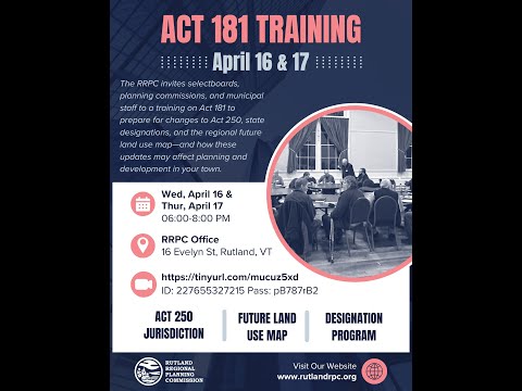
Logan Solomon, a planner with the Rutland Regional Planning Commission, presented a draft regional future land use map and an overview of Act 181 and its implications for Act 250 jurisdiction at a regional planning meeting. Solomon said the presentation aimed to explain the standardized map categories required by Act 181 and to begin municipal-level conversations about whether towns want to opt in to the permanent Act 250 exemptions tied to those categories.
Solomon said the principal purpose of Act 181 is to further Vermont's longstanding land-use planning goal: concentrate growth in downtowns and village centers while protecting rural character and encouraging housing development. "No one's losing any benefits. It's only gaining benefits throughout the process as it relates to the state designation program," Solomon said, describing how existing state designations were reviewed and, in some cases, expanded rather than reduced.
Under the draft map, the RPC applied the statutory categories from Act 181 in a specific order (for example, mapping downtowns and village centers before planned growth areas) so that areas qualifying for multiple categories would be placed in the highest-priority category. The categories that primarily relate to state designation benefits and potential Act 250 exemptions are: downtowns and village centers (merged under a new "center" designation with step 1/2/3 levels), planned growth areas, village areas, and neighborhood designations. Solomon said step 2 of the center designation is similar to the prior village-center program and step 3 is similar to the former downtown designation; step 1 is an entry-level designation with fewer benefits.
Solomon walked through several technical criteria municipalities must meet to qualify for particular categories. For example: planned growth areas must be served by public drinking water or public sanitary sewer (including small community systems such as fire district systems), have adopted zoning and subdivision regulations, and be at least 70% walkable (defined in the presentation as at least 70% of buildings within a quarter-mile of a sidewalk). Planned growth areas were discussed with a density benchmark of roughly 5 dwelling units per acre used to indicate higher-density intent for zoning and municipal plans. Village areas require either public water/sewer somewhere in the municipality and, within the village area itself, soils rated class 1'3 for on-site septic suitability.
Solomon emphasized that towns that already hold state designations will retain their pre-Act 181 benefits and that some designation boundaries were expanded in the draft (for example, Brandon and Middletown Springs were cited as cases where boundaries were extended). He said the RPC tried to align the draft map with existing local zoning and municipal-plan boundaries wherever possible, though mapped flood hazards and river corridors required statutory adjustments in a few places.
On Act 250 (the state land-use review statute historically tied to project scale), Solomon explained the change under Act 181 toward a location-based jurisdiction and described the new tiered exemptions. Tier 1A areas, he said, would be fully exempt from Act 250 for all development if a municipality meets a higher set of criteria and applies directly to the Land Use Review Board. Tier 1B areas would be eligible for a permanent exemption limited to housing or mixed-use projects of 50 housing units or fewer on 10 acres or less; municipalities must opt in to Tier 1B through the RPC. Solomon stressed that municipalities must explicitly opt in to obtain these exemptions.
Municipalities must provide the RPC with documentation of eligibility for Tier 1B (an approved municipal plan, applicable zoning and subdivision regulations or a commitment to adopt them, assurances about regulation of river corridors and special flood hazard areas where required, and a self-certification of adequate municipal staff or officials). Solomon said the RPC would take towns' information forward with the regional plan and that the RPC's timeline requires municipal opt-in decisions no later than July 1 to align with the regional plan adoption schedule.
Key dates and rulemaking milestones described during the presentation: the RPC expects to adopt the regional plan in April 2026; municipalities applying for Tier 1A would apply directly to the Land Use Review Board when that application window opens on Jan. 1, 2026; the Land Use Review Board is required to finalize rules for Tier 3 areas by Feb. 1, 2026; and Tier 3 enhanced Act 250 jurisdiction will take effect in 2027. Solomon also noted that current temporary Act 250 exemptions will begin to sunset in 2027 (specific expiration months vary by exemption) unless a municipality opts in for the permanent Tier 1 exemptions.
RPC staff said they will meet with all 27 municipalities in the region in the coming weeks and months to discuss local implications and potential map adjustments, and to help towns decide whether to opt in to Tier 1B. Solomon and other RPC staff listed a set of municipalities identified during the meeting as likely candidates for Tier 1B discussions, including Wallingford, Poultney, Rutland City, West Rutland, Castleton, Fair Haven, Benson, Proctor, Pittsford, Brandon, Killington and Mendon; RPC staff said some towns already had scheduled special meetings to review the draft map.
The presentation also outlined categories outside the state-designation/Act 250 exemption set: transition/infill areas, enterprise areas (industrial parks and major commercial/industrial sites), resource-based recreation areas (certain developed shorelines and ski-resort adjacencies), and rural categories (rural agriculture and forestry, rural conservation, rural general and hamlets). Solomon said the draft map assigns roughly 2.5% of regional land to the four primary growth categories but those areas contain roughly 38'48% of existing buildings; broader growth + enterprise + recreation categories total about 6% of land and nearly half of buildings, while rural categories account for about 94% of land and the remainder of buildings.
Solomon and RPC staff urged towns to review the draft carefully and said the RPC's goal is to have the regional planning commission tentatively approve the plan in September (to allow the legally required adoption process to run between September and April). The presentation concluded with an invitation to municipal officials and residents to attend town-level meetings and the RPC's phase-three public engagement, which staff described as the final public outreach push before formal plan adoption.
Next steps: RPC staff will hold one-on-one or joint meetings with each municipality to confirm local boundaries, document eligibility for Tier 1B where appropriate, and record any requested edits before the RPC advances the draft map into the regional-plan adoption process.