Get Full Government Meeting Transcripts, Videos, & Alerts Forever!
Get email alerts on the Traffic Calming Pilot Programs topic
No spam. Unsubscribe anytime.
Carbondale Bike/Ped commission narrows MAP implementation to Hendrick/Eighth pilots and low-cost safety work
Summary
Commission members agreed to prioritize traffic-calming pilot tests on Hendrick Drive and Eighth Street, plus townwide low-cost safety projects, and to collect baseline speed data beginning in mid‑April, while forming small public working groups and accepting help from Age Friendly Carbondale.
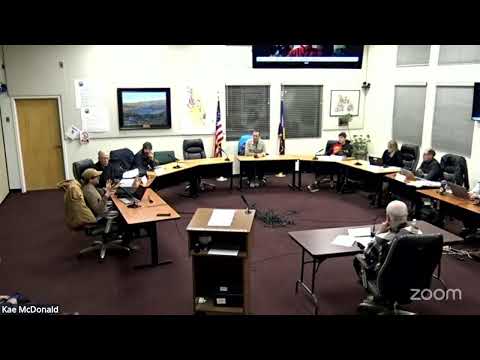
CARBONDALE, Colo. — Members of the Carbondale Bike/Ped Commission agreed at a meeting to concentrate the next phase of implementing the town’s MAP implementation list on two pilot areas — Hendrick Drive and Eighth Street — along with low-cost, townwide safety and traffic‑calming measures. Commissioners said they want baseline traffic data collected beginning in mid‑April so staff can measure the effects of pilot treatments this summer and into the fall.
The commission’s decision narrows a packet list of roughly a dozen implementation items and prioritizes pilot programs and quick, visible improvements that the group expects the town to be able to test and, where appropriate, install rapidly. “I would think probably mid April,” Kevin (staff member) said when asked when counters could be placed to collect before‑data. The move aims to produce measurable before‑and‑after results for vehicle speeds and to inform later tests of bicycle and pedestrian changes.
Why it matters: Commissioners said visible pilot projects and low‑cost maintenance will show the public that the MAP process is producing results and supply evidence for larger, longer‑term interventions. The commission wants tests that isolate single interventions so the town can identify which measures actually reduce speeds or increase walking and biking.
Commission discussion and next steps Commissioners grouped the MAP implementation list into an initial set of five priorities and then focused the immediate work on two items from that list: item 4a (pilot tactical treatments) and item 7 (low‑cost, townwide safety improvements such as repainted crosswalks and targeted curb or sidewalk repairs). Members suggested splitting into smaller, publicly noticed working groups to move faster while complying with open‑meeting rules. Age Friendly Carbondale offered to help run breakout workshops and provide extra volunteer capacity.
Staff and commissioners discussed a practical testing timeline. Kevin (staff member) told the commission he needed to know which locations to instrument so his crew could collect baseline vehicle speed and count data; he said, "I need to know where I need to measure the before data in April." Commissioners emphasized collecting data while school is in session and running summer follow‑ups, then measuring again in fall to capture seasonal variation.
Pilot design and measurement Commissioners stressed two testing principles: (1) limit the number of concurrent changes at a single location so results can be attributed to specific treatments; and (2) prioritize sites where speeding is documented. One commissioner warned, "If you change multiple variables, how in the world do you know which one had an impact?" The group estimated staff could deploy equipment and test roughly six locations if work begins in mid‑April.
Kevin said the commission’s first year of testing should focus on vehicle speed because the town lacks equipment to reliably count bicycles and pedestrians before spring; staff will research additional sensor tools for future phases. The group agreed to prioritize locations where a modest, testable intervention (painted curb extensions, temporary roundabout markings, raised crosswalks, planter boxes or lane narrowing) could be applied and evaluated for speed reduction.
Locations, roles and community input Trustee liaison Chris (trustee liaison) told the commission, “Hendrick and Eighth are… we’re perfectly happy to start there,” and encouraged testing those corridors with treatments that could also support protected bike facilities where feasible. Commissioners and staff said Hendrick Drive — a wide, relatively unobstructed street in parts — is a reasonable test case and that the group should identify a second, similar corridor for comparison.
The commission agreed to form small working groups (ideally two commissioners each to minimize public‑notice burden) that may invite outside participants and hold publicly noticed meetings or walking tours. Patrick and Lauren (staff members) advised the commission to provide clear meeting notices and consider taking minutes even for small, onsite public meetings.
CDOT, Highway 133 and crosswalk questions Commissioners also discussed ongoing coordination with the Colorado Department of Transportation (CDOT) around Highway 133, including a previously discussed roundabout and the connection of Industry Way across the Rio Grande. Members raised questions about an acceleration lane and how it ties into the roundabout; staff said a CDOT permit had been issued that permits the acceleration lane to continue into the roundabout. Kevin and others said Bike/Ped can develop recommendations for staff and trustees to bring back to CDOT.
Separately, staff described a potential crosswalk near City Market: it will sit between the two store entrances, roughly 20 to 50 feet north of the City Market building’s sidewalk connection, and not in a turn lane or acceleration lane.
Public‑comment and data issues Resident Craig Kaffura asked about radar or display signs and whether those devices collect usable download data; staff acknowledged earlier data‑download issues with some units and said the in‑street pneumatic tubes are the least visible counting method and likely the best option for a minimally intrusive baseline.
What the commission directed - Focus between now and April on: 4a (pilot tactical projects) and 7 (low‑cost townwide safety/maintenance). - Form small, publicly noticed working groups to produce location lists and recommended pilot treatments before the April meeting. - Staff to deploy speed/count equipment mid‑April and collect baseline vehicle data (school‑in‑session data preferred), with follow‑up summer and fall measurements. - Age Friendly Carbondale to be invited to assist with outreach and breakout workshops.
Ending Commissioners said they will return in April with proposed measurement locations and a narrowed set of pilot treatments so staff can begin data collection. The commission did not take formal votes during the discussion; members described the plan as a consensus direction for the near term.