Get Full Government Meeting Transcripts, Videos, & Alerts Forever!
Get email alerts on the Land‑use topic
No spam. Unsubscribe anytime.
Addison County planners outline Act 181 mapping, opt‑in exemptions and housing targets
Summary
Addison County Regional Planning staff reviewed Vermont Act 181’s new location‑based review tiers, interim Act 250 exemptions for housing, and a future land‑use mapping process that will ask towns whether to opt in to exemptions; tier 3 guidance and some implementation details remain pending with the new state Land Use Review Board.
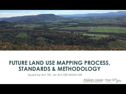
At an Addison County Regional Planning meeting, staff reviewed Vermont’s Act 181 and the regional process to create consistent future land‑use maps that will determine where Act 250 review does and does not apply for housing.
The presentation advised towns that the new framework replaces project‑based triggers with location‑based “tiers,” and that municipalities will be asked whether to opt in to Act 250 exemptions in Tier 1 areas. Staff emphasized that opting in would not change local zoning or local development review, but would change whether housing in mapped areas must go through Act 250 review.
Katie Reichertmeyer, a staff member with Addison County Regional Planning, said the session was intended as a “preview of — or review of — Act 181 and the future land‑use mapping process,” and walked attendees through the tier system and the new Future Land Use Area (FLUA) categories that regional planning commissions must use to produce consistent maps across the state. Reichertmeyer and other staff said the new system is intended to concentrate growth in existing or planned centers by providing Act 250 exemptions in those areas.
Under the new rules presented, Tier 1 areas (broken into 1A and 1B) are growth centers and planned growth areas that can receive either broader exemptions (1A) or a partial exemption (1B). The partial exemption for Tier 1B described in the presentation permits up to 50 housing units per 10 acres to be exempt from Act 250 review within the defined area; Reichertmeyer noted that the mapping work will determine which parcels are included. Adam Lucci, a planning staff member, said, “we intend to work hand in hand with you … to make sure that our plan reflects a lot of local knowledge,” describing outreach to each town’s planning commission and select board.
Presenters stressed several limits and guardrails. Planned growth areas designated as PGA must meet infrastructure and walkability requirements — staff listed wastewater capacity and a “complete streets” standard as examples — and the mapping process will not change a town’s existing zoning or subdivision regulations. “This mapping process won’t eliminate or change any existing village or downtown designation benefits, and it won't restrict development where it is currently allowed,” Reichertmeyer said. Staff repeatedly told attendees that local review procedures (for example a town’s Development Review Board) would remain in place even when a parcel is included in a Tier 1 exemption area.
The presentation reviewed an interim statewide exemption map DHCD issued after the law took effect. That interim map places quarter‑mile or half‑mile buffers around existing downtown and village designations; staff said those buffers make the listed areas exempt from Act 250 for housing until the new FLUA maps are completed. Reichertmeyer said the interim exemptions expire on January 1, 2027. Staff and attendees noted that some projects already are taking advantage of the interim map: presenters pointed to a about‑200‑unit Stonecrop development in Middlebury as an example of recent activity in the region.
Several attendees asked how hazard areas and prime agricultural soils would be handled. Caroline (identified in the meeting as an attendee) said, “Opting in is really scary — how much control does the town still have over what that development looks like after they opt in?” Staff reiterated that towns retain zoning control and local permitting, and that the mapping work will remove parcels with clear hazards — for example floodplain or other constraints — from proposed Tier 1 growth areas where appropriate. Presenters also said that agricultural soils and the Act 250 criteria related to agriculture remain in force for lands not included in exemption areas.
Tier 3 rules, staff and attendees agreed, remain the most uncertain element. Multiple speakers said the newly formed Land Use Review Board based in Montpelier will develop guidance for Tier 3, and Herb (attendee and participant) said the board “will form a group to help … advise them around Tier 3.” Staff warned that Tier 3 guidance had not been completed and could change how conservation and sensitive lands are defined under the new framework.
Staff walked through a case study map for the town of Addison, showing how existing town and regional designations would translate into the new FLUA categories (village center, village area, planned growth area, rural/ag/forest, rural general, rural conservation and resource‑based recreation). Presenters said they would fine‑tune parcel boundaries with each town and that planned growth areas may cross town lines, requiring intermunicipal coordination; Lucci noted the Vergennes planned growth area in the demonstration extended into Ferrisburg and Waltham and would require conversation among those towns.
On timing and engagement, staff said they plan to meet with every Addison County planning commission within the next three to four months, refine maps with local input, and aim to have a regional future land‑use map ready for broader outreach in summer or fall. Reichertmeyer said the regional commission hopes to submit its plan for review by the Land Use Review Board around December and to finish the regional plan before July 2026, when the commission’s current plan expires. The presenters described a multistep public process that includes town planning commission meetings, broader community outreach, and advertised hearings on the regional plan.
Attendees raised other implementation questions, including whether conserved lands could be reallocated or swapped to allow village expansion; staff said that would depend on the terms of individual conservation easements or the landowner’s agreements and is not directly an Act 250 mapping issue. Multiple participants urged clear communication and emphasized the need to consider sewer capacity, soils, and other infrastructure when allocating regional housing targets.
Ending: Staff asked towns to expect outreach and to contact Addison County Regional Planning staff if they want earlier engagement; they reiterated that opting in remains a local choice and that the mapping process will be fine‑tuned through town‑level meetings and the upcoming Land Use Review Board guidance.