Get Full Government Meeting Transcripts, Videos, & Alerts Forever!
Get email alerts on the Groundwater Flow topic
No spam. Unsubscribe anytime.
Witness says Island Lake and Barker Creek are largely disconnected from regional aquifer; opponents press for more data
Summary
At the Meadowview hearing, consultant Mr. Kindred testified that historical well records indicate groundwater elevations are lower than Island Lake and Barker Creek near the site, suggesting limited aquifer discharge to the creek within two miles of the lake; appellants questioned reliance on 1989–1990 data and urged more monitoring.
A Kitsap County hearing on Feb. 10 addressing the Meadowview preliminary plat included extended cross-examination of consultant witness Mr. Kindred on groundwater flow beneath the site and the connection between the Island Lake Aquifer, Island Lake and Barker Creek.
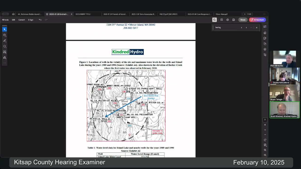
Kindred testified that an evaluation of groundwater elevations — chiefly data from a Robinson Noble 1989–1990 study — indicates groundwater contours in the area trend generally west to southwest and that the observed elevations near the site are substantially below the surface-water elevations at Island Lake and the upstream reach of Barker Creek. He concluded Island Lake and the headwaters of Barker Creek are not receiving direct discharge from the regional aquifer near the project site.
Opposing counsel highlighted the age and seasonal limits of the Robinson Noble dataset and asked why recent or longer-term pumping and well records had not been obtained; counsel said the report itself recommended continued monitoring. Kindred acknowledged the dataset dates to 1989–1990 but said the figures represent highest (winter) water levels during that monitoring period and that using high seasonal levels is conservative for his analysis. He also pointed to a February 2024 field observation run in Barker Creek and a Christa Camp well reading that, in his view, support continued separation between lake/creek elevations and the aquifer.
Numerical points exchanged in testimony included groundwater elevations recorded in the Robinson Noble dataset (examples: high of 204 feet at one well; lows near 184 feet at the same well over the study period) and other nearby wells with elevations cited around 191–196 feet. Counsel asked whether using lower recorded elevations might change flow-direction interpretation; Kindred said his overall finding that Island Lake and Barker Creek are disconnected would hold whether one uses low or high values because the lake surface typically sits many feet above the groundwater levels documented.
Kindred also described leakage dynamics at Island Lake, citing the Robinson Noble discussion that the lake is underlain by a low-permeability silty layer and that measured leakage in their study appeared independent of aquifer level — which he interpreted as evidence of weak hydraulic coupling. Counsel pressed that the Robinson Noble authors had explicitly recommended continued monitoring over multiple years to capture seasonal variability; Kindred said additional data would be useful but that the preponderance of evidence available to him supported his conclusions.
Ending: The cross-examination highlighted competing interpretations of the same datasets and a procedural question about how much new monitoring is required. The examiner said a written decision would follow; the record will determine whether the county requires supplemental field monitoring as a condition.