Get Full Government Meeting Transcripts, Videos, & Alerts Forever!
Get email alerts on the Transportation System Plan topic
No spam. Unsubscribe anytime.
Milwaukie planning commission advances Transportation System Plan work; staff to refine bike/ped maps and project scoring
Summary
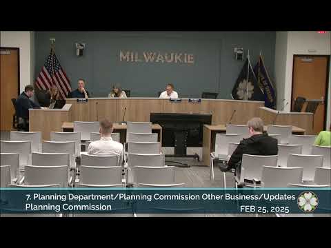
At a Feb. 25 work session, Milwaukie planning commissioners reviewed updated maps and methodology for the city's Transportation System Plan (TSP) update, raised concerns about the Lake Road bike-stress rating and school walk-shed size, and directed staff to refine classifications, outreach and project evaluation ahead of a fall adoption target.
Milwaukie planning commissioners spent their Feb. 25 meeting in a work session on the city's Transportation System Plan, reviewing updated pedestrian and bicycle level-of-traffic-stress (PLTS/BLTS) maps, proposed multimodal functional classifications and an initial project-evaluation framework.
The session, led by consultant Matt Hugart of Kittelson and Associates and city planning staff, presented a revised inventory of sidewalks, bike lanes and other facilities, introduced "priority focus areas" (Milwaukie Town Center, schools, parks, transit stops, grocery/retail hubs and certain low-income or senior housing sites) to guide prioritization, and outlined an 11-goal scoring table the team will use to evaluate candidate projects.
Why this matters: The TSP update will guide where the city proposes walking, biking and transit investments for years. Commissioners flagged several items that could change which projects rise to the top of future funding lists: the BLTS rating assigned to Lake Road, the size of the walk-shed used to prioritize school-area projects, and a set of high-cost rail/roadway intersections that need long-term planning if the city pursues major solutions.
Most of the presentation focused on two performance measures the project team is using: Bicycle Level of Traffic Stress (BLTS) and Pedestrian Level of Traffic Stress (PLTS). Hugart explained the BLTS method relies mainly on bike-lane width (the team used 5.5 feet as a threshold) and posted speed; PLTS relies chiefly on sidewalk width and obstructions. The packet that commissioners received contains the maps (the team noted several packet figures by number), and Hugart said the slides shown in the meeting were the most recently updated versions.
Commissioner concerns and staff responses - Lake Road BLTS: Several commissioners, including Commissioner Edge, said the segment of Lake Road through the city feels more stressful than the BLTS 1 rating in the analysis. City staff and the consultant explained the state-accepted BLTS method produces that rating because the bike lane width and posted speeds meet the stated thresholds, but the segment-level analysis does not fully account for intersection stress or a missing sidewalk in places. "The methodology is the methodology," Matt Hugart said, but he and staff agreed the Lake Road segment could reasonably be shown as BLTS 2 on the maps to better reflect user experience and to ensure it is considered for future interventions. - Sidewalk and PLTS gaps: The consultant showed an inventory indicating many local streets lack sidewalks; the packet statistics show a small percentage of each roadway class currently has unobstructed sidewalks greater than 5 feet. Staff and commissioners agreed the PLTS maps (the team recommended a target of PLTS 2) highlight many locations that will need investments. - School walk-shed: Commissioners debated whether the project should use a 1/4-mile walk-shed for schools (the team's current approach) or a larger buffer. Several commissioners noted North Clackamas School District uses a one-mile threshold for students who do not receive bus service; commissioners said many students walk or bike farther than 1/4 mile in practice. Staff said a larger buffer would cover nearly the whole city and could change prioritization results; they will revisit the buffer choice during the project-selection stage and explain trade-offs in the project documentation. - Priority focus areas and underserved populations: Commissioners asked how the plan addresses equity and underserved groups when census data do not show concentrated pockets in Milwaukie. Staff said they are using land-use proxies (for example, known affordable housing developments, senior centers and resource centers) and direct community outreach. The team has been coordinating with the city's equity liaison and expects to present projects to the Equity Steering Committee and other community groups when projects are more defined. - Connectivity and missing links: Commissioners and staff discussed several local connectivity opportunities and constraints, including potential bike/ped links across the railroad and U.S. 224/99E corridors, alleys and informal crossings used by pedestrians, and the difficulty of adding new connections in already-built neighborhoods. Commissioners urged the team to map realistic, opportunistic connections (for example, multiuse paths or links that could be built when parcels redevelop) while avoiding mapping lines that imply new streets through private backyards. - Large intersection/rail-crossing needs: The team flagged several intersections where freight, vehicle, bike and pedestrian needs overlap. Commissioners noted some suggestions on the map (for example, grade separation at certain rail crossings) represent projects that would require major planning and large funding sources; the consultant and staff confirmed those callouts are intended to identify gaps rather than endorse a single solution.
Process and next steps Commissioners heard that the project will move from mapping and needs assessment to a project-evaluation and prioritization phase. The team will generate a long list of candidate projects, score them using the multi-criteria table presented at the meeting, and produce a prioritized list. Staff said they expect further refinements to the maps following the evening's comments and will return to the commission several more times before adoption, targeting final adoption in the fall. The project team indicated the packet included more detailed maps (the consultant referenced a 90-page package and multiple memos) and that the slides shown at the meeting had the latest map updates.
Public process and outreach The planning staff confirmed ongoing public outreach, advisory and technical committee reviews and coordination with county and regional partners (TriMet, Metro, ODOT). The team said it will engage the city's Equity Steering Committee and community groups again as projects become more specific and said some maps and datasets will be posted on the city's website as the update progresses.
Formal action The planning commission took no land-use or fiscal action during the TSP work session. The only formal action recorded on the meeting agenda was a procedural adjournment motion at the end of the session; the motion was moved, seconded and carried by voice vote to adjourn.
What commissioners asked staff to do next - Review and consider reclassifying the Lake Road BLTS designation (staff indicated BLTS 2 would be reasonable). - Re-evaluate the walk-shed buffer used for school-focused prioritization and explain trade-offs; consider alternatives (half-mile or one-mile) and the effect on project prioritization. - Clarify mapping conventions (how out-of-jurisdiction facilities such as the Springwater Corridor are shown, and whether proposed/unbuilt connections are dashed or otherwise distinguished). - Continue outreach with the Equity Steering Committee and community groups when project-level proposals are ready. - Prepare the project-evaluation list and apply the scoring framework; return to the commission with a draft prioritized project list and refined maps ahead of fall adoption.
The commission's next regular meeting is scheduled for March 11, when staff expect to present one public-hearing item and to welcome newly appointed commissioners; the TSP team will return with project-selection materials in a later meeting.
Ending Commissioners praised the depth of the mapping and analysis and thanked the consultant and staff for the extensive work. No binding policy change was approved at the Feb. 25 work session; the meeting concluded with the adjournment vote.