Get Full Government Meeting Transcripts, Videos, & Alerts Forever!
Get email alerts on the Basalt Creek Industrial Readiness topic
No spam. Unsubscribe anytime.
Wilsonville planners review Basalt Creek industrial-readiness, flag wetlands and access constraints
Summary
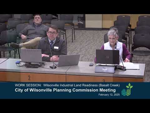
At a Feb. 12 work session the Wilsonville Planning Commission reviewed updated technical analyses for the Basalt Creek portion of the Willow project, including transportation, utilities, and a natural-resources inventory that found two significant wetland complexes and noted constrained access in the West Railroad area.
Wilsonville Planning Commission members on Feb. 12 reviewed updated technical studies and land‑use concepts for the Basalt Creek portion of the Willow (Willow/Willard) industrial land readiness project, hearing staff and consultant findings on transportation, utilities, and natural resources that will guide a Basalt Creek master plan and implementing development code later in 2025.
The planning‑level presentation, given by city planning staff, summarized four deliverables: a Transportation System Plan (TSP) reevaluation and local street concept map prepared by DKS; a natural resources inventory by Pacific Habitat Services (prepared to address Statewide Planning Goal 5); a draft infrastructure summary by city engineering staff covering water, sewer and stormwater; and a synopsis of Basalt Creek land‑use types prepared by planning staff. "We’re here tonight to seek Planning Commission’s input on technical analysis and land use types related to refinement of the Basalt Creek concept plan," a staff presenter said.
Why it matters: the studies will inform a Basalt Creek master plan and subsequent code changes that the city expects to take to adoption hearings later in 2025. The area is intended to meet regional employment needs, but staff and commissioners emphasized that infrastructure, natural‑resource constraints and market demand will shape what is feasible and when.
Key findings and staff recommendations - Transportation: The TSP reevaluation found that the projects added or updated since the 2019 concept plan remain applicable and that no additional TSP projects are required at this stage. Staff said a full reanalysis of 2035 traffic volumes was not compelling now because only about 20% of the concept‑plan development has been approved and built so far. Arterials assumed to be fixed in location include Grams Ferry Road, Day Road, Boones Ferry Road and Basalt Creek Parkway; local street alignments in the concept map are conceptual and may be public streets, private streets, or easements as development occurs. - Utilities and infrastructure: City engineering staff reported that water, sewer and storm lines are generally expected to follow the arterial layout and connect to existing lines where available. The infrastructure summary contains rough cost estimates; staff said a cash‑flow analysis and more detailed cost updates are planned later in 2025. - Natural resources: The inventory identified two significant wetland areas (referred to in the materials as BC‑1 in Basalt Creek Canyon and BC‑2 in West Railroad) and associated riparian areas. Several upland tree groves (including one labeled BCG‑7) met wildlife‑habitat criteria. Staff recommended considering a significant resource overlay zone to meet Goal 5 objectives. - Land‑use types: The concept plan retains three industrial land‑use types for Basalt Creek: high‑tech employment (modeled as roughly half office/half industrial with potential for taller office buildings near I‑5), light industrial (modeled at about 69% industrial with the remainder warehousing and office), and craft industrial (smaller tenant spaces, 2–3 story buildings with some live‑work). Staff said the concept plan’s uses remain broadly valid but that office percentages and some assumptions may need refinement based on updated market data.
Sites of particular interest - Southwest Green Hill: Staff identified a roughly 57‑acre consolidated site in the high‑tech employment type that appears well‑positioned for industrial development given ownership, undeveloped land and proximity to infrastructure. - West Railroad: The West Railroad opportunity site spans about 165 acres on large parcels and could be attractive for general manufacturing, food processing or warehousing, but staff stressed significant constraints: only one established vehicular ingress from Southwest Grams Ferry Road; a low railroad undercrossing that currently does not allow standard semi‑trailers; proximity to a mining operation and a railroad line that can introduce vibration; and extensive natural resources. The materials noted recent proliferation of contractors’ establishments in West Railroad, which complicates efforts to promote urban industrial redevelopment without targeted incentives.
Commissioner questions and concerns Commissioners pressed staff on the timing and capacity of road improvements, the potential for transit service or a regional station, and whether power utilities can serve heavy energy users. In response staff said the city is coordinating with the county on Basalt Creek Parkway planning, that concurrency rules in the development code would limit occupancy if streets exceed capacity (developers must show funding and construction on a 24‑month trajectory), and that Portland General Electric (PGE) had raised no red flags in preliminary conversations though detailed cost‑allocation and upgrade responsibilities are resolved between utilities, developers and ratepayers. Staff acknowledged more detailed engineering and cost findings would come in follow‑up analyses.
Divergent views on West Railroad and craft industrial Commissioner Jennifer Willard urged that the West Railroad area may be unsuitable for industrial use and suggested it be considered for conservation or park use because of riparian and wetland resources; she said the area "seems like a waste of a beautiful area" if developed industrially. Other commissioners asked staff to return with market inventory and vacancy data, and with a clearer description of what uses are allowed under the Metro regional employment designation. Several commissioners said market data are only one factor in a policy decision that must also balance design and community goals.
Staff directions and next steps Staff said they will: provide additional information on timing for planned road improvements and the Basalt Creek Parkway extension; work with Eco Northwest (market consultant) to present land‑use inventory and vacancy analyses in a more accessible format; follow up with PGE for any detailed infrastructure constraints or cost‑sharing information; develop a cash‑flow/infrastructure funding plan and refined cost estimates later this year; and return with a more detailed discussion focused on West Railroad after the city finishes its access and infrastructure analysis.
Ending note The Planning Commission provided general support for continuing to refine the concept plan and requested follow‑up data on transportation timing, market demand by product type, and utility capacity. Staff said additional work sessions and council hearings are anticipated through 2025 as the Basalt Creek master plan and implementing code are developed.