Get Full Government Meeting Transcripts, Videos, & Alerts Forever!
Get email alerts on the Comprehensive Plan Zoning topic
No spam. Unsubscribe anytime.
Preservation commission, public warn Envision Evanston 2045 zoning draft could threaten historic neighborhoods
Summary
Public commenters and Preservation Commission members said the draft comprehensive-plan zoning changes would increase tear-down pressure and destabilize low-scale commercial corridors and residential historic districts; the commission agreed to prepare consolidated comments for Land Use Commission review.
Public commenters and members of the Evanston Preservation Commission warned the commission and city staff on Tuesday that proposed zoning changes tied to the draft Envision Evanston 2045 comprehensive plan could accelerate demolition and undermine the character of multiple neighborhoods.
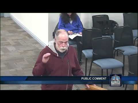
The warning came during public comment and a lengthy preservation-commission review of draft zoning maps that would increase allowed building height and bulk across several downtown and neighborhood commercial corridors. Steve Test, a resident of 1135 Hinman Avenue, told the commission the draft plan “is weighed so heavily towards developers” and urged the commission to push for a stronger preservation chapter to give the body more tools to protect Evanston’s existing fabric.
Why it matters: The commission’s review focused less on individual applications than on the broader policy and zoning changes in the draft plan — specifically proposals that would raise maximum heights and floor‑area ratios on blocks now characterized by low‑scale storefronts, historic landmarks and small multifamily buildings. Commissioners said increasing development potential without neighborhood‑sensitive safeguards could make demolition and large infill projects more likely and increase pressure on long‑time residents.
What was said and discussed
- Tina Paden, who said she lives at 1122 Emerson Street, described a local history of displacement tied to earlier large projects and urged the commission to “stop Envision 2045 and stop the comprehensive plan” unless safeguards are added. She recounted past land‑use changes tied to Northwestern University and the Research Park that she said removed Black households from her block and contrasted past public actions with current proposals.
- Cecile McHugh, who identified herself as the owner of buildings in historic districts at 1926 Orrington, said she was concerned how the proposed upzoning would affect buildings in historic districts that are zoned R4A and R2. She asked whether the preservation ordinance would “overlay any changes to the zoning” for properties not zoned R1.
- Mary Rosinski, a real‑estate agent, urged the commission to press for a stronger preservation chapter, saying prospective buyers choose Evanston neighborhoods in part for scale and architectural character.
- City staff (identified in the meeting as “Kate,” city planning staff) told commissioners that draft materials include a preliminary zoning diagnostic prepared by ZoneCo; she walked the commission through examples where current D2 downtown zoning (maximum heights cited at about 42 feet and FAR of 1.75 in existing code) were shown in the draft as much larger envelopes (examples shown in the meeting cited drafts with proposed maximum heights up to 135 feet and FARs up to 7 in some blocks). Staff noted the zoning diagnostic and draft are under active revision and that a revised comprehensive‑plan draft was expected to be released to commissions and the public in late February.
Commission reaction and next steps
Commissioner John Jacobs (Preservation Commissioner) summarized the commission’s concerns in a prepared statement: the proposed increases in height, bulk and unit capacity would incentivize teardown and replacement with buildings “not sensitive to their context,” potentially changing the character of districts and threatening both historic buildings and affordable housing stock. Jacobs said he opposed the draft zoning changes in their current form and urged the city to pursue targeted plan‑development tools (planned developments) and other approaches rather than wide‑ranging upzoning.
The commission agreed — without a formal recorded vote on a motion — to consolidate the discussion into formal comments to the Land Use Commission and city staff. Chair Klein asked staff to collect written comments and for commissioners to send suggested language; staff said they would attempt to compile a draft letter and redistribute it for review. Commissioners also discussed asking the Land Use Commission for additional review time when the revised draft is released.
Context and specifics cited in the meeting
- Participants called out multiple places on the draft map: portions of Sherman/Clark and the block around the Marshall Field building and the Varsity Theater (downtown), the Asbury Hall and Sherman Gardens areas, the Women’s Christian Temperance Union / Frances Willard block, Central Street’s form‑based overlay, and a cluster near Florence/Greenleaf frequently used by artists and small businesses.
- Commissioners and residents described specific draft proposals shown in meeting slides: D2 downtown parcels with current 42‑foot/1.75‑FAR parameters shown in the draft as zones with up to 135 feet in height and FARs up to 7; Central Street overlay rules (current: max 3 stories/35 feet, transitional height planes and fenestration/articulation requirements) contrasted with a proposed M2 designation that the draft illustrated at 65 feet and FAR 5.
- A public commenter referenced the former Research Park area and the recent sale of a development parcel (cited in testimony as $148,000,000) as examples of how land‑value shifts can change neighborhood access and affordability.
What the commission will do next
Commission staff said a revised comprehensive‑plan draft would be released to commissions and the public on or about Feb. 21; Land Use Commission discussion was expected shortly afterward. The Preservation Commission planned to review the revised draft, consolidate comments into a single letter, and present them to the Land Use Commission. Commissioners also flagged a joint ward informational meeting on Tuesday, Feb. 18 at 6 p.m. in the Civic Center Parasol Room as an opportunity for public comment and outreach.
Ending
Commissioners and members of the public framed the discussion as pro‑active: several said they supported the city’s stated goals of increasing housing affordability and diversity but asked for neighborhood‑specific analysis and tools that protect architectural character and existing affordable housing rather than blanket increases to height and FAR that, they said, would likely accelerate tear‑downs.