Get Full Government Meeting Transcripts, Videos, & Alerts Forever!
Get email alerts on the Data Guidelines topic
No spam. Unsubscribe anytime.
Office of Energy Infrastructure Safety reviews revised draft data guidelines v4, sets Jan. 1, 2025 effective date
Summary
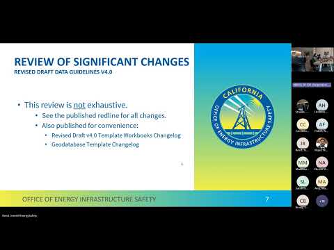
Jenny Reed, supervisor of the data analytics unit at the Office of Energy Infrastructure Safety, opened a hybrid public workshop to present the agency’s revised draft Data Guidelines version 4 and to solicit public comments.
Jenny Reed, supervisor of the data analytics unit at the Office of Energy Infrastructure Safety, opened a hybrid public workshop to present the agency’s revised draft Data Guidelines version 4 and to solicit public comments. "This workshop is for convenience, for information sharing. It's not an exhaustive review of all of the changes in the published revised draft data guidelines version 4," Reed said.
The revised draft aligns the department’s reporting schema with the Wind Management Plan (WMP) technical guidance appendix A, Reed said, and implements related changes across both the GIS (spatial) and tabular templates. The agency published a redline and two change logs (a geodatabase template change log and a template workbooks change log) to document edits and help users locate less-visible template changes.
Why this matters: The changes are intended to clarify the relationship between categories, initiatives and activities used in WMPs, reduce ambiguous field names in spreadsheets, and improve consistency between the WMP technical guidance and the department’s data collection templates. Reed said the department has tried to limit substantive changes but proceeded with the edits because they standardize terminology and reporting across documents.
Key changes explained
- Alignment with WMP appendix A: The department says it updated Appendix C of the guidelines to implement the WMP hierarchy (category → initiative → activity). In the templates this appears as renamed fields and clarified definitions so reported items roll up correctly. Reed said reporting has historically occurred at the activity level and the edits were intended to make labels cleaner and consistent with the WMP guidance.
- Rename and ID handling: The geodatabase and templates rename an existing identifier to "utility mitigation activity tracking ID" (UMAT ID) to reflect the clarified category–initiative–activity structure. Reed said this is not a new identifier, only a rename to keep consistency with the WMP guidance. A participant asked why the shorter UMAT alias appears in some spatial-field names; staff explained the shortened alias is a technical workaround for Esri field-name character limits and that the full label appears as the field alias in desktop software.
- GIS vs. tabular changes: Revisions apply across the initiative feature dataset in GIS and to tabular templates (tables 1, 3, 4, 10, 11 and 12 were called out). Table 11 (financial reporting) gained a column to distinguish initiative-level versus activity-level financial lines; table 12 remains the mid- and end-year target table tied to table 1 activities. The department added table 3 to the annual WFP workbook to provide projections that had been omitted.
- Clarification: inspections vs. projects: The guidelines clarify that asset- and vegetation-inspection feature classes are for inspection observations only, while project/management feature classes (for grid hardening, vegetation management, etc.) are for physical work. Staff said the change is intended to prevent inspections and work projects from being reported under the wrong feature class.
- Field-name and unit simplifications: The tabular templates remove lengthy inline instructions from column headers and move calculation details to Appendix B (glossary), producing shorter, clearer field names. Staff emphasized these are label and documentation changes intended to preserve existing semantics, not to change the meaning of fields.
- Units represented and initiative audits: The "units represented" field was added to most initiative feature classes but was not added to initiative-audit features. A participant from a utility raised that audits often need units information because they quantify audited units. Department staff acknowledged the point and said they would consult policy staff to determine whether initiative-audit feature classes should mirror the other initiative fields.
- Parentheticals and multiple IDs: The templates now allow parenthetical disambiguation when a category and an initiative (or two initiatives) share the same name. The tabular templates also accept plural utility mitigation activity tracking IDs on a single reporting line when multiple activities roll up to the same initiative.
Geodatabase template availability and Esri date-field issue
Reed said the revised geodatabase template is posted on the department’s website under the data team page and described it as the "draft final" version for this comment period. Several participants said they could not open the draft geodatabase because it used a new Esri "date-only" field type that some utilities have not yet adopted in their software versions. Reed said the team will publish a version that reverts those fields to the older date style to maintain compatibility for users running older Esri builds and invited affected users to contact the data team promptly rather than waiting until the end of the comment period.
Adoption timetable and reporting deadlines
Reed explained the department’s adoption process: substantive changes are posted for a 30-day comment period; the revised draft is now in its second 30-day comment period. The draft states an effective date of Jan. 1, 2025; if adopted, the guidelines will apply retroactively to that date. The department said the first GIS submissions expected under the revised schema will accompany the Q1 2025 quarterly data report (due May 1, 2025), assuming adoption proceeds in time. Reed said the department cannot commit to a final adoption date during the workshop and urged utilities to perform their own risk assessment when deciding whether to prepare data for the new schema before formal adoption.
Public comments and technical follow-up
Participants raised technical and implementation questions: a utility representative asked that added custom fields be appended to the far right of attribute tables to minimize disruption to existing ETL scripts; a commenter asked about numeric field types for PSPS duration fields (short vs. long); and PG&E’s Bob Nelson asked for confirmation that the annual tabular submission is due three days before the final WFP submission deadline; staff confirmed it is.
Reed closed by thanking participants and reminding attendees that some suggestions collected during the first comment period were not implemented in this revision but remain under consideration for future workshops or policy work. "Keep an eye out for our next notice, hopefully for our adoption meeting," she said.
Ending
The department asked stakeholders who are affected by the Esri date-only field issue to email the data team or the contact listed on the Energy Safety website so the team can prioritize fixes during the comment period. Staff said the draft will remain open for comment through the stated 30-day period and that the department intends to workshop additional implementation issues later in the year.