Get Full Government Meeting Transcripts, Videos, & Alerts Forever!
Get email alerts on the Zoning Mu Consolidation topic
No spam. Unsubscribe anytime.
Salt Lake City planning staff outline wide mixed‑use zoning consolidation, map changes and design standards
Summary
Salt Lake City planning staff presented a proposal to consolidate 26 commercial and mixed‑use zones into six MU districts and to update map designations, design review thresholds and active ground‑floor rules to simplify the code and promote compatible housing and mixed‑use development.
Salt Lake City planning staff on Feb. 4 presented a consolidated mixed‑use zoning proposal that would merge 26 existing commercial, mixed‑use and form‑based districts into six new mixed‑use districts (MU2, MU3, MU5, MU6, MU8 and MU11), revise the zoning map in targeted areas and add citywide design standards and open‑space minimums.
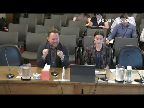
The presentation, given by Chrissy Gilmore, senior planning staffers Daniel Echeverria and Kelsey Linguist, and introduced to the council by Nick Tarbot, described the twin aims of the project: to simplify the zoning code so it is easier to administer and to better align regulation with building form and neighborhood context. "This proposal is to update the zoning ordinance and the zoning map by consolidating 26 commercial mixed use and form based districts into 6 new mixed use districts," Gilmore said.
Planning staff said the new MU zones are scaled by typical building heights and forms — MU2 and MU3 for lower‑scale neighborhood commercial and townhouse forms, MU5 and MU6 for mid‑scale corridors and transit areas, and MU8 and MU11 for higher‑intensity commercial and mixed‑use locations outside the core downtown area. The proposal would retain most existing development rights but in some places allow slightly greater height or reduced setbacks to support additional housing production and by‑right development.
Staff described substantive code changes that would apply across the proposed MU districts: a 10% minimum open‑space requirement for most mixed‑use zones (with some forms requiring 20–25%); a 15‑by‑15‑foot minimum dimension for at least one usable open‑space area; design standards for facades (minimum glazing, doorway spacing, limited facade length and active ground‑floor uses); and new rules for lots without public street frontage. The draft also sets district‑specific thresholds that trigger planning commission design review (for example, MU3 at 35 feet, MU8 at 75 feet and MU11 at 85 feet).
Planning staff emphasized two categories of ground‑floor activation: a general active ground‑floor requirement (any non‑parking use) and an "enhanced active ground‑floor" requirement (retail, restaurants, civic uses, etc.) that would apply only on specified corridors and intersections. Kelsey Linguist explained that MU2 would generally prohibit replacing neighborhood‑serving commercial buildings with purely residential uses while MU3 would require enhanced active uses at certain arterial corners.
The map changes described in the briefing include a proposal to rezone selected M1 (light industrial) properties in the West Side plan area to MU6 to align the code with the future‑land‑use plan, and consolidations of TSA/Sugar House Business District rules into the new MU framework. Staff also proposed replacing four overlays (South State Street corridor overlay, Downtown Main Street core overlay, light manufacturing height overlay and the existing transitional overlay) and substituting a revised transitional overlay that preserves certain higher‑impact uses where appropriate while requiring extra buffering next to residential areas.
Planning staff noted several substantive refinements they plan to bring back to council, including: (1) adding contractor's yard and indoor contractor office uses to the transitional overlay; (2) removing a Richard Street (Ballpark area) enhanced active ground‑floor designation after further analysis; (3) increasing private directional sign height to 8 feet; (4) shortening the proposed code transition period from the initial 9–12 months to a 3–6 month window (with alternatives under discussion); (5) deleting a 6‑foot walkway requirement between long facades; and (6) clarifying which high‑intensity MU zones require ground‑level vegetation (i.e., not counting only tree canopy) to improve pedestrian comfort.
Council members asked technical and policy questions throughout the hour. Members pressed staff on: whether ground‑floor activation requirements could force inappropriate commercial uses into locations that lack retail demand; how the code treats rooftop uses and rooftop parapets; how stepback/setback rules would apply where zoning bands meet parcel lines; drive‑through allowances (a few MU districts would allow drive‑throughs as conditional uses); parking context and whether applicants could still provide additional or structured parking beyond minimum requirements; and how the changes would be phased for projects already in design. Planning staff repeatedly said some topics will be subject to future amendments and implementation details, and that staff intends to hold follow‑up meetings with council members on parcel‑specific map decisions.
Why it matters: The consolidation is a comprehensive rewrite of much of the city's mixed‑use, corridor and small‑scale commercial zoning. If adopted, it will affect allowable uses, design review thresholds, building massing, and where the city expects commercial activation versus purely residential redevelopment. Staff characterized the proposal as intended to reduce complexity and encourage by‑right housing and mixed‑use development while retaining tools to require compatibility next to lower‑scale neighborhoods.
Next steps: Planning staff asked the council for policy feedback and noted they will incorporate council direction before final transmittal to the planning commission and subsequent ordinance drafting. Staff said they will return with revised text and additional mapping fixes and that some items will be scheduled for small‑group follow‑ups with council members to discuss specific parcels and technical questions.
Ending: The council did not take any final votes on the consolidation during the work session; staff will return with ordinance language and map corrections for the council and planning commission to review in the coming months.