Consultants present Okaloosa County flood vulnerability findings; hotspots include Okaloosa Island and key evacuation routes
Loading...
Summary
Tanya Gallagher, project manager for Jacobs, and county officials presented preliminary results of a countywide vulnerability assessment at a Feb. 2025 public meeting, saying the analysis found that fewer than 10% of the assets the team reviewed are exposed to the 1% annual (100‑year) flood but that localized hotspots pose substantial operational and community risks.
Tanya Gallagher, project manager for Jacobs, and county officials presented preliminary results of a countywide vulnerability assessment at a Feb. 2025 public meeting, saying the analysis found that fewer than 10% of the assets the team reviewed are exposed to the 1% annual (100‑year) flood but that localized hotspots pose substantial operational and community risks.
The assessment, funded through the state Resilient Florida program and prepared for Okaloosa County, maps present‑day and future flood scenarios and will be used to support grant eligibility and to develop adaptation projects. Jacobs staff said the report will be finalized for submission to the county and then to the Florida Department of Environmental Protection for alignment with state requirements.
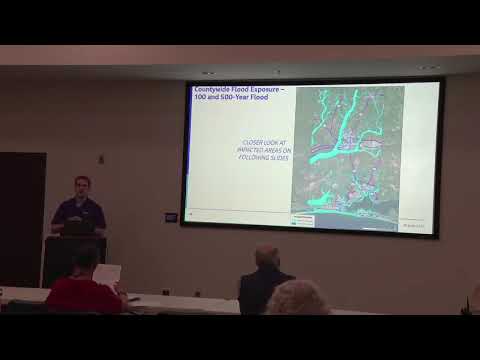
The consultants said the study began in April 2024, used county and state spatial data and FEMA baseline products, and applied a county‑scale “bathtub” approach to map flood exposure and depth. Jacobs staff said the team analyzed roughly 127,000 assets compiled from multiple sources and classified vulnerability at the asset level (no exposure → extreme) to prioritize mitigation strategies.
Preliminary findings highlighted concentrated vulnerabilities rather than countywide failure. "The most vulnerable critical, community and emergency facilities was found to be the Elliot Point Elementary School and the fire station out on Okaloosa Island," said Blake, a Jacobs presenter, noting those facilities’ proximity to tidal and storm‑surge inundation.
The presentation named specific asset classes and locations that showed elevated exposure: wastewater lift stations (including a set of lift stations in south Okaloosa County and some on the south side of U.S. 98), two water tanks on Okaloosa Island, the Lower Memorial Lake Dam, electrical infrastructure and several county‑ or municipal‑owned parks and boat ramps. Consultants said much of the north‑county flooding is driven by rainfall and riverine overflow, while tidal and storm surge inundation dominate south county results.
Transport and evacuation routes were a central concern. Consultants identified segments of U.S. 98 on Okaloosa Island and in Fort Walton Beach, portions of State Road 85 near the Shoal River and crossings in the Crestview area, County Road 393, and low sections around Destin and Mid‑Bay Bridge as vulnerable under the 100‑year and higher tide scenarios. Presenters noted existing planning efforts — including FDOT projects and a military installation resilience review — that are already tracking some of those locations.
Jacobs showed two tidal scenarios: a high tide definition tied to mean higher high water plus two feet, and longer‑term scenarios that add sea‑level rise. Under tidal scenarios the consultants said about 6,400 residential parcels would be affected in one model and roughly 13,000 residential parcels under an intermediate high scenario; they emphasized those parcel counts are county‑level tallies for planning, not property‑level engineering assessments.
Public commenters and local officials raised operational and coordination concerns. Several attendees said resurfacing and roadway design along U.S. 98 had changed local drainage patterns and created new low spots; residents described repeated short‑duration flooding on sections of 98 and county roads and said pedestrians and cyclists are at risk when motorists divert around standing water. A county official and county water‑and‑sewer staff outlined ongoing investments in lift‑station monitoring, portable and permanent generators, and system improvement programs.
Consultants addressed modeling questions from the public: they said FEMA flood products were used as a baseline and that the team built a regionally‑aligned bathtub model drawing on county and state datasets. Jacobs staff said they did not rely as primary inputs on private products such as First Street Foundation, though they will consider external models for “gut checks” where appropriate.
Participants asked whether vulnerability assessment results would remain on a shelf; Jacobs and county staff said the assessment is intended to support the county’s Local Mitigation Strategy and future grant applications. Presenters recommended using the assessment to prioritize projects already in local capital improvement plans and to coordinate across jurisdictions on issues such as seawall heights and consistent shoreline protections.
Next steps cited at the meeting included finalizing the vulnerability assessment report, submitting it to county staff and the Florida Department of Environmental Protection, and beginning a formal adaptation planning phase that will evaluate and rank mitigation options and outreach needs. County and regional actors discussed using the Emerald Coast Regional Council and regional resilience collaborative as venues for interjurisdictional coordination and potential memoranda of understanding.
The meeting closed with Jacobs and county staff inviting written feedback and follow‑up conversations on specific assets and local drainage issues; staff said they will return with the adaptation planning schedule and further engagement opportunities.