Get Full Government Meeting Transcripts, Videos, & Alerts Forever!
City launches public permits and development dashboards to show active projects
Summary
City staff demonstrated new public-facing GIS dashboards that show active permits and development plans for Centennial; the tools are browser-based, updated daily, and intentionally omit direct links for sensitive locations. Staff will monitor usage and collect feedback before expanding shown permit types.
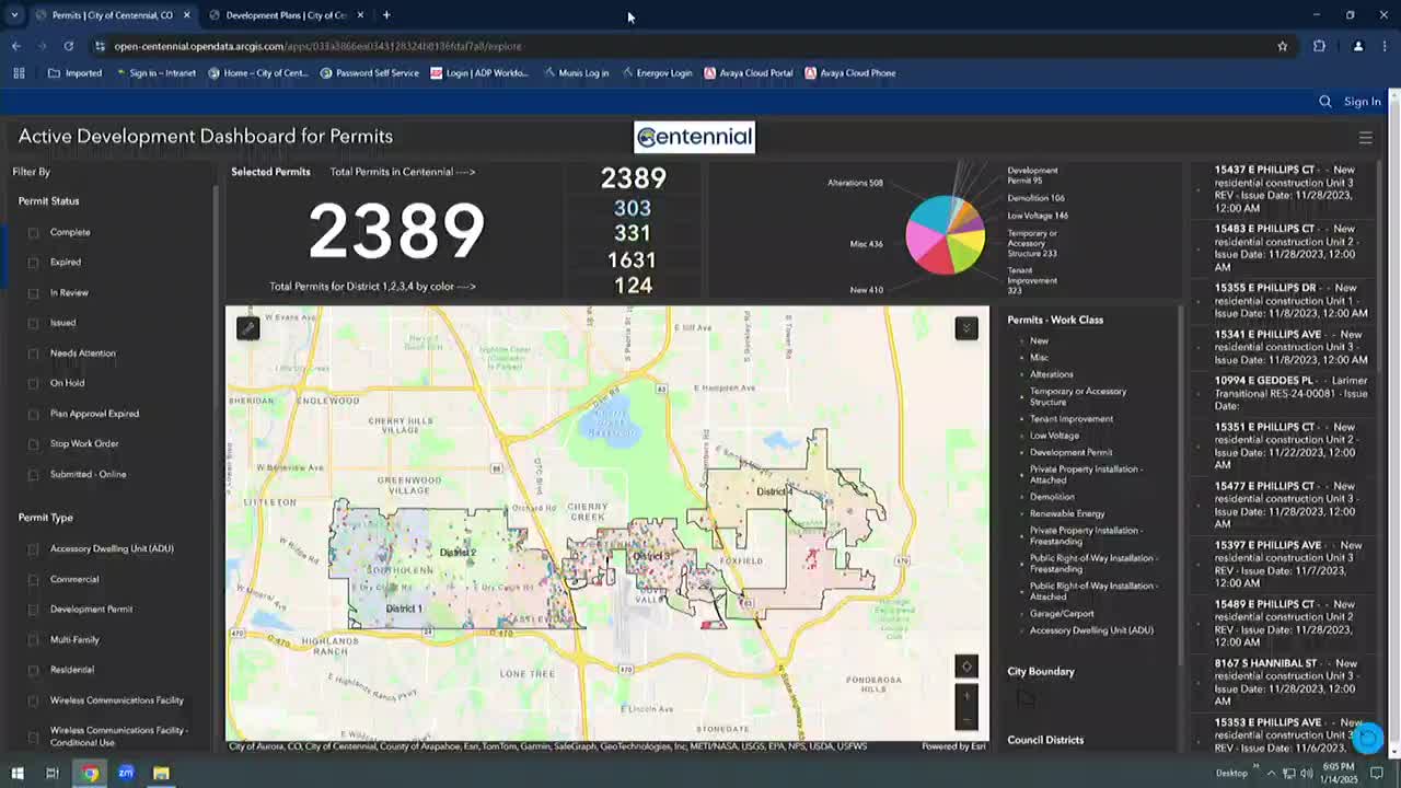
Centennial staff demonstrated a new, publicly accessible set of interactive dashboards that let residents and council members view active development permits and planning applications across the city.
The dashboards, staff said, are available without a login from the city’s Maps & Open Data web page and “are updated automatically, daily,” giving users the ability to search by address, filter by permit status, work class or council district, and access application details and attachments where available. “These interactive tools are designed to provide real time information on ongoing development projects and permit activities throughout Centennial,” Michael Sandoz, senior GIS analyst, told the council during a live demo.
City staff framed the dashboards as an early-transparency tool intended to let neighbors see proposals and permit progress before projects reach public hearing stages. “This is a tool to increase that transparency and show the progress of permits and plans from beginning to end,” Sandoz said. Mike Jones, the city’s Technical Services Manager, described the effort as an investment in both…
Already have an account? Log in
Subscribe to keep reading
Unlock the rest of this article — and every article on Citizen Portal.
- Unlimited articles
- AI-powered breakdowns of topics, speakers, decisions, and budgets
- Instant alerts when your location has a new meeting
- Follow topics and more locations
- 1,000 AI Insights / month, plus AI Chat