Commission denies request to change 0.7‑acre South Beaches lot from Res‑1 to Res‑2 after extensive public opposition
Get AI-powered insights, summaries, and transcripts
Subscribe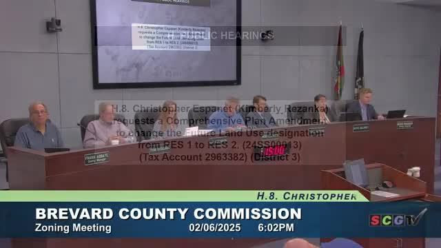
Summary
The commission voted unanimously to deny Christopher Espinet’s comprehensive plan amendment request to change a 0.7‑acre lot from Res‑1 to Res‑2 following hours of testimony from residents, counsel and planners; county counsel and planning staff said policy 7.1 prohibits increasing residential density on the county’s Barrier Island area.
The Brevard County Board of County Commissioners on Feb. 6 denied a request by Christopher Espinet to change the future land‑use designation of a 0.7‑acre lot on the South Beaches from Res‑1 to Res‑2, after substantial public testimony and legal briefing that centered on coastal policies limiting density.
The board voted 5–0 to deny the application. The item drew more than an hour of public comment, local planning commentary and legal analysis. Several residents said the proposal would increase density in a sensitive Barrier Island area already identified as an Area of Critical State Concern; they called the request precedent‑setting and incompatible with the county’s Coastal Management policies.
Applicant’s case and planning argument: Espinet’s attorney, Kim Rezanka, and planner Jim McKnight argued the parcel is an unusual legacy condominium lot created when a larger parcel was subdivided under condominium declarations. Rezanka said the application proposed a single‑family house, not multifamily housing, and submitted a binding development plan (BDP) to limit uses. “There’s been a lot of unnecessary anger and worry about a matter that’s really about one single family house,” Rezanka told the commission.
County legal and staff position: County counsel and the planning director told the board the requested change would increase residential density designations on the Barrier Island between the southern boundary of Melbourne Beach and Sebastian Inlet and thus conflicts with Policy 7.1 of the Comprehensive Plan. County counsel said Policy 7.1 must be followed and that the plan and its policies together form the governing standard for land‑use decisions. “Policy 7.1 clearly and unequivocally prohibits increases in residential density designations for properties located on the Barrier Island,” the county representative said during remarks to the board.
Public testimony: Dozens of residents, neighborhood groups and coastal advocates urged denial. Speakers cited evacuation limitations, groundwater and septic constraints, wetlands and the area’s role for loggerhead nesting. Multiple speakers pointed to the parcel’s 0.7‑acre size and the county rule that Res‑1 density is one unit per acre. Residents said the developer who created the condominium regime decades ago caused the nonconforming lot and that the county should not fix what one speaker called a private real‑estate error.
Board action: Commissioner Atkinson moved to deny the comprehensive plan amendment; Commissioner Delaney seconded. The motion passed unanimously.
What’s next: Because this was a comprehensive plan amendment request on a future land‑use map, the denial ends the application at the local level. The applicant may pursue other legal or administrative remedies outside the forum of this meeting, but the board’s vote leaves the lot at its existing Res‑1 designation.
Ending: Commissioners thanked residents for participating. Several said the matter raised difficult questions about fairness and land‑use history but reiterated that current comprehensive‑plan policy determined the outcome.