Get Full Government Meeting Transcripts, Videos, & Alerts Forever!
Planning staff outlines proposed future land‑use map changes to meet state housing targets
Summary
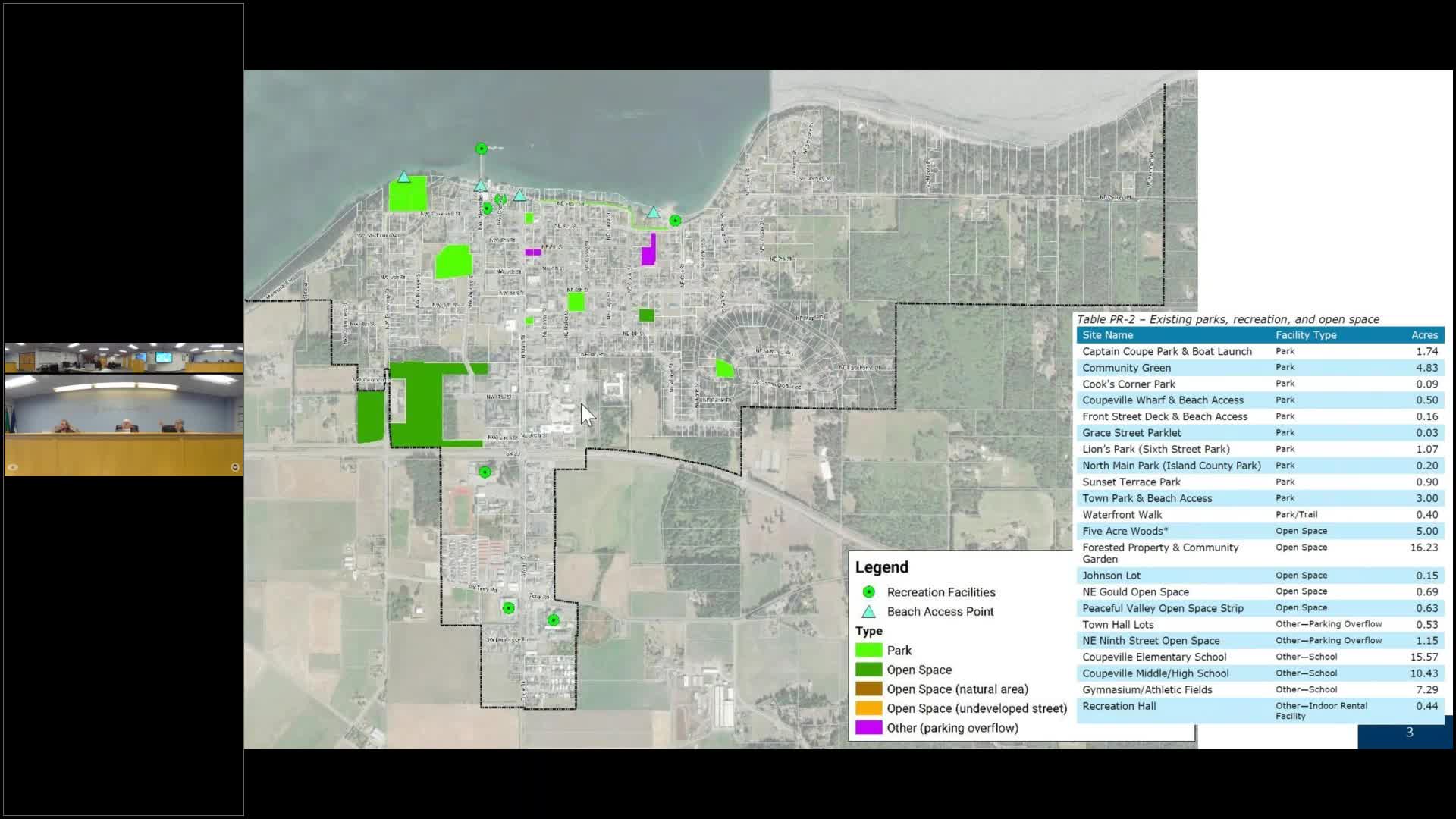
Staff presented parcel‑specific changes to Coupeville’s future land use map—low→medium at Vine & Codeland, medium→high on South Main, and a rural‑reserve boundary shift where sewer now exists—to address state planning obligations and housing capacity shortfalls.
Planning staff presented a map of proposed future land‑use changes and the math behind Coupeville’s housing capacity obligations under Washington State law at the Jan. 21 Planning Commission meeting.
Staff said the town must plan for roughly 350 dwellings across income categories as part of countywide planning coordination; the state now requires capacity to be shown by income category. The draft map proposes three major, parcel‑specific changes: reclassifying a parcel at Vine and Codeland from low‑density to medium‑density residential, redesignating a landlocked parcel behind South Main Street from medium‑density to high‑density residential, and moving the…
Already have an account? Log in
Subscribe to keep reading
Unlock the rest of this article — and every article on Citizen Portal.
- Unlimited articles
- AI-powered breakdowns of topics, speakers, decisions, and budgets
- Instant alerts when your location has a new meeting
- Follow topics and more locations
- 1,000 AI Insights / month, plus AI Chat