Get Full Government Meeting Transcripts, Videos, & Alerts Forever!
Get email alerts on the Resilience Vulnerability Assessment topic
No spam. Unsubscribe anytime.
Broward County unveils vulnerability assessment, estimates $20–28 billion for countywide adaptation
Summary
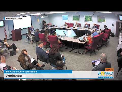
Broward County leaders on Thursday heard a county presentation of a multi‑year vulnerability assessment and adaptation plan that models how sea‑level rise, heavier rainfalls and increasing heat will affect the county and estimates the cost to adapt at between roughly $20.1 billion (Tier 1) and $28 billion (Tier 2).
Broward County leaders on Thursday heard a county presentation of a multi‑year vulnerability assessment and adaptation plan that models how sea‑level rise, heavier rainfalls and increasing heat will affect the county and estimates the cost to adapt at between roughly $20.1 billion (Tier 1) and $28 billion (Tier 2).
The report, presented by Dr. Monica Harada of the county’s resilience team, maps flood and heat exposures, projects economic losses under no‑action scenarios, and models the effects of two tiers of adaptation projects. “This is essentially our blueprint,” Mayor Fuhr said as the presentation opened.
Why it matters: the study ties technical flood modeling to economic metrics and shows that, without adaptation, average annual exposures and damages rise sharply; with modeled Tier 2 investments the team estimates large reductions in damage and preservation of property value. The work is intended to guide county and municipal priorities, funding requests and public‑private coordination.
Key findings and scope
Dr. Harada told commissioners the team used scenario‑based modeling that combines sea level rise, storm surge, saturated groundwater and intensified rainfall in 81 compound scenarios. She said the county has seen a regional sea‑level rise of “5 to 7 inches only since 2010,” and that the county is using the NOAA intermediate high curve as a planning basis. The study modeled a 2‑foot scenario (mid‑century / 2050) and a 3‑foot scenario (circa 2070) and found that extreme events similar to the April 2023 floods can already occur under present conditions.
The team organized proposed projects into Tier 1 (2‑foot planning) and Tier 2 (3‑foot planning). Dr. Harada summarized modeled outcomes: Tier 2 investments “are modeled to reduce damages by 83% countywide,” and the full Tier 2 portfolio was estimated to mitigate as much as $4 billion in modeled property damages for the scenario shown. The report also estimated that Tier 2 implementation could preserve tens of billions of dollars in property value and protect thousands of jobs and hundreds of millions in annual economic output.
Costs, cost shares and timing
The Hazen consultancy produced the project cost estimates included in the presentation: about $20.1 billion for Tier 1 and about $28 billion for Tier 2 (Tier 2 inclusive of Tier 1). The team represented those totals as the aggregate public+private investment needed; Dr. Harada said the modeling assumes roughly $9 billion of the $28 billion would be public funding and the remainder private. Commissioners asked repeatedly how much of the public share would fall to the county itself versus municipalities, special districts or the state and federal partners; Dr. Harada said that allocation exercise has not been completed and that many projects fall within municipal drainage and water control district jurisdiction.
Commissioners and staff discussed options the county could use to accelerate hard infrastructure projects (pumps, culverts and similar channel/structure work). The presentation and subsequent discussion singled out those projects as “low‑hanging fruit” for early action. As an order‑of‑magnitude example raised during the meeting, front‑loading pumps, culverts and similar structures countywide was described as roughly a $100 million per year effort over a decade (the county asked staff to return with funding options and priorities).
Adaptation strategies and equity
The plan groups the county into priority zones. “Zone 1” covers areas where heat, flooding and social vulnerability overlap; the report recommended prioritizing investments in those corridors to capture co‑benefits (flood reduction plus urban cooling). The adaptation toolbox reviewed by the county includes green infrastructure (bioswales, street‑level swales, underground storage beneath parking lots), conveyance improvements, incremental seawall upgrades (seawall “caps”), and more robust engineering where necessary. The team also modeled smaller‑scale land‑use approaches—such as converting two‑way local streets to single‑lane or one‑way configurations to create space for green infrastructure—identifying about 1,760 miles of local roadways that might be physically able to accommodate such streetscape changes.
Insurance, property values and economic metrics
The county’s economic analysis used FEMA’s Risk Rating 2.0 (the insurance rating framework) as the exposure baseline. Presenting the modeled results, staff said adaptation reduced the number of policies expected to drop out under rising insurance costs and preserved insured coverage and property values in the modeled scenarios. The Hazen/McKinsey economic modeling estimated that, under some scenarios, Tier 2 projects could preserve about $660 million in annual gross value added and about 8,000 jobs by reducing disruption and damage to businesses.
Implementation questions raised by commissioners
Commissioners repeatedly asked where county funds would come from, how much the county itself would be expected to pay, and which projects the county should prioritize. County Administrator (unnamed in the transcript) warned that discretionary county funds are constrained and that any new program would compete with existing priorities (affordable housing, public safety, health, other mandatory costs). Commissioners also asked for two sets of numbers accounting for whether large regional canal upgrades (for example, the Central and South Florida flood protection work by the U.S. Army Corps of Engineers and the South Florida Water Management District) are assumed completed or not; staff said the current modeling assumes primary canal function is maintained and that costs would be higher if that function is not restored.
Legal and regulatory context
Presenters and commissioners referenced the Southeast Florida Climate Change Compact and the county’s prior adoption of a unified sea‑level curve. Commissioners also noted that the county has previously adopted higher seawall standards for intertidal waterways—a county ordinance now requiring a five‑foot NAVD seawall standard in certain areas was discussed in the meeting—and that seawalls can be incrementally capped when the underlying structure is built to accommodate future caps.
Stakeholder engagement and next steps
Staff said the project included an extensive stakeholder process (municipal, water control districts, community organizations and business groups). Bob Swindell, representing business and civic interests, praised the county’s outreach and said private‑sector actors and startups are already developing technologies (seawall materials, cooling and building innovations) that could lower adaptation costs. The county also plans public tools—the presentation noted an interactive viewer showing modeled flood conditions pre‑ and post‑adaptation to help agencies, cities and the public evaluate options.
Commission direction and immediate follow ups
Commissioners asked staff to return with more granular allocations of the $9 billion public estimate (how much the county would be asked to contribute), prioritized short‑term projects (pumps, culverts, canal structures) and funding models that could support an accelerated program. Commissioners also requested breakdowns that show results both with and without expected federal canal work. Staff said it would bring back funding model options, a proposed priority list and additional materials for municipalities, and noted that the county will highlight private‑sector innovation at the 2026 Southeast Florida Climate Change Compact summit and at a February 26 business workshop.
“There’s a lot to flush out here,” Mayor Fuhr said; commissioners asked staff to come back with cost shares and priority plans that would allow the board to consider realistic fiscal choices.
Ending
The meeting produced no formal vote. Instead, the commission used the session to receive the assessment, test questions from commissioners and direct staff to return with detailed funding and prioritization options for early‑stage investments and for the larger program. Staff said the interactive mapping tool will be launched publicly in the coming months to help municipalities and the public review modeled outcomes.