St. Mary's County holds public hearing on comprehensive zoning overhaul; residents raise mapping, density and critical‑area concerns
Get AI-powered insights, summaries, and transcripts
Subscribe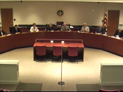
Summary
St. Mary's County officials and planning staff presented proposed, countywide revisions to zoning maps and ordinance text at a joint public hearing on May 20, 2010, and opened the record for written comments through June 15, 2010.
St. Mary's County officials and planning staff presented proposed, countywide revisions to zoning maps and ordinance text at a joint public hearing on May 20, 2010, and opened the record for written comments through June 15, 2010.
The proposed changes would implement the county's recently adopted comprehensive plan and include a new Residential Low‑Density Transitional (RLT) zone; rezoning a handful of schools into designated growth areas; options to reduce the 50% open‑space requirement in growth areas for measures such as enhanced design or affordable/workforce housing; new uses for small equestrian centers and, subject to standards, campgrounds in some critical‑area waterfront locations; updated subdivision design standards to limit disruption of farmland; stronger outdoor‑lighting rules; and digital submission of record plats, among other revisions.
Why it matters: county staff said prompt implementation is intended to reduce the lag between adoption of the comprehensive plan and its zoning implementation. Phil Shire, deputy director of the Department of Land Use and Growth Management, told the joint Board of County Commissioners and Planning Commission that the revision package is the culmination of a multi‑year process that began in 2008 and that the public hearing on May 20 is the third on the topic. Shire said the package aims both to guide development toward appropriate areas and to preserve natural, agricultural and cultural resources.
Most substantive proposals and technical specifics were described by Shire during the staff presentation. He said the RLT zone would allow uses identical to the existing RL (Residential Low Density) zone but at a lower density: the RL standard permits up to 5 units per acre where site conditions permit, while the RLT would permit up to 3 units per acre outside the state critical area and would require a minimum of 2 acres per dwelling (one dwelling per two acres) within the critical area. Shire also described a draft allowance for ‘‘small equestrian centers’’ as a permitted use with arenas up to 30,000 square feet; larger facilities would require conditional use review before the Board of Appeals. The proposal includes targeted rezoning of about five schools adjacent to growth areas so those parcels would be in growth districts for future state funding eligibility, technical map corrections, and clarified rules on sales of household propane where gas stations are allowed.
Public commenters raised multiple, specific concerns rather than proposing alternate text changes. Hamer Campbell, director of government affairs for the Maryland National Capital Building Industry Association, urged commissioners not to “hastily adopt the proposed amendments” to the RLT and argued the RLT mapping in parts of Lexington Park would effectively downzone properties, reduce buildable land and increase housing costs in waterfront areas. Campbell said the proposal could affect “hundreds of properties within the development district” and asked staff to consider economic impacts during work sessions.
Several speakers questioned the accuracy and notice of new critical‑area and tidal‑wetland boundaries on the draft maps. Brian Abel said a professional field delineation for his property matched the 2002 maps but differed from the 2010 proposed maps, and he urged further review. Another commenter said some neighbors had not received notice that their properties appear as critical‑area parcels on the new maps.
Other public remarks raised technical and programmatic issues: Bernard (Bernie) Chalmers and Buddy Winslow urged the county not to require public water systems for all subdivisions of 25 or more homes and recommended a case‑by‑case approach that retains individual wells where appropriate; Bob Massey recommended a dedicated variant section in the ordinance to address evolving stormwater management and redevelopment best practices (noting the county’s use of ESD, ‘‘environmental site design, to the maximum extent practicable’’); and residents, including Susan McGee, asked staff to correct apparent mapping errors that labeled established single‑family neighborhoods as higher density.
Staff said the record will stay open for written comments until June 15, 2010, and listed a schedule of planning commission work sessions (May 27; June 1; June 3; June 7) to review public input and proposed ordinance language. Shire told the bodies that staff will collate and transcribe all comments, provide staff responses, and forward recommendations from the Planning Commission and staff to the Board of County Commissioners for subsequent review.
The hearing also included shorter policy details and clarifications: stronger design standards for residential subdivisions in the Rural Preservation District to reduce conflicts with farm operations; potential expansion of designated scenic corridors; defined limits on indoor and outdoor agritourism events; a modest enforcement provision aimed at preventing vacant structures from becoming unsafe; and exploratory standards for limited campgrounds in some critical‑area resource conservation areas to support county tourism.
The county noted that legal advertising for the hearing ran in the local paper April 30 and May 5, 2010, and that the presentation would be rebroadcast on county cable. Staff encouraged anyone with questions to meet with staff after the hearing or to submit written comments to the Planning Commission or Board of County Commissioners at P.O. Box 653, Leonardtown, MD 20650 by June 15, 2010.
The joint bodies did not take formal votes at the hearing; staff and the planning commission will review public comments in scheduled work sessions before any ordinance or map adoption actions are considered.
For now, the next procedural steps are the listed planning commission work sessions and subsequent consideration by the Board of County Commissioners. Staff said both planning‑commission recommendations and staff responses will be provided to the board for its work sessions.