Get Full Government Meeting Transcripts, Videos, & Alerts Forever!
Get email alerts on the Zoning Chicago Avenue topic
No spam. Unsubscribe anytime.
Preservation commission urges lower heights, setbacks for proposed 100-foot zoning on Chicago Avenue adjacent to Lakeshore Historic District
Summary
After public comment and a lengthy staff-led review, the Evanston Preservation Commission recommended against allowing M3 zoning that would permit 100-foot buildings directly adjacent to the Lakeshore Historic District and asked staff to pursue lower heights, stepped-down bulk toward the alley and context-sensitive design.
The Evanston Preservation Commission on Wednesday moved to oppose the draft Envision Evanston 2045 zoning that would place M3 zoning — allowing up to 100-foot buildings — on Chicago Avenue between Lee Street and Dempster Street, a corridor that directly abuts the Lakeshore Historic District.
Preserve staff and commissioners told the meeting that the draft M3 designation would permit building heights and bulk that “would loom” over single-family houses east of Chicago Avenue, and the commission coalesced around recommendations for lower maximum heights and a modest rear setback or stepped-down bulk where new development approaches the district.
Why it matters: The corridor under discussion sits immediately west of the Lakeshore Historic District, and several properties along Chicago Avenue were previously identified by the Illinois State Historic Preservation Office as individually eligible for the National Register. Commissioners said the combination of shallow lot depths on Hinman Avenue and a sudden 100-foot zoning edge would create an abrupt and damaging transition in scale to the district.
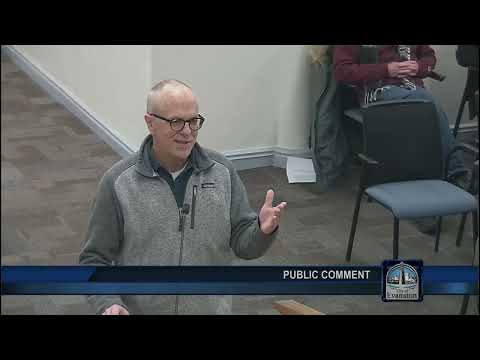
The discussion began with public comment. Steve Test, 1135 Hinman Avenue, told the commission he opposed the proposed M3 zoning for the three blocks of Chicago Avenue between Lee and Dempster, calling it “particularly inappropriate” because it would place 100-foot maximum heights directly adjacent to R1 single-family zoning. Jeff Wootton, 1028 Hinman Avenue, and Michael Davis, 1109 Hinman Avenue, echoed that concern and asked the commission to defend the city’s Preserve 2040 plan and its Initiative 2.5, which recommends form‑based overlays to ensure sensitive transitions in height and bulk near historic districts. Jim McKee, a Third Ward resident, said the Envision plan’s proposed changes would encourage tear‑downs and alter the character of R1 and R2 neighborhoods.
Kate (city planning staff) presented photos and a block-by-block review for commissioners, noting that existing commercial and light-commercial zoning along the corridor permits heights in the 40–45-foot range and that the draft M3 designation would allow up to 100 feet, an FAR of 6 and a 5-foot rear-yard setback where currently larger setbacks apply. Staff also noted multiple properties along the corridor that appear on the commission’s study list and have been identified as eligible for the National Register.
Commissioner Stuart Cohen and other members said they support corridor redevelopment that replaces surface parking with mixed-use buildings but stressed the east side of Chicago Avenue — the side that abuts the Lakeshore Historic District — should be limited to a much lower height and bulk than the draft code proposes. After extended deliberation commissioners expressed a shared view that the east side should not be rezoned to permit 100-foot buildings and that some combination of a 4-story (not to exceed 45-foot) street edge with stepped-down bulk toward the alley would be more appropriate. Commissioners were more open to greater height on the west side of Chicago Avenue (the side buffered by the rail lines), with multiple members citing 6 stories as an acceptable compromise and some panelists saying up to 8 stories could be considered only where the rail tracks provide a clear buffer or a parcel is large enough and subject to additional design review.
Council member Melissa Wynne, Third Ward, told commissioners that prior rezonings at Chicago and Main had been built as-of-right in some cases and that PUDs and court challenges have shaped what was ultimately constructed at those corners; she urged commissioners to be clear in their recommendations because zoning decisions can have long-term consequences.
Commissioners asked staff to incorporate into the commission’s formal comment letter the following points: oppose M3 (100-foot) as proposed where the corridor abuts R1 historic districts; recommend a maximum of 4 stories/45 feet at the street edge on the east side with required step-down or increased rear setback toward the historic lots; allow for somewhat greater height on the west side of Chicago Avenue where the rail tracks provide a buffer, but encourage design incentives rather than a uniform 100-foot allowance; and ask staff to explore form‑based overlay or other step-back mechanisms similar to Central Street’s existing overlay to achieve a more sensitive transition.
The commission did not adopt a formal motion or vote on a binding ordinance at the meeting; the text above summarizes the consensus direction commissioners gave staff and the written points they asked be included in the commission’s comment letter to the Land Use Commission.
What’s next: Staff told commissioners the zoning draft is expected to be refined and that the commission’s comments will be forwarded to the Land Use Commission and the city departments drafting final recommendations. Commissioners asked staff to flag properties on the city study list in GIS so potential permit applications will trigger additional review.
Ending: Several commissioners and members of the public asked the city to pursue targeted landmark nominations and design guidelines for the corridor as complementary strategies to zoning changes, and some commissioners suggested pursuing grant-supported surveys or an expanded volunteer program to accelerate identification and protection of eligible properties.