Get Full Government Meeting Transcripts, Videos, & Alerts Forever!
Get email alerts on the Land Use Zoning topic
No spam. Unsubscribe anytime.
Lancaster planning commission tables proposed revision to waterfront residential overlay after mixed public comment
Summary
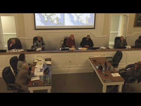
The Lancaster County Planning Commission on Monday held a public hearing on a staff proposal to revise Article 18 (the Waterfront Residential Overlay, W‑1) and related changes to Article 1 definitions, then voted to table the item and directed staff to explore concerns raised by residents.
The Lancaster County Planning Commission on Monday held a public hearing on a staff proposal to revise Article 18 (the Waterfront Residential Overlay, W‑1) and related changes to Article 1 definitions, then voted to table the item and directed staff to explore concerns raised by residents.
Planning staff presented the draft amendment as a map‑based narrowing of W‑1 that would leave all land within 800 feet of tidal shoreline subject to the overlay but would remove many inland stretches now included because of the current definition tying the overlay to tributary streams on USGS 7.5‑minute quadrangle (solid blue line) maps. "The only thing that's changing is that the areas outside of 800 feet of tidal waters would no longer be under the W‑1 waterfront residential overlay," planning staff said during the presentation.
The nut graf: The revision would not alter the overlay rules that apply within 800 feet of tidal shoreline — setbacks, the 2‑acre minimum for lots created after the 1988/1990 ordinances, or water‑front lot‑width requirements would remain in place for tidally affected parcels — but it would allow many inland parcels to be governed by underlying zoning (R‑1 or A‑2), which staff said would permit smaller, less expensive lots (roughly 0.69 acre in R‑1 or about 0.75 acre in A‑2) where the overlay was removed.
Most important facts: Staff said the proposal (referred to in packet materials as "option 3") responds to subdivision restrictions on inland parcels that currently fall inside W‑1 because the ordinance applies to tributary streams. The draft would adopt the Virginia Institute of Marine Science (VIMS) shoreline definition for mapping and base W‑1 on distance from tidal shoreline rather than the older USGS tributary‑stream mapping. The presentation noted the county has roughly 330 miles of tidal shoreline; staff also said the Planning Commission had discussed revisions at four prior meetings.
Public comment ran more than an hour. Speakers who opposed narrowing the overlay cited sediment and pollutant runoff from upland development, loss of wetlands and marsh, historical changes in headwater streams and marshes, and the Chesapeake Bay watershed obligations. "The wetlands need to be protected," said Charlie Costello, a resident who described decades of experience on local streams, adding that increased density inland would add septic systems, cars and other sources of pollution that flow downstream. Several other speakers cited state and regional Bay restoration efforts and recent Chesapeake Bay Executive Council guidance as reasons to retain broader protections.
Other commenters supported the staff proposal as a means to relieve long‑standing subdivision constraints on small landowners. One attendee described an inherited 3‑acre parcel where the owner could not split off a 1‑acre lot for a family member under the current overlay rules and urged relief for similar, modest family‑level subdivisions. Several speakers suggested compromise options, including applying changes only to individual, pre‑existing parcels or excluding large master‑planned developments from the reduced overlay; staff said those legal design options could be explored.
Commissioners and staff clarified technical points: the Chesapeake Bay Preservation Act requires a 100‑foot resource protection area (RPA) buffer, and that state requirement would remain in place inside the 800‑foot shoreline band under the draft; the proposed change affects only which parcels fall under the W‑1 overlay beyond tidal shoreline. Staff said field determinations (or surveyor plats) establish whether a mapped blue‑line feature is perennial or intermittent when subdivisions are proposed.
Action and next steps: After public comment, Commissioner [name recorded in minutes as the speaker who made the motion] moved to delay forwarding a recommendation to the Board of Supervisors and to ask staff to investigate the issues raised by commenters (including enforcement capacity, heritage/legacy owner concerns, subdivision counts already approved, and the legal options for limiting changes to individual parcels vs. large developments). Another commissioner seconded the motion; the commission voted in favor. The motion was recorded as approved by voice vote (ayes), and staff will return with findings at a future meeting; commissioners said the item likely will return at the next monthly meeting if staff can address the questions, or in March if more time is needed.
Other routine actions recorded in the meeting minutes included acceptance of an acting chair for the session, permission for Commissioner Tara Booth to participate remotely (both approved by voice vote), and acceptance of the previous meeting minutes.
What remains unsettled: The commission did not change code language or adopt the amendment. Specific questions staff will research include whether and how to (a) limit any overlay reduction to individual legacy parcels or to small parcel divisions, (b) preserve Chesapeake Bay Act RPAs and enforcement capacity, (c) measure and map perennial stream headwaters versus ephemeral channels on current USGS mapping, and (d) estimate how many subdivision units are pending under current ordinances. The item will return after staff reports back.
The commission closed the hearing after more than an hour of public comment and discussion; no vote on the ordinance change was taken.