Dunn County land information officer details GIS services, Beacon usage and funding pressures
Get AI-powered insights, summaries, and transcripts
Sign Up Free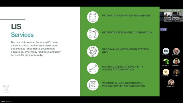
Summary
Land Information Officer Rachel Wells described the county's property and GIS services, daily Beacon site usage, the program's reliance on state grant/recording fees and an active bill (Senate Bill 218) that could change program funding distribution.
Rachel Wells, Dunn County's land information officer, told supervisors that the county's land information division maintains property records, rural addressing, geographic-information-system (GIS) datasets and public mapping tools used by county departments and residents.
Wells described core services that support assessment, tax, emergency-response and planning workflows: maintenance of parcel geometries and taxing jurisdictions; coordination with municipal assessors; rural address administration; aerial imagery acquisition; and countywide elevation-data efforts. She noted that county GIS supports the CAD dispatch system and emphasized that many datasets are updated daily and serve as authoritative references for municipalities and the public.
On public access and usage, Wells highlighted the county's Beacon online portal, which "integrates the data that we do maintain with the information that's in the property information system." She said Beacon and related services have high traffic: "from the start of the year to the twelfth there have been a total of 1,300,000 requests for information," and she added Beacon shows an average of about 4,800 requests per day and roughly 82,000 visits to date for the year.
Wells described funding for the land-information program as a mix of state grants and retained fees; she cautioned that funding fluctuates with the real-estate market and refinance activity. She told supervisors there is an active Senate bill (referred to in the presentation as Senate Bill 218) that seeks to change fee distribution and increase county-level funding for land information by altering how recording-related fees are allocated between the state and counties.
Wells said the land-information office supplies data to public-safety routing, planning, conservation, and other county efforts; staff also help landowners and service providers interpret parcel information and produce internal field applications and datasets for county departments. She said the county has maintained GIS since 2006 and that regular high-resolution aerial imagery and periodic elevation capture remain priorities.