Taos County hearing on 95-foot monopine tower in Arroyo Hondo draws hours of testimony; no final decision recorded
Get AI-powered insights, summaries, and transcripts
Sign Up Free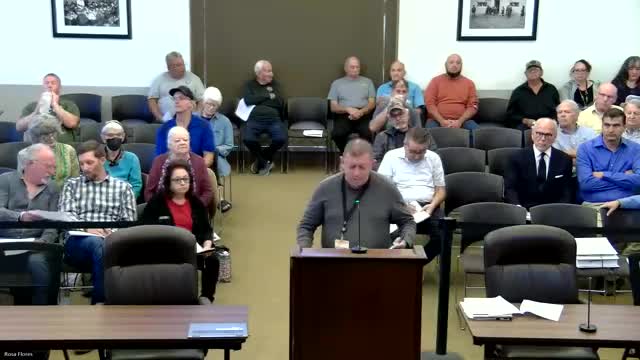
Summary
Taos County commissioners heard more than two hours of testimony Sept. 16 on an appeal of a Taos County Planning Commission decision to approve a special use permit for a 95-foot “monopine” telecommunications tower at Grace Community Church in Arroyo Hondo; planning staff recommended upholding the Planning Commission, but no final decision was recorded in the transcript.
Taos County commissioners heard more than two hours of testimony Sept. 16 on an appeal of a Taos County Planning Commission decision to approve a special use permit for a 95-foot “monopine” telecommunications tower at Grace Community Church, 159 Old State Highway 3 in Arroyo Hondo. Planning Director Rudy Perea recommended the Board uphold the Planning Commission’s approval, saying the proposed tower “will provide a substantial public health, safety, and welfare benefit to Arroyo Hondo” and that the applicant had complied with applicable Taos County land use regulations.
The appeal was presented by Ben Thomas, who identified himself as representing Arroyo Hondo neighbors. Thomas said the tower would cause “significant, unjustified impacts on our community, our environment, and property values” and argued the application failed to meet multiple provisions of the Taos County Land Use Regulations, including use-compatibility and visual-impact standards and requirements for colocation and concealed wireless facilities.
The disagreement centered on two primary questions: whether a bona fide technical need exists that cannot be met by alternatives or colocation, and whether the tower’s scale and siting are compatible with the neighborhood and sensitive sites nearby. Opponents — including longtime residents, nearby property owners and a retired landscape architect — said a 95-foot artificial pine would dominate a largely single‑story, agricultural landscape, sit within about 50 feet of a small, historic community cemetery, and depress nearby property values. “Placing an industrial structure of this scale right next to the cemetery is, I believe, both inappropriate and disrespectful,” said Penny Prevette, who testified that both her grandparents are buried in the church cemetery.
Several appellants cited Taos County code Section 4.6.1 (use compatibility and visual impact) and Section 4.11.1 (requirements for new wireless facilities and colocation) in arguing the application does not show the required community benefit or that no reasonable alternatives exist. Appellant witnesses submitted photos, petition signatures and a letter from a local real estate broker that Thomas said showed visibility could reduce nearby home values by roughly 10 percent; Thomas told commissioners he calculated an estimated $2 million collective loss for 39 homeowners within 1,000 feet of the tower site (figure presented by speaker; commissioners did not independently verify during the hearing).
Representing the applicant, Bev Francis, counsel for Vertical Bridge/BTS Towers LLC, argued federal and state legal standards constrain denial. Francis cited the Telecommunications Act of 1996 and said a denial must be based on “substantial evidence” and must not effectively prohibit the provision of wireless service. Francis introduced engineering, fall‑zone and appraisal documents, including a sealed engineering letter from Pinnacle Consulting certifying a 50-foot fall radius; she said the Taos County code setback requirement (the greater of 85 feet or 110 percent of fall radius) is satisfied by the proposed siting.
Technical witnesses for the applicant — site acquisition specialist Nick Romano and radio‑frequency engineer Steven Kennedy — presented coverage analyses and third‑party crowd‑sourced drive‑test data. Kennedy said the record shows “a significant gap in service for 2 miles around the proposed site” and that the proposed facility would markedly increase the population served with indoor coverage. Kennedy’s modeling, as presented to the Board, estimated low‑band indoor population coverage rising from about 269 people to about 1,125 if the site is activated; he also said the site would improve highway coverage on State Road 522 and support first‑responder broadband capabilities.
Opponents disputed the need and the applicant’s maps. Several speakers noted recent improvements they say have already improved service (some citing recent nearby towers) and urged exploring other locations — for example, the county transfer station, a Kit Carson substation or other nonresidential sites — that they said would be less visually intrusive. Speakers also raised cultural‑resource concerns and asked that the Section 106 / SHPO consultation and the cultural‑resource survey be revisited; appellants contended the existing survey mislocated an acequia and undercounted potential visual and cultural effects.
The hearing included cross‑examination on alternatives and documentary evidence. The planning director told commissioners that the staff report and findings of fact used by the Planning Commission are in the packet (pages 9–15 of the staff report were cited) and recommended upholding the Planning Commission. The applicant’s team provided sealed engineering letters, an independent appraisal study and a NEPA/Section 106 record claiming no effect after consultation with the State Historic Preservation Division.
No formal decision or roll‑call vote on the appeal was recorded in the portion of the meeting transcribed here. The Board heard extensive public comment both opposing and supporting the permit: opponents emphasized visual impacts, proximity to the cemetery, property values and cultural sensitivities; supporters — including volunteer first responders and the church pastor — emphasized public‑safety, emergency response and improved broadband access for residents and travelers along Highway 522.
The matter remained under the Board’s consideration at the time the transcript ends; commissioners did not register a final vote in the recorded portion of the hearing. The planning director’s recommendation to uphold the Planning Commission and the evidence submitted by both sides will remain part of the record for the Board’s subsequent deliberation and any final decision.