Get Full Government Meeting Transcripts, Videos, & Alerts Forever!
Get email alerts on the Groundwater Monitoring topic
No spam. Unsubscribe anytime.
Wyandotte Creek board approves initial monitoring network for interconnected surface waters and groundwater-dependent ecosystems
Summary
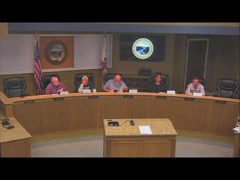
The Wyandotte Creek Sustainability Agency on Oct. 23 approved a preliminary monitoring network and timeline to better measure interconnected surface waters and groundwater-dependent ecosystems, voting to add three existing shallow wells to five already used in the basin.
The Wyandotte Creek Sustainability Agency on Oct. 23 approved a preliminary monitoring network and timeline to better measure interconnected surface waters (ISWs) and groundwater-dependent ecosystems (GDEs), voting to add three existing shallow wells to five already used in the basin.
Agency staff said the action is intended to respond to Department of Water Resources (DWR) recommendations and to begin filling “data gaps” that DWR flagged during plan review. Becky Fairbanks, SGMA project manager, told the board the item covers wells that already have at least five years of groundwater-level data and that the board was not being asked to take final action on plan amendments at the same meeting.
The board’s consultant, Laura Foglia, walked members through the technical rationale for using shallow wells and groundwater-level metrics as an initial proxy for interconnected surface water. “When we look at the interconnected surface water, we think about surface water body with the ground water,” Foglia said, describing three conceptual conditions (gaining stream, connected losing stream, disconnected stream) and why the first two are the primary concern for SGMA assessment. She emphasized the limits of model outputs and the need to check modeled depletion estimates against field data.
Why it matters: DWR’s periodic-evaluation process and corrective comments encourage GSAs to show progress on filling gaps and improving justification for monitoring sites; the board’s vote establishes a small, defensible network that staff say can be expanded as new wells come online and additional data are collected.
Key details and timeline: consultants told the board they identified eight monitoring candidates in the subbasin—five already in the 2022 Groundwater Sustainability Plan (GSP) and three additional shallow wells with at least five years of data that staff propose to include now. Staff said preliminary sustainable-management-criteria (SMC) for those wells will be prepared to show progress by March (the date when grant funding expires was referenced by staff) and that a formal periodic-evaluation and plan amendment would be submitted by January 2027. Consultants explained that additional new wells (the ones currently being funded/drilled) will not immediately qualify for SMC because they lack five years of historical data; those wells will be added to the network and used for longer-term evaluation through 2032.
Technical caveats and discussion: Byron Amerson, a geomorphologist and hydrologist with Environmental Science Associates, presented results from a GDE mapping exercise that combines species rooting-depth estimates with depth-to-groundwater calculations. His analysis found vegetation patches likely to be sensitive along a south–central axis of the basin where small changes in groundwater elevation could dewater riparian vegetation (willows, cottonwoods and valley oaks). Amerson said depth-to-groundwater is a practical field measure to evaluate potential GDEs but also acknowledged heterogeneity in soils and subsurface materials that can alter connectivity at local scales.
Board members raised model and data concerns. One member noted that the integrated hydrologic model shows the Feather River as mostly gaining but said local data (for example, test drilling around a copper site) showed groundwater movement in other directions; consultants and staff agreed that the model provides a useful starting map but that field data are needed to validate model results. Several board members asked staff to emphasize stakeholders such as farmers, ranchers and domestic-well users when describing collaboration; staff agreed to revise outreach language accordingly.
Vote and immediate next steps: The board approved the proposed monitoring-network additions and the approach and timeline. Staff said the near-term work is grant-funded, and that the monitoring plan would be refined and expanded with new wells over time. Consultants recommended targeted vegetation surveys in the near term to ground-truth the mapping and to select long-term monitoring locations where vegetation is most sensitive to changes in groundwater level.
Ending: Staff said the monitoring network is a first step to respond to DWR corrective comments and to demonstrate progress ahead of the periodic-evaluation submission. Additional field work, outreach to affected stakeholders, and future board decisions will determine final SMCs and any required plan amendments.