Get Full Government Meeting Transcripts, Videos, & Alerts Forever!
Get email alerts on the Land Use Development topic
No spam. Unsubscribe anytime.
Manatee commissioners deny ‘The Point’ mixed-use plan amid floodplain, access and neighborhood concerns
Summary
The Board of County Commissioners voted to deny a preliminary site plan for a 9.09-acre mixed-use project called The Point that proposed 36 multifamily units and a 100,000-square-foot self-storage building after prolonged testimony citing flood risk, limited neighborhood outreach and access concerns.
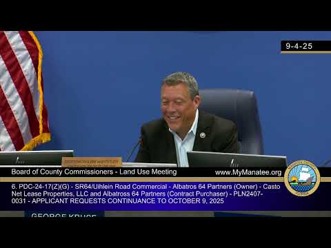
The Manatee County Board of County Commissioners on Sept. 4 denied a preliminary site plan called The Point, a proposed mixed-use development of 36 multifamily units and a 100,000-square-foot mini-warehouse on a 9.09-acre parcel west of the intersection of State Road 70 East and 60th Street East in Bradenton.
The denial came after staff presentations, technical testimony from the applicant’s engineers and environmental consultants, and public comment from the Girl Scouts of Gulf Coast Florida and other neighbors who warned that the parcel sits within FEMA’s 1% annual-chance floodplain and in coastal hazard zones. Commissioner Bob McCann made the motion to deny; Commissioner Phelps seconded it and the board voted to deny and directed county attorneys and staff to prepare written findings and return the item to the Oct. 9 land-use meeting.
Staff and the applicant described the site as a 9.09-acre infill parcel in the PDMU zoning district that is already designated for mixed use. The applicant said the project would place a three‑story, 36-unit building over parking on the northern portion of the site and a four‑story, 100,000‑square‑foot mini‑warehouse on the southern portion, and that utilities exist along the State Road 70 right of way.
Environmental consultant Carrie McNutt said the property contains 4.41 acres of wetlands and 0.41 acres of historic manmade ponds, with roughly 4.68 acres of upland. She told commissioners the design avoids impacts to existing wetlands, preserves buffers and proposes converting portions of required 30‑foot wetland buffers into vegetated areas that would also serve as flood‑plain compensation. McNutt said recent removal of invasive Brazilian pepper improved the site’s condition and that the consultant team had received Southwest Florida Water Management District verification of wetland lines in July.
Traffic consultant Alexander (last name not provided) said a traffic impact analysis showed the project’s generated trips were below Manatee County thresholds and that a multimodal analysis — including bicycle parking and measures to reduce ingress/egress vehicle trips — produced a trip count under the county’s 50‑trip PM‑peak threshold, allowing staff to deem the project’s roadway impact negligible and to accept a waiver of a full traffic study.
Staff noted, however, that the segment of State Road 70 adjacent to the site is operating below the county’s adopted level-of-service standard and that background traffic (not the project) is the cause. Staff also noted the county’s models do not extend past the Braden River at this site and that flood‑plain compensation will be required because the entire parcel lies within FEMA’s mapped 1% annual‑chance flood hazard area. County staff said the applicant will be required at final site plan to provide mitigation, a hurricane evacuation plan and to construct or pay its proportionate share of any public infrastructure improvements identified as necessary.
In public comment, Mary Anne Servian, CEO of Girl Scouts of Gulf Coast Florida, said the applicant’s property is immediately upstream of the Girl Scouts’ 130‑acre camp and that the camp hosts about 10,000 users annually, including roughly 4,000 who use the river for kayaking and canoeing. Servian warned that the camp “routinely suffers from flooding,” said the site is in coastal high‑hazard and evacuation areas, and asked the board to limit building heights and to require buyer notice about flood risk. She also asked that there be no direct water access from the project and requested limits on registered offenders living at the site.
Multiple commissioners expressed concern about placing residential units and a public storage facility on a parcel that flooded in recent storms, the limited neighborhood meeting attendance (one participant by applicant records), and the challenge of relying on man‑made buffer grading as long‑term flood protection. Several commissioners said they supported a lower‑density or differently configured development that would better account for the river and flood risks.
Commissioner McCann moved to deny and asked county attorneys to prepare findings of denial and return the item to the Oct. 9 land‑use hearing. The board voted for denial. The motion and the board direction were recorded in the meeting minutes.
The decision preserves the applicant’s right to return to the county with a revised plan or with additional studies; staff and applicants noted flood‑plain compensation, coordination with state and regional agencies and final site plan requirements remain necessary if any future submittal is pursued.