Get Full Government Meeting Transcripts, Videos, & Alerts Forever!
Get email alerts on the Land Use Planning topic
No spam. Unsubscribe anytime.
Milpitas planning commission recommends Gateway Main Street specific plan to city council
Summary
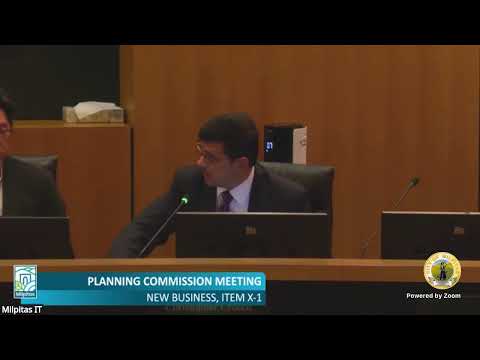
The Milpitas Planning Commission on Sept. 24 voted to recommend that the City Council adopt the Gateway Main Street Specific Plan, related zoning and general-plan map amendments and the citys supplemental environmental impact report.
The Milpitas Planning Commission on Sept. 24 voted to recommend that the City Council adopt the Gateway Main Street Specific Plan, related zoning and general-plan map amendments and the citys supplemental environmental impact report. The commission approved Resolution No. 25-014 by voice vote; all five members present voted aye.
The specific plan is a long-range land-use and implementation framework intended to revitalize Milpitas historic Main Street and surrounding districts by encouraging mixed-use, walkable development, updated zoning and streetscape and public-realm improvements. Planning Director Jay Lee said, "I am excited to be here to present on the Milpitas Gateway Main Street specific plan," and described the document as a vehicle to "establish the future vision of this key area in the city." The commissions action was a recommendation to the City Council, not final adoption.
The plan area and purpose
City staff and consultants described the Gateway Main Street Specific Plan as a re-focused update to the citys earlier Midtown specific plan. The plan adjusts boundaries to include several commercial and residential parcels previously outside the Midtown area and renames the project to emphasize Main Street as a gateway and local destination. Christine Bubla, principal for urban design and planning at Ascent Environmental, told commissioners that the specific plan document is organized into chapters required by state law and said the plan focuses on four primary districts: Main Street, the Crossroads, the Gateway District and the Abbott District.
Key provisions and development standards
Staff and consultants said the plan would: create new mixed-use districts that serve as the plans implementing zoning; set typical maximum building heights at five stories across much of the plan area with up to seven stories in the Crossroads (including the Sarah Center); establish minimum and maximum density ranges and floor-area-ratio standards; and adopt objective design standards for site layout, building massing, ground-floor activation and pedestrian-level design. The team described a community-benefits incentive program with six incentive categories that allow projects to exceed baseline development standards in exchange for public benefits such as green building, public open space or shared parking.
Public outreach and environmental review
Lee and the consultant team summarized a multiyear outreach program that included stakeholder interviews, pop-up events, public workshops and a 90-day public review period for the draft plan and draft supplemental EIR (mid-April to mid-July 2025). Pat Angel, the environmental lead, said the city prepared a supplemental EIR off the Milpitas 2040 General Plan EIR and that the final EIR was released earlier in September. Angel stated that most impacts are less-than-significant or mitigable but identified unavoidable significant impacts for several topic areas, specifically: historic resources, archaeological and tribal cultural resources, transportation noise and vehicle miles traveled (VMT). Angel noted adoption would require the city to adopt a Statement of Overriding Considerations for those unavoidable effects.
Commissioner questions and staff responses
Commissioners asked about how the plan would create walkability on narrow, irregular Main Street parcels, how anchor public spaces (such as a plaza) would be secured, property-ownership constraints at key parcels including the Sarah Center, and minimum-density proposals from commenters. Lee replied that making Main Street more walkable would rely on development-required block breakups (alleys, paseos or private streets), widened sidewalks through setbacks or easements, flex zones for parklets or outdoor dining and street-design changes prioritizing parking and pedestrian space over bike lanes in some segments.
On density, staff said the Crossroads District already includes a minimum density of about 40 dwelling units per acre, while Main Street was set with a lower minimum (around 20 dwelling units per acre) to preserve flexibility for narrow, small, frequently individually owned parcels where very high minimums could make development infeasible. Lee said developers could still build at mid-range densities (for example, 30 du/acre) if projects make economic sense; the adopted minimums are intended to avoid unintentionally prohibiting redevelopment on constrained parcels.
Visioning for the Sarah Center and catalyst sites
Staff and consultants described two redevelopment concepts for the Sarah Center: a linear park-block spine with mixed-use development facing new park blocks, and an alternative organized around a central urban green with an activated mixed-use core. Lee said the Sarah Center is identified as a catalyst site, and staff has met with the property owner but cannot predict the timing of any private redevelopment. The plans standards say the Sarah Center should be "a vibrant contemporary mixed-use community anchored by public open space and civic outdoor gathering spaces," language staff said would guide future project-level review.
Formal action and next steps
After closing the public hearing with no public speakers, a commissioner moved to recommend adoption of Resolution No. 25-014 to approve the specific plan amendment (SP20-00200002 as presented to the commission), the zoning text and map amendment (ZA25-0002) and the general plan amendment (GP25-0002). The motion was seconded and carried by roll call: Commissioner Wasty (Aye), Commissioner Medina Ashby (Aye), Commissioner Albana (Aye), Vice Chair Calkins (Aye) and Chair Gupta (Aye). The commissions action forwards the plan and the final EIR to the City Council for its consideration and potential adoption.
What remains
If the City Council adopts the specific plan and associated amendments, the specific plan will serve as the implementing zoning for the plan area. Staff identified near-term implementation priorities in the document, including a sense-of-place (branding) plan for Main Street and the Crossroads, localized flooding and infrastructure improvements, a land-assembly approach (a capital/land acquisition fund), creation of a parking district to support shared parking solutions, and a nexus study to structure development impact fees to fund public improvements. The final EIRs unavoidable impacts would require council consideration of a Statement of Overriding Considerations at adoption.
Meeting note
No members of the public submitted speaker cards for this item during the meeting. The Planning Commissions recommendation sends the Gateway Main Street Specific Plan, the supplemental EIR and related map and zoning amendments to the City Council for its decision.