Get Full Government Meeting Transcripts, Videos, & Alerts Forever!
Get email alerts on the Land Use Residential topic
No spam. Unsubscribe anytime.
Planning commissioners debate residential classifications, call for clearer neighborhood definitions
Summary
At an Orem Planning Commission work session Sept. 17, staff presented draft residential land-use classifications. Commissioners questioned terms such as "stacked units" and "transitional residential," urged clearer definitions of “neighborhood,” and used a mapping exercise to discuss buffers between commercial corridors and single-family areas.
Orem — At a Sept. 17 work session of the Orem City Planning Commission, planning staff presented proposed revisions to residential land-use classifications and commissioners spent the meeting pressing for clearer definitions and limits on where certain housing types would be allowed.
Planning staff framed the draft as two broad categories: neighborhood residential (with subcategories ranging from rural neighborhood lots to conventional single-family zones) and multifamily residential, which the draft breaks into neighborhood-scale multifamily (townhomes, duplexes, triplexes, fourplexes), mid‑rise and high‑rise categories. "We have neighborhood residential, and that's kind of three different subcategories," planning staff summarized during the presentation.
Commissioners and staff discussed whether certain typologies belong in neighborhood-scale areas. Several commissioners objected to listing "stacked units" inside neighborhood multifamily, saying the form (units stacked one over the other, as in stacked flats or some fourplex arrangements) differs in scale and appearance from townhomes or small multiplexes. One commissioner suggested stacked units might be suitable only in transitional or higher‑density multifamily zones rather than typical neighborhood settings.
A recurring point of debate was the draft label "transitional residential." Multiple commissioners said the label risked downplaying residents who already live in those areas and recommended folding that concept into a broader "multifamily neighborhood" designation. Commissioners also said the plan needs a clearer, shared definition of "neighborhood" to guide where attached housing forms and small‑scale apartments would be appropriate.
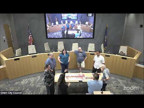
The commission conducted a mapping exercise applying the draft categories to a test area of the city. Commissioners used the exercise to identify places where a stronger buffer is needed between commercial corridors and single‑family neighborhoods — whether the buffer should be physical green space, an intermediate housing form (for example, townhomes), or restrictions on driveway and service access. Several commissioners emphasized that "buffer" should be defined not just by setback space but by access and intensity — for example, limiting truck or service access onto streets that directly abut single‑family lots.
Commissioners asked staff to return with sharper definitions, to indicate where higher‑intensity forms could be allowed by right and where more protection for long‑term neighborhood permanence is appropriate. The mapping exercise also prompted discussion about identifying specific corridors or nodes for higher intensity while preserving surrounding neighborhood character.
The commission did not take formal action at the work session; commissioners instructed staff to refine the categories, incorporate clearer definitions of neighborhood and buffer expectations, and bring revised language and maps to a future meeting.
Looking ahead, commissioners said they want the general plan language to provide enough granularity to guide subsequent zoning code changes and master-plan work (for utilities, parks and transportation) without locking the city into a single development pattern.