Get Full Government Meeting Transcripts, Videos, & Alerts Forever!
Get email alerts on the Small Area Planning topic
No spam. Unsubscribe anytime.
Buncombe County steering committee narrows scope for Swannanoa small-area plan, debates boundary and resilience coverage
Summary
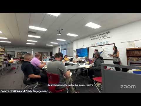
At a Swannanoa steering-committee meeting, Buncombe County staff reviewed a boundary poll that favored a historic township boundary for data-gathering, discussed how a future policy map would apply to areas outside that boundary, and asked residents to help refine maps and priorities for a small-area plan focused on post-Helene resiliency.
Buncombe County staff and members of the Swannanoa steering committee met to review public input on boundaries and next steps for a Swannanoa small-area plan aimed at guiding land use and resiliency after damage from Hurricane Helene.
Jillian Phillips, long-range planning division manager for Buncombe County, told the committee that a small-area plan is “a document that's used by local governments to make recommendations about a lot of different things,” and that the county expects the plan to run on a 10- to 20-year horizon and focus on growth, conservation, hazards and resilience.
The meeting centered on results from a public boundary poll and how staff will use that choice. About 100 people completed the boundary poll; roughly 45% of respondents selected the historic Swannanoa township boundary as the best area for collecting existing-condition data, staff said. Of those respondents, staff reported that about 85% said they live in Swannanoa and about 72% said they own property there.
Phillips and other county planners emphasized a technical distinction the committee must resolve: the “existing condition” study (used to pull census and agency data) will follow a single selectable boundary (the township, per the poll), while the later “policy map” will determine where any recommendations or regulatory proposals would apply. Phillips said that drawing data on an established boundary lets staff efficiently compile census, DOT and partner agency information; the policy map, which the steering committee will help draft, is the layer that would carry specific policies such as buffers, setback changes or overlay districts.
Residents questioned whether areas excluded from the township boundary would still be subject to policies. Committee members and residents cited Lytle Cove, KOA/hotel areas east of town, Bryceville and other neighborhoods as places that some respondents wanted added or treated differently. RJ Taylor, a steering-committee member, asked directly whether areas left off the township for data collection would nevertheless be affected by plan policies; staff clarified that policy boundaries are separate from the data boundary and that the committee can recommend policy-area inclusions.
The county named Land of Sky Regional Council as the lead consultant; staff said Land of Sky has subcontracted with Burnley and Equinox for resilience and flood mitigation analysis. Buncombe County also reported a grant from the North Carolina Wildlife Resources Commission providing $10,000 and 80 hours of technical assistance focused on conservation-based land-use planning and wildlife habitat.
Steering-committee members and residents described community recovery work since Helene, cited new local organizations and requested that the plan treat watersheds and downstream impacts as a priority. Tanya Allen, director of the Swannanoa Resilience Hub, described the hub’s role in disaster case management and community rebuilding since the storm.
Staff outlined a tentative schedule: the county expects much of public engagement to conclude by April 2026 and said it hopes to have a final plan adopted in August (staff did not specify a year beyond the meeting’s timeline statement). Staff also corrected an earlier calendar error and said the next steering-committee meeting will be on the 22nd (staff to send updated calendar notices).
As immediate next steps, staff will produce a draft policy map reflecting tonight’s discussion, publish an interactive online map for public comment and send committee meeting notes. Committee members will receive a link to an interactive mapping tool and were given one week to submit pins, lines and comments — staff said the interactive map would remain open until the following Sunday. At the next meeting staff plans to present the full hazard analysis, existing-condition study and the results of a related SWOT poll.
No formal votes or ordinances were taken at the meeting; the committee’s role is advisory. County staff emphasized that final adoption of any plan language or zoning changes would require review by the planning board and adoption by the Buncombe County Board of Commissioners.
The county asked the steering committee to focus on where policies should apply — not only which data the county will gather — and to note concerns about representation and data coverage for areas that community members consider part of Swannanoa but that the township boundary does not encompass.
Staff said they will circulate meeting notes, the boundary poll dataset, and an updated policy-map draft before the next meeting, and they invited committee members to bring watershed, hazard and community-identity input to upcoming design workshops scheduled for December.