Get Full Government Meeting Transcripts, Videos, & Alerts Forever!
Get email alerts on the Land Use Subdivision Appeal topic
No spam. Unsubscribe anytime.
Valley County commissioners deny appeal, approve Elder Ranch Estates with conditions
Summary
The Valley County Board of Commissioners denied an appeal of Planning and Zoning approval for the Elder Ranch Estates subdivision and approved SUB25-013 (referred to in the record as L Branch Estates) with conditions including a monitoring well and designating Lot 20 as nonbuildable.
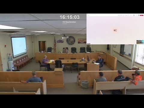
The Valley County Board of Commissioners on Sept. 10 denied an appeal of the Planning and Zoning Commission’s approval of the Elder Ranch Estates subdivision and approved the project (recorded in the motion as “SUB25-013 L Branch Estates”) with written conditions, including a requirement for a monitoring well for data collection and a designation that Lot 20 (between the road and the river) cannot be buildable. The motion passed with the two commissioners voting in favor; one commissioner was absent.
The decision follows a public hearing and an earlier tabling of the appeal from Aug. 27. Commissioner Coble, speaking online, reviewed the appeal’s six issues — traffic, wildlife, wildfire risk, well-water quality and impacts, view corridors, and alleged errors in factual findings — and said the record did not contain evidence sufficient to uphold the appeal. “Public participation is always an important part of this process,” Coble said. “I don’t believe that those exhibits showed us enough evidence to deny this or to uphold this appeal.”
Why it matters: the approval allows initial construction under the conditional-use/subdivision approvals while reserving local oversight through conditions and future review of later phases. Commissioners cited agency reviews, existing county standards and a county housing needs assessment during the discussion.
Commissioners and staff cited multiple agency inputs and conditions in reaching their decision. The transcript record notes exhibits from a Fish and Game representative (identified as Brandon) addressing a bald eagle nest and elk population; Commissioner Coble said those exhibits did not provide grounds to deny the project. The Idaho Department of Water Resources (IDWR) supplied well logs and a finding that there appears to be adequate water in the area, and wetlands were plotted as open space in the plan.
Wildfire mitigation and fire protection were raised during the discussion. Commissioners said the developer must submit a wildland-urban-interface fire protection plan in accordance with Valley County Code Title 10-7 and comply with the county fire marshal’s requirements, which the transcript records as including a 30,000-gallon water tank or other acceptable mitigation.
Traffic and road impacts were addressed through a required road development agreement. Commissioners said the road agreement will be used to mitigate off-site improvements that arise from the subdivision and may include improvements to Barker Lane that serve adjacent subdivisions. The board directed that the developer pay a fair share of mitigation costs through that agreement.
Water resources and monitoring: Commissioner Mopin requested that the approval include a monitoring well in the subdivision so the Idaho Department of Environmental Quality (DEQ) or other agencies will have additional monitoring data for the Valley floor. “I’m gonna request that you guys add a monitoring well to the subdivision so that IDWR has additional monitoring wells for Valley County,” Mopin said, noting public concern about wells going dry but acknowledging the record lacked proof of declining wells.
Density, lot counts and phasing: Commissioners noted the application under consideration applied only to phase 1; any phase 2 would require a separate application and public review. The board discussed lot and acreage counts: the transcript records that the property size noted at one point was 60 acres (not 60 lots), that the project initially reflected 21 lots, then was reduced to 20 and would be reduced to 19 once the unbuildable Lot 20 is reserved.
Other items mentioned in the record: Valley County Code minimum lot size of one acre (for appropriate well/septic), a compatibility rating of +24 on the project, that Planning and Zoning voted 5-0 in favor of approval, and a title-policy typographical correction completed by Cassandra Drake at Ameri Title.
The board’s action and conditions: the commissioners voted to deny the appeal and approve the subdivision with written conditions. Two specific additional conditions were raised on the record: (1) add a monitoring well for data collection by DEQ (or applicable monitoring agency), and (2) designate Lot 20 between the road and river as nonbuildable/open space. The board indicated staff will proceed with a road development agreement and related mitigation as part of implementation.
Looking ahead: commissioners emphasized that future phases would require separate approvals and that the board’s action addresses only the phase under current review. Planning and Zoning’s unanimous recommendation and the cited agency reviews were central to the board’s finding that the record did not show legal error or missing information warranting overturning the earlier decision.