Get Full Government Meeting Transcripts, Videos, & Alerts Forever!
Get email alerts on the Land Use Zoning topic
No spam. Unsubscribe anytime.
Thornton advances major development code rewrite and new zoning map after hours of review and public comment
Summary
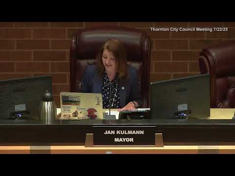
After two years of outreach and drafting, the Thornton City Council voted unanimously on first reading July 22 to repeal and reenact Chapter 18 — the city’s development code — and to adopt a new official zoning map, setting in motion broad changes to zoning districts, review procedures and design standards.
After nearly two years of study and public engagement, the Thornton City Council on July 22 voted unanimously on first reading to repeal and reenact Chapter 18 of the Thornton City Code and to adopt a new official zoning map.
Karen Wodomski, long‑range planning manager, presented the final package, describing a comprehensive rewrite of the city’s development code to align regulations with the comprehensive plan and contemporary development practice. The rewrite covers 13 articles, including procedures, zoning districts, use standards, design standards, landscaping, access/mobility, subdivision standards and nonconformities. Wodomski said the update is intended to make standards more objective, increase walkability, encourage a range of housing types and reduce the city’s reliance on plan‑development (PD) exceptions.
Major changes explained in the staff presentation include renaming and reorganizing zoning districts, creating two new districts (a residential low‑density district and a plan‑development overlay), clarifying the difference between new development and redevelopment, and moving some provisions such as nuisance/blight rules to Chapter 38. Staff also proposed changing the application type called Conceptual Site Plan to a Preliminary Plan and — by Council direction — treating Preliminary Plans as administrative (rather than quasi‑judicial) reviews. Wodomski said administrative review would include added public notification and optional additional neighborhood meetings at Council’s request; she also noted that Planning Commission had recommended retaining quasi‑judicial status for the Preliminary Plan at its July 1 hearing but that Council previously directed the administrative approach.
Wodomski told the council the city conducted extensive outreach: interviews with 20 staff across 13 divisions, direct interviews with 47 nonprofit and faith‑based stakeholders, six topical stakeholder meetings, 29 stakeholder surveys, four public input meetings, 11 community event booths and 89 resident surveys. She said the city sent more than 61,600 postcards to property owners to notify them of hearings and open houses.
Public comment at the council hearing was sharply divided. Several neighborhood residents — including Sarah and Dale Walski of Hunters Glen — urged the council to preserve existing neighborhood character and expressed alarm at draft dimensional changes they said would reduce minimum lot sizes, reduce front setbacks, increase allowed building heights and raise lot coverage limits. The Walskis said those changes would increase density and congestion and asked for more public education and opportunities to comment. Staff responded that many apparent differences reflect revised definitions (for example, changes in how impervious surface or lot coverage is measured) rather than an immediate rezoning of existing neighborhoods; Wodomski emphasized that the new code does not automatically rezone any property and that pending applications would be reviewed under the current code.
Other residents and local developers supported the code’s expanded housing options — duplexes, cottage homes, motor courts and “green courts” — as necessary to provide attainable housing for younger residents and recent graduates. Ben Smith, a resident who identified himself during public comment, said the code would give families more options and that the rewrite balances walkability, transit orientation and preservation of existing neighborhoods.
Council members acknowledged residents’ concerns about specific dimensional changes and a nearby project that had raised anxiety in the neighborhood, but they also expressed support for modernizing the city’s land‑use rules to expand housing options. Council member Martinez thanked staff for two years of stakeholder engagement and said the code is a starting point that council and staff will continue to amend and refine. Several council members noted that the city will pursue a separate, targeted affordable‑housing study funded through Prop 123 (a housing grant) this fall to identify additional incentives and adjustments.
Wodomski said the new code’s effective date would be Sept. 1, 2025, with a pause on new application intake from July 23 while staff updates forms; applicants submitting before July 23 would be processed under the existing code. She also said staff plans to bring cleanup amendments within the first year after adoption.
Councilor Martinez moved to approve the ordinance on first reading; the motion was seconded and the council voted unanimously to approve the ordinance on first reading. The ordinance will return for second reading and final adoption on a subsequent council agenda.
Ending: Council approved the development code and new official zoning map on first reading, with staff planning a Sept. 1 effective date and follow‑up cleanup amendments. Rezonings of particular parcels, and any pending development applications, will be processed according to the existing code unless otherwise noted by staff.