Get Full Government Meeting Transcripts, Videos, & Alerts Forever!
Get email alerts on the Debris Flow Mitigation topic
No spam. Unsubscribe anytime.
Provo Public Works details debris‑flow response after Buckley Draw fire, outlines channel extension and short‑term protections
Summary
Provo City Public Works officials and geotechnical consultants told neighborhood residents they expect to complete a permanent debris‑flow channel within weeks, described temporary berms and basins installed after an August fire and storm, and said the developer will fund the channel extension while the city continues cleanup and monitoring.
PROVO, Utah — Provo City Public Works officials on Wednesday presented findings from recent debris flows connected to a late‑summer wildfire above Buckley Draw and described near‑term and permanent mitigation the city and a private developer are pursuing.
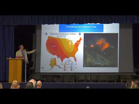
The presentation by Jacob O’Brien, Provo Public Works stormwater engineer, and Tim Thompson of GeoStrata said nearly the entire Buckley Draw watershed burned this summer and an intense storm — about 0.7–0.8 inches of rain in roughly 30 minutes — produced a debris flow that carried far more sediment and water than earlier events. “That flow would not have occurred if it were not for the fire,” O’Brien said.
The meeting mattered to residents because the debris flow sent mud and rock into a developed area that includes businesses, two churches and homes along Slate Canyon and Nevada Avenue, and because construction grading on an adjacent development altered how the flow moved. Officials emphasized that temporary and permanent measures are intended to reduce risk but cannot eliminate it entirely.
O’Brien and Thompson outlined the basin and channel history: the Buckley Draw watershed is roughly 500 acres; federal work after a 2002 fire installed a deflection berm, a conveyance channel and temporary silt fences; about 450 acres (roughly 90 percent of the watershed) burned this summer; and modeling indicates this year’s event carried substantially more material than the 2003 episode. Thompson said, “The deflection berm, the conveyance channel, and the fencing were all designed to be temporary.” He added that the temporary features nonetheless provided important protection in 2025 by directing flows away from many homes.
Officials described actions taken after the fire and before the first large flow about 10 days later: the city and contractor installed temporary berms and basins, placed Jersey (concrete) barriers on Nevada Avenue, and staged pumps to move muddy water into the storm system. City staff and crews, led by Streets and Stormwater Superintendent Richard Snyder, worked daily during rain events to maintain protections.
On the permanent side, the city said the developer will extend the upstream section of the existing debris‑flow channel and construct a final basin. O’Brien described planned storage volumes: the existing channel (after sediment removal) has about 10 acre‑feet of capacity, the area immediately upstream will provide another roughly 10 acre‑feet, and a final basin is expected to provide about 15 acre‑feet, for a total the presentation described as approximately 35 acre‑feet. City staff said that total storage is more than double the volume of the 2025 flow modeled in their analysis.
Residents raised questions during a roughly hour‑long Q&A about whether grading on the development contributed sediment, whether homes now sit in new flood paths, trail closures for cleanup, and whether the city or developer should have built the channel before grading began. City staff said the majority of the mud that reached Nevada Avenue and the church originated on the burned mountainside rather than from the graded construction site, though they acknowledged some erosion from the site is possible. Officials also explained that grading on the development changed topography in ways that, in the city’s assessment, reduced impacts to several homes and businesses by shifting the flow northward.
Multiple residents asked whether taxpayers would cover cleanup or repairs; Public Works staff said the developer will pay the construction cost for the channel (city staff stated this was approximately $500,000), while the city will continue routine maintenance and has set aside emergency funds to restore and improve the conveyance channel. The city also confirmed the contractor that began channel cleanup last week expects about 21–30 days to clear the original channel section and that the city has been pumping and managing sediment and water into temporary basins while construction continues.
Officials stressed limits of mitigation and authorities. Thompson and O’Brien said the designs aim to reduce hazard to a reasonable level (the team said the design addresses likely post‑fire storms in the 5–25‑year range) but cannot be designed to prevent extremely rare events such as 100‑ or 500‑year post‑fire storms. They also noted some dependencies: Rocky Mountain Power had to move poles and guy wires before final grading and channel construction could proceed, and portions of the downstream street network are under UDOT jurisdiction, which will affect storm‑drain solutions on State Street.
The meeting closed with staff offering follow‑up: presentation slides, an after‑action report by GeoStrata, and contact information will be posted on the city website. Staff encouraged residents with additional data or studies to submit them for review.
Residents and officials asked for continued monitoring and clearer neighborhood outreach going forward; several neighborhood representatives said they will hold an independent meeting with academics and residents to review soil samples and modeling. The city said it will continue weather monitoring, daily maintenance of temporary works when storms occur and coordination with federal, state and utility agencies as permanent work proceeds.
Provo City Public Works described the next steps as completion of initial channel cleanup (approximately 30 days from the contractor start), final design adjustments to the permanent channel based on recent flow data, construction of the channel extension funded and built by the developer, and continued site monitoring and weather coordination.