Get Full Government Meeting Transcripts, Videos, & Alerts Forever!
Get email alerts on the Annexation topic
No spam. Unsubscribe anytime.
Committee refines annexation expansion map; keeps overlaps with Salem and Elk Ridge
Summary
Woodland Hills Community Development Committee reviewed a proposed annexation expansion map required by Utah code, agreed to remove a parcel tied to the Nelson holdings, and to retain overlaps on the north and east sides where neighboring city plans already exist. No formal adoption occurred; staff will update the draft.
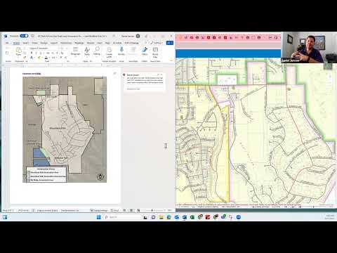
Woodland Hills Community Development Committee members reviewed a draft expansion-area map for the annexation policy element of the city's general plan during their Aug. 11 meeting and directed staff to remove a specific parcel tied to the Nelson holdings while retaining planned overlaps with neighboring cities Salem and Elk Ridge.
The discussion centered on compliance with state law. Daniel Jensen, a consultant with Sunrise Engineering, told the committee that “Utah code is very specific about what needs to be included in an annexation policy plan.” He said the chapter is being written to meet state-code checkboxes, including the required expansion-area map.
Jensen said he drafted a map after reviewing neighboring jurisdictions’ expansion-area maps and consulting with local planning stakeholders. He told the committee that the map intentionally preserves some overlaps with nearby jurisdictions and that state code allows overlaps if the plan states the reason. Jensen said he included language noting that the city’s prior general plan (2017) showed some of the same areas and that Woodland Hills wants to remain available should property owners seek annexation.
Committee members and attendees discussed specific properties shown on the map. Ben Hilliard, who identified himself during the meeting, described utilities and ownership on several parcels and said many homeowners “don't currently have any desire due to property tax increase” to join a city. Hilliard said some parcels are serviced by Woodland Hills for trash and in some cases sewer billing is handled by other jurisdictions, and that some properties are already intended to be incorporated into Elk Ridge based on utility access.
After reviewing ownership and utility information, Jensen and the committee agreed to remove certain parcels associated with Robert and Linda Nelson from Woodland Hills’ expansion map because those properties are expected to be annexed into Elk Ridge. The committee agreed to keep the overlap on the east and north sides of the draft map to show Woodland Hills’ interest in those areas while acknowledging potential overlap with Salem and Elk Ridge.
Kirsten Thompson, chair of the committee, and others emphasized that the expansion-area map is not an immutable boundary and that parcels can be added or removed later. Jensen said the draft will be revised to remove the Nelson parcel and will retain explanatory language about overlaps as required by state code.
No formal vote was taken on the annexation map at the meeting; the committee treated the discussion as direction to staff and consultants to update the draft for further review.
Next steps: Jensen will revise the draft expansion-area map to remove the Nelson parcel and circulate the updated chapter with the rest of the general plan materials for the committee’s upcoming reviews.