Get Full Government Meeting Transcripts, Videos, & Alerts Forever!
Get email alerts on the Transportation topic
No spam. Unsubscribe anytime.
Port St. Lucie studies roadway network as Southwest annexation growth accelerates
Summary
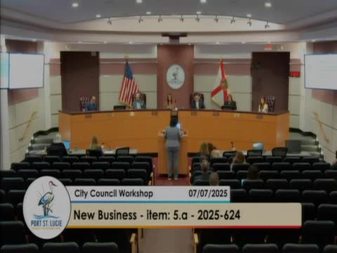
At a July 7, 2025 City Council workshop, the Treasure Coast Regional Planning Council presented an early-stage transportation and land-use analysis of the Southwest annexation area and the wider roadway network serving Port St. Lucie.
At a July 7, 2025 City Council workshop, the Treasure Coast Regional Planning Council presented an early-stage transportation and land-use analysis of the Southwest annexation area and the wider roadway network serving Port St. Lucie.
The presentation, led by Kim Delaney of the regional council, said the study will assemble entitlement and traffic data, incorporate the mobility plan and city engineering standards, and run scenario tests with Kittelson & Associates to show how changing one roadway segment affects others. “We're at the beginning of that conversation,” Delaney told the council. She said the project team will test roughly eight scenarios and return to the council in the fall with findings and recommendations.
The briefing matters because large, previously approved Developments of Regional Impact (DRIs) and more recent entitlements together represent substantial future travel demand on the city's streets. Delaney summarized historical approvals from the 2003'006 period that the team used as a baseline: roughly 17,000 acres and about 44,000 residential units, plus millions of square feet of retail, office and industrial space. She said those totals have changed as market conditions and project plans evolved, and she identified updated 2025 inputs the team will use in modeling.
Key figures mentioned in the presentation and staff slides include (as presented): original DRI-era totals of about 17,000 acres and 44,000 residential units; roughly 5,000,000 square feet of retail, 4,000,000 square feet of office, nearly 5,000,000 square feet of industrial, and about 3,000,000 square feet of research/office that were included in older entitlements. Delaney said more recent adjustments envision roughly 6,300 additional residential units and more than 7,000,000 square feet of industrial space in the Southwest area. The Northwest annexation area was described as containing just under 5,000 acres with about 14,000 residential units and roughly 2,000,000 square feet each of retail and office; development outside the city limits accounts for another roughly 8,000 acres and 16,000 potential residential units, with additional retail and office square footage.
Delaney emphasized that drivers do not observe municipal boundaries: growth outside the city contributes demand on Port St. Lucie roads. She said the study will integrate mobility-plan standards (connectivity index, block/link standards, access management and complete-streets considerations) and run models to show how removing or adding links changes lane and intersection needs. “Drivers don't know when they're in the city limits. They're just driving on the roadway network,” she said.
Council members used the briefing to raise operational and policy concerns. Several members urged the project team to test truck-routing scenarios after officials said industrial uses in the Southwest area will generate heavy truck traffic. A council member suggested restricting tractor-trailers on Village Parkway to force large truck movements onto the Spine Road and through Southern Grove; staff and Delaney said that is a scenario the consultants can test. One council member offered examples of projected truck volumes for new commercial sites (estimates were presented by a council member during discussion, not by the consultant) and asked the analysis to show where heavy vehicle trips will concentrate.
Multiple council members also discussed the effects of past negotiated changes to the roadway network, including removed link segments that have increased spacing between grid connections. Several speakers said that earlier policy choices and the state and regional trip-generation assumptions (including the council's disputed —55-plus' methodology) have delayed some roadway triggers. Council members debated trade-offs between (a) preserving all future rights-of-way and strict adherence to the original grid and (b) negotiating to accelerate construction of certain critical links now, sometimes at the cost of giving up or modifying other obligations. One council member said the public right-of-way is a lasting public asset and warned against permanently relinquishing it without compensation; others argued the city should retain flexibility to front roads and seek reimbursement from developers to accelerate construction.
Council members identified several specific connections and operational issues they want the study to address, including the Community-to-Becker extension (a developer obligation often cited by residents as a near-term need), Discovery-to-Range Line, and the North-South connection often referred to in staff materials as North-South A (sometimes discussed using the placeholder name "Sundance Vista Boulevard"). Staff and councilmembers noted a planned two-story Publix opening on Community Boulevard that will increase local traffic pressure and underscored the urgency of the Community-to-Becker connection.
Delaney said the project team will collect data for one to two months, assist Kittelson & Associates with the model runs, test the identified scenarios (including truck-restriction and rerouting options) and present findings to the council and county partners in the fall. The council discussed holding a joint city-county meeting in the fall to present the maps and analysis to county officials and to show how outside approvals affect Port St. Lucie's network.
The presentation identified options, not decisions. Delaney and staff framed the work as an informational basis for future policy choices; final changes to the city's network, developer obligations, or right-of-way transactions would require subsequent council action.
The council thanked the Treasure Coast Regional Planning Council for the briefing and signaled interest in seeing the scenario results and in continuing the discussion with county partners and developers in the fall.