Get Full Government Meeting Transcripts, Videos, & Alerts Forever!
Get email alerts on the Walk Bike Plan topic
No spam. Unsubscribe anytime.
Town hears Walk, Bike, Woodfin plan; council to consider adoption in August
Summary
Consultants presented a draft active-transportation plan that ranks sidewalk, bike-lane and greenway projects and explains how adoption would improve the town’s ability to compete for NCDOT funding. Council agreed to place formal approval on the August agenda after DOT comment period.
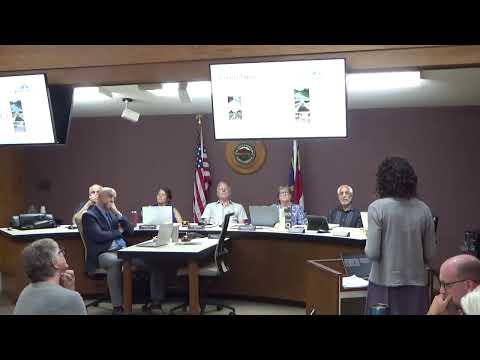
Rachel Bronson, a consultant with McAdams, presented the draft Walk, Bike, Woodfin plan to the Woodfin Town Council on Tuesday, July 15, describing it as “the purpose of this plan project is to provide a vision and a blueprint for the town of Woodfin to make it more walkable and bikeable for everyone.”
The plan sets a multimodal network of sidewalks, bike lanes, multiuse sidepaths and greenways, ranks projects by safety, equity and connectivity, and bundles local-priority projects separately from those that would require North Carolina Department of Transportation (NCDOT) action. Bronson said the plan was funded by NCDOT’s Integrated Mobility Division and that adopting a locally approved plan increases the town’s chances of securing DOT funds under the agency’s updated Complete Streets policy.
Why this matters: NCDOT’s Complete Streets policy and the State Transportation Improvement Program (STIP) generally prioritize projects that are identified in locally adopted plans; placing projects on that map can change the town’s cost-share and eligibility for DOT funding. Bronson told council that DOT projects tend to score higher in regional competition, so the consultants separated town-level projects from DOT-level projects to help Woodfin identify achievable, short-term “quick wins.”
Key details: - Top local priorities identified in the presentation included Merriman Avenue, Weaverville Highway, Elk Mountain Road (Riverside Drive to Elkwood), a short Jonestown segment near Roy Pope Memorial Park, Riverside Drive crossing improvements, and West City View Drive connections. - The plan groups recommendations into facility types: sidewalks for pedestrians, bike lanes for on-street bicycling, multiuse sidepaths (roadside greenways) for mixed users, traditional greenways and neighborhood shared streets with traffic calming. - Consultants described ranking criteria that emphasize safety first, then equity (using DOT’s Transportation Disadvantage Index alongside local knowledge), connectivity to destinations, and public support gathered from surveys, in-person events and steering-committee input. - Bronson noted certain projects would need to enter the STIP or be timed with NCDOT repaving (the Highway Maintenance Improvement Program) to be feasible; she said the DOT has about a three- to five-year paving cycle that can be used to advance low-cost improvements.
Council response and next steps: Council members asked about STIP timing and whether the document should be forwarded to NCDOT and the regional MPO. Bronson confirmed NCDOT has a 60-day comment window and recommended council approval to make it an NCDOT-reviewed plan; council agreed to place the plan on the August agenda for formal consideration after the DOT comment period. Staff were asked to collect questions and route them to town staff (Shannon was named during discussion as the contact for routing questions).
Community context: Consultants described outreach that included in-person events (5K races, food-distribution events, a New Bridal Baptist Church public meeting), online surveys and focus groups with Buncombe County Schools and Woodfin Elementary representatives. The plan also referenced the Beaver Dam Creek Greenway and the town’s Blueway/Greenway planning.
The council did not take a final vote on the plan at this meeting. The matter will return in August after the NCDOT comment period and staff follow-up.