Get Full Government Meeting Transcripts, Videos, & Alerts Forever!
Get email alerts on the Area Of Impact Boundary topic
No spam. Unsubscribe anytime.
Valley County holds public hearing on McCall area-of-impact boundary; decision continued to July 23
Summary
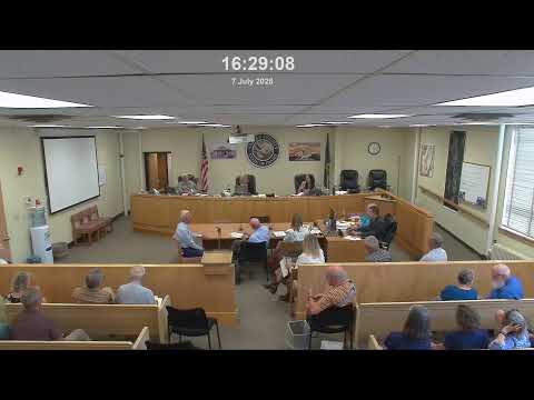
Valley County commissioners on July 7 heard extensive public testimony on competing maps for the McCall area-of-impact boundary and tabled a decision until July 23 at 2:00 p.m.
Cascade, Idaho — Valley County commissioners on July 7 heard extensive public testimony on a competing set of maps that would redraw the City of McCall’s area of impact (AOI), closing public comment and tabling final action until a July 23 meeting at 2:00 p.m.
Chairman Morelaff opened the hearing by describing the county’s process and the statutory framework in Idaho Code 67-65-26, noting the county had 90 days from the city’s May 16 request to reach a decision. "The purpose of today's meeting is to consider a request from the city of McCall to modify the current area of impact boundary," he said, and announced that the county would take testimony, then review the record before making a decision at the later date.
McCall’s mayor, identified in testimony as Mayor Bob, and City Manager Forrest Atkinson presented the city’s case first. Atkinson said the city’s proposed boundary was produced from a GIS-based suitability analysis incorporating 24 data layers tied to the five statutory criteria and designed “to comply with the law while preserving the successful model of regional planning that we have.” He told the board the county proposal represents about a “97% reduction” of the existing AOI — from “over 22,000 acres” to roughly “600 acres” in the county-drafted map — and that the city does not believe the county’s map meets the statutory criteria.
County staff described the legal timeline and background for the hearing. The staff report, which the county posted and mailed to affected property owners, noted the 2024 amendments to Idaho law required review of AOIs and summarized prior joint work sessions between the county and McCall (listed in the staff report as 9/27/2024, 3/3/2025 and 5/5/2025). Staff told the board the city’s May 16 submission started a 90-day decision window and that the county had posted its own proposed map and ordinance (draft ordinance number listed in materials as 2025-06).
Public testimony ran more than two hours and split sharply. Many speakers who live in or near the current AOI urged the county to adopt the city’s proposed boundary or to defer major changes until McCall’s planned 2026 comprehensive plan update. Common concerns included: the potential loss of joint planning and tailored AOI codes that residents said protect Payette Lake and neighborhood character; the effect on property predictability and property values; and the costs homeowners may face if eventual annexation requires sewer and water hookups. As one resident said of past annexations, connecting to city sewer once annexed had forced a homeowner to spend “probably close to $30,000.”
Several commenters, including homeowners and a representative of the Valley Soil and Water Conservation District, urged clearer or stronger local environmental protections if governance shifts to the county. Leonard Long, speaking for the district, pointed to specific code differences the district had submitted for the commissioners (shoreline setbacks, stormwater treatment, design-review provisions) and asked the county to adopt comparable protections if the AOI governance changes.
Other speakers backed the county’s reduced AOI. Supporters argued the county’s map better reflects where municipal services such as sewer are likely to be provided in the near term, noted that AOI property owners do not vote in city elections yet are sometimes subject to city-adopted codes, and said county governance could reduce permitting confusion and cost. County Public Works Engineer Dan Jones told the hearing the county already manages transportation in the area of impact and cited limited road department funds as a constraint.
Several participants suggested legal ambiguity in the new state statute and urged the county and city attorneys to seek external legal clarity if necessary. At least one commenter asked whether the county had sought an opinion from the state attorney general; a county representative said both the city and county have counsel and had not sought a higher-level opinion at the hearing.
After public comment, Chairman Morelaff closed the public hearing portion of the meeting and said the board would "do our due diligence" on the record. He announced that the board would table the matter and resume deliberations on July 23 at 2:00 p.m. No formal ordinance adoption or vote on a final boundary occurred on July 7.
Why this matters: The AOI determines which land-use rules and permitting processes apply around McCall and can shape where and how development occurs near Payette Lake, a locally significant water body. Testimony on July 7 centered on trade-offs between preserving a long-standing joint planning approach with tailored protections for the McCall area versus applying more generalized county codes in areas the county concludes are unlikely to be annexed in the near term.
The record for the July 7 hearing includes the city’s GIS analysis and maps, the county’s draft ordinance (posted as draft 2025-06), the Valley Soil and Water Conservation District’s code comparison and the public comment packet. Commissioners said they will consider that material and return July 23 for further deliberations.