Get Full Government Meeting Transcripts, Videos, & Alerts Forever!
Get email alerts on the Fire Hazard Maps topic
No spam. Unsubscribe anytime.
Council tables adoption of state fire‑hazard severity maps after local officials cite mapping errors and insurance concerns
Summary
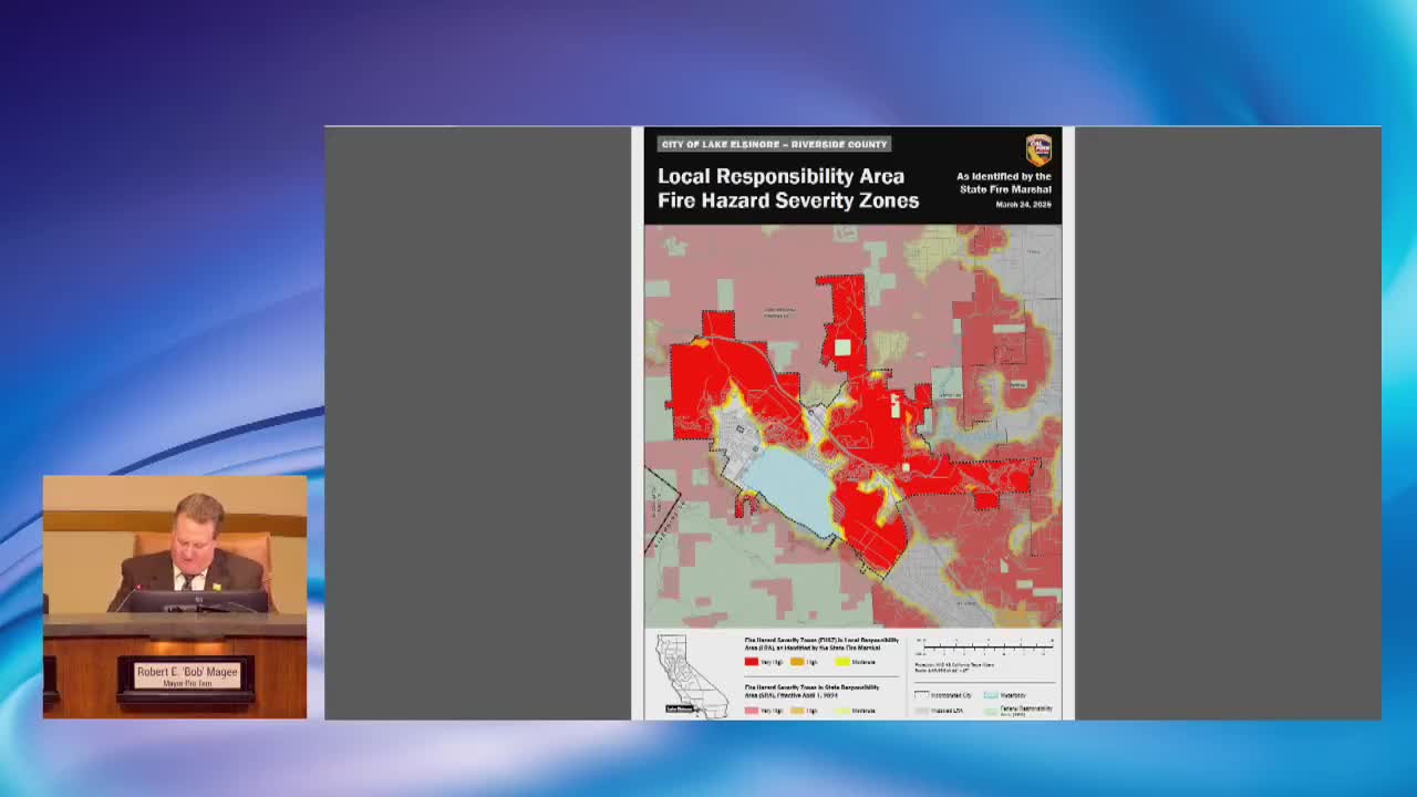
Council members expressed concerns that the state-prepared local responsibility area fire maps contain errors (including water-covered areas and master‑planned communities shown as high hazard) and voted to table adoption to seek further review and local input; staff said adoption is mandated but consequences of nonadoption were unclear.
The Lake Elsinore City Council voted to table introduction and adoption of local responsibility area fire hazard maps after councilmembers and residents raised substantive concerns about the maps’ accuracy and the potential insurance and financial impacts for homeowners.
Fire Marshal Tracy Williams introduced the ordinance and told the council staff recommended no map changes. Residents and councilmembers then raised numerous objections: Kim Cousins, speaking from Leech Canyon, said parts of the lake and areas that have been underwater for decades appear as high fire hazard; councilmembers pointed to master‑planned communities (Canyon Hills, Tuscany Hills, Rosetta Canyon) that the maps designate as high hazard despite local infrastructure, water supplies and fire stations. Councilmembers also noted apparently abrupt boundaries that stop at city limits, a condition they described as inconsistent with fire behavior and harmful for residents’ insurance.
Councilmember Manos and Mayor Pro Tem McGee urged additional local review and asked that adoption be postponed until state staff provide corrected maps or local input is incorporated. City attorney and fire staff said the adoption is mandated by state law and technically non‑discretionary; staff could not provide a clear penalty the state might impose for not adopting on the state timeline, though one staffer said withholding of some state grant funding had been discussed in other jurisdictions.
Division Chief (identified in the record as Chief Reif) said the statutory deadline for adoption falls roughly 120 days from the map posting and that the council’s adoption window closes in mid‑July. Given the concerns and desire for additional local input, the council voted 4‑0 to table the ordinance to an undisclosed date and asked staff to pursue corrections and to coordinate with state representatives and the State Fire Marshal’s office.
The council emphasized it funds and staffs local fire protection and that it will press state officials and regional partners for technical corrections and clarifications before the map is formally adopted.