Get Full Government Meeting Transcripts, Videos, & Alerts Forever!
Get email alerts on the Open Space Planning topic
No spam. Unsubscribe anytime.
Maine webinar panel outlines how towns plan, fund and implement open-space strategies
Summary
Panelists from state programs, land trusts and town committees discussed definitions of open space, benefits and common concerns (access, taxes, competing land uses), examples of implementation, and funding avenues including current-use tax programs, Community Resilience Partnership funds and FEMA credits.
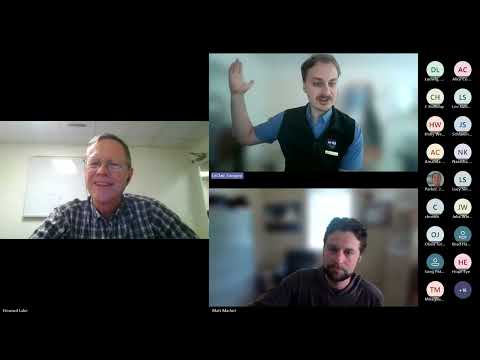
Gregory LeClaire, municipal planning biologist with the Beginning with Habitat program at the Maine Department of Inland Fisheries and Wildlife, hosted a webinar panel that described how Maine towns can develop and implement open-space plans and what local officials and volunteers should expect.
Panelists said open space encompasses both publicly owned undeveloped land and privately held parcels kept out of development, and that planning for open space can advance water-quality protection, wildlife habitat, recreation and community resilience. "Open space is just as much about wild places and ecosystem function as it is about people and how people interact within their communities," said Matt Marcotte, executive director of Loon Echo Land Trust and a member of a town open-space committee.
Why this matters: Panelists framed open-space planning as a practical tool towns can use alongside comprehensive planning to direct growth, maintain access to lakes and forests, manage flood-prone areas and, in some cases, reduce municipal costs. They emphasized that effective plans require a core group of motivated volunteers or staff and often succeed when a land trust or nonprofit partners with town officials.
Panel summary
Gregory LeClaire opened the session by saying the webinar would be a panel discussion on open-space planning in Maine and introduced the two panelists and host. Tom Mariola, senior planner with DACF's Municipal Planning Assistance Program, moderated and handled logistics and announcements.
Panelists defined open space broadly. Howard Lake, described in the session as a long-time local attorney and a member of his town's open-space committee, said his committee’s 2006 plan spurred a trails committee and a town open-space fund that now exceeds $100,000. "That can be hopefully leveraged into some land acquisition," Lake said, noting the fund was not intended to dictate specific purchases but to support future priorities.
Marcotte and Lake identified three frequently raised community concerns: public access to privately conserved land, the impact of conserved land on municipal tax revenue, and conflicts between open-space goals and other land uses such as housing, solar or farm production. Marcotte pointed to recent University of Maine research as useful background on fiscal impacts. Both panelists urged towns to define conservation responsibilities and long-term stewardship clearly to avoid problems (for example, easements on land that a land trust must monitor).
Panelists described common tools and examples used in Maine towns: current-use tax programs (tree growth, farmland and open-space filings) that can lower owners' assessed value if land is managed consistent with program rules; partnerships between towns and land trusts for acquisitions and easement holding; and external funding. Marcotte said Bridgeton used Community Resilience Partnership (CRP) funds for its open-space planning; he said other towns have used EPA/ARPA-related funds, philanthropy and local appropriations.
Floodplain management and resilience were raised as reasons to prioritize open space. Panelists discussed the FEMA Community Rating System (CRS), which gives communities credit for preserving floodplain lands as open space and can lower flood insurance costs. Marcotte and Lake also described post-flood acquisition examples in which FEMA-transferred parcels were repurposed for parks and floodplain function.
Implementation experience
Panelists contrasted different implementation approaches. Lake described Redfield’s 2006 plan leading to an active trails committee, partnerships with a land trust (referred to in the session as Kennewick Land Trust) and a municipal open-space fund. Marcotte described Bridgton’s recent plan and the town’s decision to begin with small, highly likely-to-succeed projects (wayfinding, a hand-carry boat launch, inventory of town-owned lands) to build credibility before tackling larger policy changes such as growth-area incentives and rural-zone reform.
Both panelists recommended assembling a broadly representative working group (select board or town council liaisons, conservation commission members, land-trust representatives, farmers and young people). Matt Marcotte said the “critical mass of engaged volunteers” and identifying political allies are essential to move from plan to implementation.
Costs and timing
Panelists said cost varies widely: volunteer-driven plans can be produced with little funding while consultant-led processes typically run several months and require paid staff or contract support. Marcotte suggested about six months for a consultant-facilitated plan from start to finish, whereas volunteer-driven updates may take a year. Funding options cited included CRP grants, ARPA/EPA-related funds, local appropriations and private philanthropy; land trusts can serve as fiscal agents to help towns access grants.
Identifying conservation priorities
Speakers recommended combining local knowledge (community mapping exercises, resident input, roadkill/wildlife-vehicle collision data) with statewide datasets. Significant wildlife habitats subject to regulation under Maine’s Natural Resources Protection Act were noted (examples include vernal pools and inland waterfowl and wading-bird habitats); panelists cautioned that corridor mapping and movement models vary in quality by species and that local observations are valuable.
Questions from attendees covered clustering in subdivisions, the role of land trusts in capacity building, how open-space plans interact with municipal legislative processes and triggers for updating plans. Greg LeClaire said by his count 43 Maine towns have an open-space plan or a similar document and that Beginning with Habitat can share examples.
Ending
Panelists closed by encouraging towns to involve atypical stakeholders (young residents, trail users, farmers) to broaden support. Gregory LeClaire shared his email for follow-up (gregory.leclaire@maine.gov) and DACF announced the next webinar on Shoreland zoning updates.