Get Full Government Meeting Transcripts, Videos, & Alerts Forever!
Get email alerts on the General Plan Land Use topic
No spam. Unsubscribe anytime.
Orem planning commission maps land-use refinements, approves Lakeridge Farms plat with sidewalk waiver
Summary
The Orem City Planning Commission spent a work session updating land-use classifications and buffer ideas for State Street and other corridors, discussed preserving existing affordable housing stock, and approved several consent items including preliminary plat approval for Lakeridge Farms with a curb-adjacent sidewalk waiver for the cul‑de‑sac.
The Orem City Planning Commission met on May 21, 2025, for a work session and regular meeting in City Council Chambers to continue review of the city’s general plan land‑use maps and to consider several consent‑agenda items. Commissioners spent most of the work session marking up the existing land‑use map, discussing new classification types and buffer areas along State Street and other corridors, and debating whether and how to preserve older, smaller housing that can provide affordable units. In the regular meeting the commission approved several consent items, continued the May 7 meeting minutes to the next meeting, and approved a preliminary plat for Lakeridge Farms (840 West 600 South) that included a waiver to place the cul‑de‑sac sidewalk curb‑adjacent instead of behind a park strip.
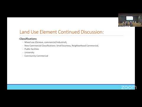
Commissioners and staff said the work session aimed to identify a short list of land‑use classifications and future studies the commission should address as the general‑plan update continues. “We went through the goals and objectives…we thought it would be interesting for the purpose of updating the land use map…to come down and draw actually on the existing land use map, mark it up,” a staff member said as the group began the mapping exercise. Staff presented a list of potential new classifications and buffer types and invited commissioners to identify additional areas for study, including segments of Geneva Road, the State Street corridor, the mouth of Provo Canyon and several neighborhood nodes.
Why this matters: Commissioners framed the mapping work as the first step in a multi‑stage update to the general plan. They said clarifying where the city wants neighborhood‑oriented commercial, regional commercial, medical corridors, and targeted preservation zones will guide future zoning, public investments, and development negotiations.
Buffering and transitions: Much of the discussion focused on how the city should define “buffers” where commercial or higher‑intensity uses meet residential areas. Commissioners described physical buffers such as walls, park strips and landscape berms, and regulatory buffers (setbacks, use restrictions). One commissioner asked, “So do we actually really have any buffer that is along State Street? Because it, I mean, we’re almost everywhere, butts up against residential in some form or other. What do we consider buffer?” Staff and commissioners agreed that buffers must be defined both by physical treatments and by allowable uses so that transitions are gradual and compatible with neighboring homes.
Preserving affordable housing stock: Commissioners raised repeated concerns about older fourplexes, duplexes and small single‑family homes that currently provide relatively affordable housing. One commissioner said, “New housing is always gonna be more expensive even when it’s designed to be affordable than existing fourplexes, duplexes. So if that’s already in your back buffer, let’s identify that…that kind of housing study. That’s very important.” Discussion centered on whether to create preservation districts or incentives to rehabilitate existing smaller multi‑unit properties instead of allowing incremental replacement by higher‑priced townhomes.
Neighborhood commercial and community nodes: Commissioners discussed creating a finer set of commercial categories—examples included neighborhood commercial, community commercial and regional commercial—rather than the two broad commercial types currently shown on the land‑use map. They cited small walkable nodes (shops near schools or a converted small building serving students) as an example of neighborhood commercial that should be encouraged. Commissioners asked staff to return with draft definitions that would translate into zoning or overlay tools and potential implementation steps.
Churches, public facilities and hospitals: Commissioners spent time locating and marking churches and public facilities on the map during the work session, noting the amount of land held by religious institutions and its implications for open space and future development. They also discussed the concentration of medical services near the hospital and flagged the area as a potential medical corridor for targeted economic development and protective policies.
Transit and circulation issues: Commissioners raised concerns about bus service coverage and whether the city has coordinated sufficiently with the regional transit agency to improve routes. One commissioner said the bus network used to have more routes through Orem and that current service leaves “vast amounts of land that’s not getting service.” The group agreed transportation and transit will receive deeper analysis in later plan chapters.
Consent agenda and votes: During the regular meeting the commission pulled three items from the consent agenda for separate action, continued the May 7 meeting minutes to the next session, and approved multiple consent items. The commission separately approved Abbey Road Phase 4 plat amendment (combining phases for financing) and preliminarily approved Lakeridge Farms, a 15‑lot single‑family subdivision at 840 West 600 South in R‑8 zoning. For Lakeridge Farms, the applicant asked the commission to waive the city’s buffered sidewalk requirement around the cul‑de‑sac bulb and place the sidewalk curb‑adjacent there to gain a few feet of front‑yard area for homes. Planning staff noted the city code provides a process that allows the commission to waive the buffered sidewalk in cases where a curb‑adjacent sidewalk would be “functionally or aesthetically” consistent with adjacent development; staff also said many nearby cul‑de‑sacs use curb‑adjacent sidewalks.
On Lakeridge Farms the commission approved the preliminary plat and the requested waiver; staff told the commission the developer would need to finalize the details during final plat review. The commission also approved the Abbey Road Phase 4 plat amendment after a staff clarification that the homeowners association had voted and has signed the application to combine the phases for financing.
What the commission directed next: Staff asked commissioners to continue refining the list of classifications and buffer types and to send written suggestions for the general plan update. Commissioners asked staff to prepare more precise definitions for “neighborhood commercial” and similar categories and to propose follow‑up studies (for example, a fourplex/duplex preservation study and targeted State Street corridor actions).
Ending: Commissioners closed the work session with a plan to resume the mapping exercise after the regular meeting and to fold the mapping notes and suggested classifications into the next revision of the goals and objectives for the general plan update.