Get Full Government Meeting Transcripts, Videos, & Alerts Forever!
Get email alerts on the Creek Trail Master Plan topic
No spam. Unsubscribe anytime.
Santa Clara holds first community meeting on Creek Trail Network master plan; consultants outline corridors, constraints and next steps
Summary
City of Santa Clara staff and consultants on Monday presented an early master-plan study for the proposed Creek Trail Network expansion, describing three corridor concepts, ownership constraints and likely design challenges and asking the public for feedback as a survey remains open through June 22.
City of Santa Clara staff and consultants on Monday presented an early master-plan study for the proposed Creek Trail Network expansion, describing three corridor concepts, ownership constraints and likely design challenges and asking the public for feedback as a survey remains open through June 22.
The presentation, led by project manager Ralph Garcia, senior civil engineer with the City of Santa Clara Public Works, and principal planner Jonna Socale, summarized preliminary concepts for Calabasas Creek, the Hetch Hetchy right of way and Saratoga Creek, and emphasized that most of the land for trails is owned by other agencies or private parties. "Not much of the land that we're talking about is owned by the city of Santa Clara," Socale said, noting San Francisco Public Utilities (SFPUC), Valley Water, Caltrain, Union Pacific Railroad and private owners among stakeholders.
The master-plan phase described on-site constraints and opportunities. For Calabasas Creek the team identified five potential underpasses, three required pedestrian overcrossings (including across Highway 101, Central Expressway and Caltrain) and about six at‑grade crossings that could use existing bike improvements. Socale said the Highway 101 undercrossing is a reinforced box culvert with vertical walls and structural supports that prevent cutting back walls to create an underpass; that, she said, makes an overpass the more feasible option. "If we were to try and build under 101, we would be filling, and that would change both the cross sectional area for water to flow as well as the hydraulics of how the water moved through there, and we determined that that was not feasible," she said.
On the Hetch Hetchy corridor the team noted an 80‑foot-wide SFPUC right of way that offers space for a paved trail but restricts vertical supports because of buried pipelines. Socale told attendees the SFPUC has become more restrictive than in the past: when joint‑use agreements are granted, "they will charge the city a small fee to use that trail, and they'll also require the city be willing to dismantle their infrastructure at any time that those lines need to be worked on," she said. She also said SFPUC prefers trails to be placed on the outer margins of the right of way or on adjacent private property obtained through development agreements.
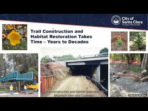
Saratoga Creek presents site‑specific limitations where vegetation preserves and flood‑control work have left little top-of-bank to build off‑street trails; the consultant team said in constrained reaches they are developing on‑street alignments but questioned their utility compared with existing nearby routes. The team emphasized habitat sensitivity along riparian corridors and explained that any trail design would need to account for protected vegetation and species, permitting requirements and flood hydraulics.
Community members raised questions about flooding, safety and maintenance. Santa Clara resident Craig Larson asked about seasonal inundation under Highway 101 and said visitors sometimes "wade through it, which I've done." Socale and staff explained that some culverts and bridges are box culverts with vertical walls that cannot be modified without affecting flood capacity. Other commenters urged better detours during stadium events, improved crossings at El Camino Real and Tasman, and longer pedestrian signal times at some intersections. Several speakers noted crumbling trail edges and requested resurfacing; staff said pavement work for parts of the trail is planned in the next year or two.
Residents and frequent trail users also discussed lighting and wildlife. One participant asked whether motion‑sensing or constant lighting should be used underpasses; Socale, who described herself as trained in biology, said she is "biased" against 24‑hour lighting in creek corridors and recommended limited, downcast or time‑limited lighting in constrained spots because the creek corridors serve as remaining habitat for wildlife. The consultant added that lighting decisions must balance user safety and habitat impacts and that underpasses can flood, complicating electrical installations.
Other technical and policy issues addressed in the Q&A included coordination with Valley Water on habitat restoration and Pond A8 near the Bay, the need to negotiate with private landowners for access through parking areas, and the complexity of modifying levees: widening an existing levee to expand trail width can require FEMA‑level engineering and approvals and often would require major construction or land take.
Next steps and outreach: Garcia and the consultant team said they will hold corridor‑level meetings this summer, incorporate public feedback in the fall, circulate a draft master plan and then a final master plan. The project web page with materials and the public survey is posted at santaclaraca.gov/creektrailplan; the survey remains open through June 22. Staff encouraged written comments and said the project team will meet individually with property owners and agencies as part of design and permitting work.
The City and consultant team stressed that the study so far is conceptual and intended to identify feasible alignments, likely constraints, and permitting and partnership needs; no construction decisions or funding commitments were made at the meeting.