Get Full Government Meeting Transcripts, Videos, & Alerts Forever!
Get email alerts on the Emergency Medical Services topic
No spam. Unsubscribe anytime.
Morrow County EMS committee to create refined ambulance response‑time maps after OHA review
Summary
Committee members, local EMS providers and public‑health staff agreed to form a subcommittee with GIS support to produce ambulance response‑time maps that meet Oregon Health Authority (OHA) guidance and to propose a winter alternative for remote areas. Provider reports on staffing, mutual aid and quarterly call volumes were also discussed.
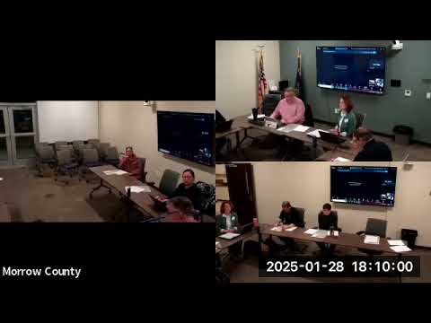
Morrow County EMS providers and health‑district staff agreed Wednesday to form a subcommittee with GIS support to redraw the county’s ambulance response‑time maps after the Oregon Health Authority requested clearer mapping for the county’s Ambulance Service Plan.
The committee said it will map multiple response tiers (for example, shorter times around bases and longer times for remote areas), produce an alternative “winter” map for parts of the south county that are seasonally inaccessible, and report percentages of runs that meet each response target so the county can evaluate compliance with state standards.
Why it matters: OHA’s feedback is a required step in completing the Ambulance Service Plan. Accurate response‑time mapping affects local planning, public information and whether providers are meeting the state’s performance expectations — commonly measured as the percentage of calls reaching a target response time (committee members said the state commonly uses an 80 percent benchmark).
Committee members reviewed a draft “20‑minute” travel‑time map and an OAR (administrative rule) that breaks prehospital response times into categories: an urban area (8 minutes), suburban (15 minutes), rural (45 minutes), frontier (2 hours) and search‑and‑rescue (no fixed standard). Matt Jensen, the county administrator who led the discussion of the OAR reference, said the rule did not give the county direct instruction about how to draw the map but did describe the categories the county could use for a defensible plan. “As we looked into it, we found the OAR that talks about the response… and it’s OAR 333‑200‑008, section 2,” Jensen said.
Providers reported current operational metrics before the mapping discussion. Boardman Fire and other agencies ran 68 calls plus 18 interfacility transports in the most recent quarter, with about 68 percent of 9‑1‑1 calls resulting in transport. Providers said they continued to meet NFPA turnout standards (the group cited 45 seconds daytime and 90 seconds nighttime turnout targets) and that recent paramedic training and recruitment had improved staffing. “We’ve been very successful in our recruitment,” Paul Martin, paramedic and EMS director for the Morrow County Health District, said, noting the health district has one recent full‑time hire and two additional applicants.
Committee members discussed several mapping options: keep a single countywide standard, draw multiple concentric response tiers (for example, 8‑minute inner zones, 15‑minute suburban rings, and 45‑minute rural rings), or produce separate maps for winter and nonwinter conditions in the south county where road closures can extend travel times. Eric Chick, a south‑county responder, urged the group to account for seasonal road closures on western routes and recommended the subcommittee “get a complete understanding of what it’s actually gonna take to get there” before committing to a single target.
Members agreed the subcommittee — consisting initially of Eric Chick, Tom Roberts and the county GIS staff — will meet next week to produce draft maps for committee review. The group also agreed to include percentage‑within‑target reporting (for example, percent of runs meeting a given time threshold) in quarterly reporting so the committee can evaluate whether providers meet the state’s expected performance levels. Kristen Bowles and Michael Metzler, the ambulance service medical adviser, joined online for parts of the discussion and listened while the committee discussed technical mapping choices.
Votes at a glance: the committee approved the minutes from the previous meeting. Motion to accept the minutes was moved by Adam McCabe and seconded by Robin Canaday; the motion carried (approval recorded by voice; quorum of six members present was established earlier in the meeting).
The committee scheduled its next full meeting for April 22 at 6 p.m., with a planned subcommittee meeting (GIS and providers) the following week to produce initial maps. Members said final recommendations will return to the full committee for review before any change to official reporting or the Ambulance Service Plan.