Get Full Government Meeting Transcripts, Videos, & Alerts Forever!
Get email alerts on the Arcola Grove Rezoning topic
No spam. Unsubscribe anytime.
Board forwards Arcola Grove rezoning; debate centers on enclosed GIS substation, height and buffering
Summary
The Board of Supervisors voted May 14 to forward the Arcola Grove rezoning and special exception to the July 15 business meeting after staff flagged compatibility issues over building height, a proposed transmission substation adjacent to residential uses, and landscape buffer language.
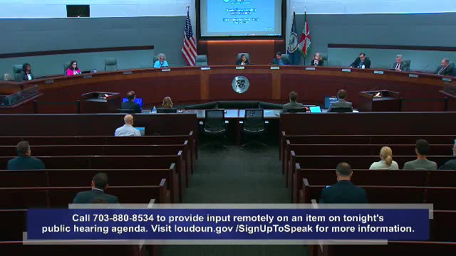
The Loudoun County Board of Supervisors on May 14 voted to forward the Arcola Grove rezoning application and related special exception to the July 15, 2025 business meeting for action after extended staff and applicant presentations and public comment.
The application seeks a zoning map amendment for the 30.49‑acre Arcola Grove site west of Arcola Boulevard (suburban policy area) to rezone approximately 6.98 acres from RC (Retail Commercial) to Planned Development Industrial Park (PDIP), add a special exception to permit a transmission substation, increase data‑center square footage above the previously approved 614,400 square feet, and increase maximum building height. Staff raised outstanding compatibility issues related to building height, the proposed substation location adjacent to residential uses, and landscape buffer language that permits plant‑unit substitutions.
Why it matters: the proposal would enlarge the existing approved PDIP data‑center campus, add a proffered gas‑insulated (GIS) substation, and raise building heights in an area where the 2019 General Plan calls for lower heights and transitional uses adjacent to residential neighborhoods. Nearby and planned residential projects — including Arcola Town Center and an affordable housing conversion at the Old Arcola School site — were cited repeatedly in board and public remarks.
Staff presentation and outstanding issues - Darby Metcalfe, Department of Planning and Zoning, told the board the subject property totals 30.49 acres and that the application requests rezoning of about 6.98 acres to PDIP with a special exception for a transmission substation and a zoning modification to raise maximum building height from 60 feet to up to 100 feet. Metcalfe said the application proposes increasing permitted data‑center square footage above the previously approved 614,400 square feet and noted staff cannot support the application as submitted because it lacks stepped transitions to adjacent residential uses, has a substation sited adjacent to residential without transitional uses, and contains proffer language allowing plant‑unit substitutions that prevents staff from verifying buffer compliance.
Applicant revisions and commitments - Brian Winterhalter (DLA Piper) and Elizabeth Nicholson (American Real Estate Partners) presented changes since the planning commission hearing: they said the applicant reduced the substation footprint by switching to a gas‑insulated substation (GIS), lowered proposed maximum building height to 96 feet (the applicant described this as a reduction from earlier materials), committed to enhanced architectural treatment and additional landscaping, proffered dedication of right‑of‑way for Dulles West Boulevard from an adjacent parcel under contract, and offered to seek LEED certification for the data‑center buildings. The applicant said the GIS design reduced the substation footprint from about 4 acres to roughly 2.25 acres and that much equipment would be enclosed.
Public comment and board discussion - The Piedmont Environmental Council (spokesman Jim Bingle) opposed the rezoning, citing incompatibility with the general plan and urging the applicant to pursue other legally‑permitted uses allowed in the current approval. - Supervisors and the applicant discussed heights, noise and generator siting, buffer composition, and alternatives to the proposed three‑story data‑center design. Supervisor LeTourneau, whose district includes the site, pressed for specific setback and height comparisons with the nearby approved residential projects and requested the applicant and staff provide additional detail on nearby residential heights, generator noise mitigation and whether the project could be redesigned as a two‑story facility. The applicant offered to explore a two‑story alternative and to provide additional detail on generator specifications and sound mitigation ahead of the business meeting.
Key quantitative points and clarifications - Site and zoning: 30.49 acres total; approximately 6.98 acres proposed to be rezoned from RC to PDIP (staff presentation). - Previously approved development: 614,400 square feet of data‑center space under earlier approvals (staff). The applicant described different square‑foot figures during the hearing: staff cited 786,369 as one figure in the packet; the applicant later described capping square footage at 760,000 in updated proffers. (Transcript shows differing figures; the board requested precise reconciliation before final action.) - Height: staff originally noted a modification request up to 100 feet; applicant said it lowered maximum building height to 96 feet in revised materials. - Substation: applicant said the GIS substation reduces footprint from ~4 acres to ~2.25 acres and includes masonry screening and a landscaped berm up to 16 feet in most locations; some berm sections may be reduced to 12 feet where transmission lines must be brought in. - Setbacks: applicant provided building‑to‑residence setbacks in the packet: the closest residential unit to the substation was cited at about 263 feet; residential distances to the data‑center buildings were cited in the 400–900 foot range depending on the parcel; the closest residential corner to the data‑center building face was cited at about 468 feet.
Board action and next steps - Motion: Supervisor LeTourneau moved to forward the Arcola Grove rezoning (ZMAP and SPEX applications as referenced in the staff report) to the July 15, 2025 Board of Supervisors business meeting for action; motion was seconded and approved. - Vote outcome: motion passed 7–1–1 (seven yes, one no, one absent). The transcript records Supervisor Brixman as the lone no vote and Supervisor Turner as absent from the dais during the vote. - Follow up requested by board: additional information on nearby residential heights, generator enclosures and noise profiles, reconciliation of square‑foot figures in the record, clarification and removal of proffer substitution language for plant units, and further consideration of building height transitions or stepped backs toward adjacent residential uses.
What remains unresolved - Staff indicated it cannot support the application as submitted because of compatibility and proffer language issues; the board directed further negotiation. The applicant agreed to explore two‑story alternatives, provide generator/noise specifications, and refine proffers and buffer language before the July 15 business meeting.
Quotes from the hearing - Darby Metcalfe (DPZ staff): "Staff cannot support approval of the application as submitted because of outstanding issues, including building height, the utility substation use, and landscape buffers." - Brian Winterhalter (DLA Piper, applicant): "We have shrunk the substation by 40% with the GIS substation... Were intending to evoke a performing arts center at a real institutional quality level of architectural design." - Supervisor LeTourneau: "So I think the primary concerns at this juncture are gonna be the height of the building, and then noise... that there aren't going to be gas turbine fans at any point in the process."
Why this matters locally: the decision weighs an existing, previously approved data‑center entitlement against the county’s stated plan goals for transitions near residential neighborhoods. The board’s direction to negotiate additional proffers and to reconcile technical details reflects balancing county design expectations with existing entitlements and private infrastructure needs.