Get Full Government Meeting Transcripts, Videos, & Alerts Forever!
Get email alerts on the Coastal Resilience topic
No spam. Unsubscribe anytime.
Modeling shows artificial reef can cut storm erosion at Crescent Beach but may shift damage to nearby gaps
Summary
Researchers presented numerical-model results to the New Shoreham Coastal Resilience Committee showing an artificial reef design could reduce storm-driven erosion at Crescent Beach by roughly 25–40% but may produce increased erosion in gaps and at reef ends, making placement and design site-specific.
Researchers and contractors presented numerical-modeling results to the New Shoreham Coastal Resilience Committee on the potential of nature-based measures — including submerged artificial reefs and combined “purge” beach nourishment — to reduce storm-driven erosion along Corn Neck Road and Crescent Beach.
The presentation, led by Annette Grilli, described a two‑year, event-focused modeling campaign that simulates storm waves, surge and sediment transport to test how reefs and nourishment would change nearshore currents and shoreline loss. “The objective of the project was trying to see if we could find nature based solution to protect Corn Neck Road,” Grilli said.
Grilli said the team used nested numerical models driven by storm forcing derived from basin-scale simulations and validated with local observations. The model runs used Hurricane Sandy as a design storm and a high-resolution coastal model with shoreline resolution down to roughly 2 meters. “This model doesn't do the decadal long term,” Grilli cautioned; “it's focusing on storm events for this.”
Key findings
- Under the tested designs, a submerged reef placed about 300 meters offshore at a crest roughly 0.75 meters below mean sea level produced a reduction in modeled storm erosion of about 25% (for one crest height) to about 40% (for a deeper crest) at parts of Crescent Beach compared with the Sandy baseline. Grilli summarized the panel results: “In term of erosion… you have 40% less erosion and 25% less erosion. So this is the best you can hope for.”
- The reef designs concentrated currents and formed macro‑vortices in model runs. Those vortices reduced wave energy but also produced localized erosion in the gaps between reef segments and at the reef ends. Grilli warned that “you can have current…and it's the thing,” adding that gaps and the ends of segmented reefs can drive local erosion.
- Moving reefs farther offshore (tested at about 400–500 meters) did not uniformly improve outcomes; in some tested configurations offshore placement increased focused flows in gaps and produced worse local erosion. Grilli said the modeled behavior was site‑specific and sensitive to reef geometry, depth and storm characteristics.
- Designs that place the reef shallower or emergent tended to perform better at dissipating energy but would be subject to higher regulatory, navigational and ecological review.
Implications discussed
Committee members emphasized tradeoffs between energy dissipation and redirected sediment transport. A committee member noted local homeowners report seeing the modeled split and migration of currents in some conditions. Grilli and the team repeatedly stressed that designs must be tuned to local bathymetry and that a single prototype does not generalize. “The depth at which you put it is extremely important,” Grilli said, describing wave breaking, friction and reflection as the primary physical controls.
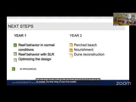
Researchers highlighted additional design options the model can test, including porous reef structures and a hybrid “purge” beach (nourishment placed between reef and shore). Grilli described a candidate reef geometry used for sensitivity tests (crest lengths of hundreds of meters, segmented gaps, and crest dimensions noted in the team’s internal design), and said the next modeling steps are normal‑condition simulations, sea‑level‑rise scenarios and combined reef+nourishment tests.
Regulatory and use considerations
Presenters and committee members raised permitting, navigational marking and fisheries issues. The team noted reefs must be clearly marked as navigation hazards and that reef materials and crest depths affect small‑boat passage. The committee also discussed the need for an environmental and coastal impacts study if the town pursued a permit application; Grilli said a CRMC (Coastal Resources Management Council) filing would require site‑specific impact modeling.
What happens next
Grilli said the team will finish normal‑condition simulations, run sea‑level‑rise sensitivity cases and test combined purge‑beach nourishment with GZA’s dune reconstruction designs if time permits. The committee agreed the modeling has answered many preliminary questions but that any consideration of construction would require additional, site‑specific study, permitting and substantial funding.
Ending
Committee members thanked the researchers for detailed modeling results and noted the work will inform future design, permit planning and public outreach. The team plans to return with updated runs and to test a broader set of storms and design permutations.