Get Full Government Meeting Transcripts, Videos, & Alerts Forever!
Get email alerts on the Stormwater Drainage topic
No spam. Unsubscribe anytime.
Bellaire commissioners approve tighter drainage rules, create limited pathway for residential regrading
Summary
The Bellaire Building Standards Commission on April 24 approved amendments to Chapter 9, Article 2a of the city code to align residential and commercial drainage rules, limit lot fill and create a controlled pathway for certain single‑family topographical grading modifications with engineering requirements.
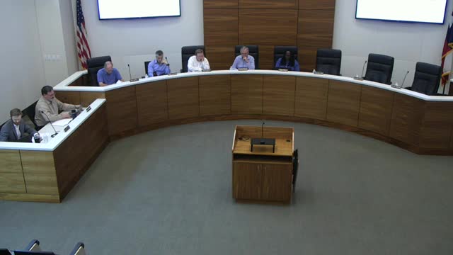
Bellaire — The Building Standards Commission on April 24 unanimously approved amendments to the city’s Code of Ordinances (Chapter 9, Article 2a) to align commercial and residential drainage requirements, clarify no‑net‑fill rules and create a narrowly defined pathway for residential topographical grading changes.
The changes require engineered drainage plans for certain projects, limit allowable lot fill to 8 inches in most cases, and mandate a no‑rise certification demonstrating no adverse impact to the city’s 100‑year storm profile. The commission voted 4–0 to adopt the amendments after staff presentation and discussion.
The commission’s action codifies several items staff said were already standard practice and adds new, explicit criteria for residential submittals and post‑construction verification. The amendments revise sections referenced in staff materials as 9‑70.17, 9‑70.18, 9‑71 and 9‑72 to (1) tighten permitting criteria and requested documentation for equipment elevation and garage lip elevation; (2) require engineered drainage plans, seals and calculations where specified; and (3) make clear that commercial drainage requirements formally reflect the city’s no‑net‑fill policy.
Why it matters: Commissioners and staff said the changes aim to reduce downstream flooding and drift of imported topsoil that changes neighborhood drainage over time. Building staff reported recurring problems where fill added to lots has shifted drainage patterns and put neighboring properties at higher risk.
Key provisions and requirements - No‑net‑fill and 8‑inch limit: The amended language establishes an 8‑inch cap on lot fill except where specific engineered exceptions apply. An engineer preparing a drainage plan must provide calculations and a no‑rise certification demonstrating no net increase in runoff volume and no impact on the 100‑year event; the city engineer will review and approve such certifications. - Engineered drainage plans and thresholds: Staff said an engineered drainage design is required when a project disturbs 1,500 square feet or 25% of a lot, or when proposed work could otherwise change drainage patterns (staff described pool projects, large patios and retaining walls as examples). - Residential topographical pathway: The ordinance creates a limited pathway for single‑family homeowners to request approvals for topographical grading modifications (including work within the right of way in selected circumstances), but does not guarantee approval. As the building official put it, “This is a pathway; this doesn't mean you submit and you're approved nor does it mean you're entitled to build in the right of way.” - Yard amenities and pools: The draft clarifies that certain yard amenities (pools, spas, fountains, waterfalls, outdoor kitchens and patios) are treated as features that are not counted as fill for specific, narrowly defined adjustments — but elevated solid slabs and pool decks may be required to provide openings or other floodplain measures. - Non‑conversion agreements: The amendments extend non‑conversion agreement language to attached garages and ancillary structures; the agreements would identify the height of the lowest enclosure and the prohibition on converting required flood openings.
Commissioners raised enforcement and monitoring concerns. One commissioner said topographical changes are difficult to police over time and warned that initially compliant installations can be altered later, sending runoff onto neighboring properties. Staff acknowledged the difficulty but said the engineered plan requirement and as‑built verification at project completion aim to reduce the risk of long‑term contour changes.
City staff also proposed clarifying requests for topographical surveys and elevation information for placement of exterior equipment. The amendments would encourage, but not require, topographical surveys where available; staff will still assist in determining appropriate equipment heights using flood insurance study profiles, elevation certificates or other available survey data.
Vote and next steps Commission Chair Redding moved to approve the proposed amendments as presented; the motion was seconded and carried unanimously (4–0). Staff said some language will be refined for clarity and that any further edits would return to the commission for final wording before publication for public comment or implementation.
Background and context Staff said many of the proposed changes reflect existing practice and codify guidance that previously lived in plan review procedures or informal guidance. The amendments aim to make permitting expectations clearer for homeowners, designers and contractors and to give the city a consistent framework for review and enforcement.
The commission’s approval does not itself authorize specific lot work; it creates the regulatory pathway and criteria under which future applications will be reviewed.